East Meon to Old Winchester Hill
South Downs Walk
Nat Park - South Downs
County/Area - Hampshire
Author - Sandy Saunders
Length - 12.0 miles / 19.5 km Ascent - 600 feet / 182 metres
Time - 6 hours 40 minutes Grade - moderate
Maps 

| Ordnance Survey Explorer OL3 | Sheet Map | 1:25k | BUY |
| Anquet OS Explorer OL3 | Digital Map | 1:25k | BUY |
| Ordnance Survey Explorer OL32 | Sheet Map | 1:25k | BUY |
| Anquet OS Explorer OL32 | Digital Map | 1:25k | BUY |
| Ordnance Survey Landranger 185 | Sheet Map | 1:50k | BUY |
| Anquet OS Landranger 185 | Digital Map | 1:50k | BUY |
Walk Route Description
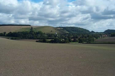
Click image to visit gallery of 3 images.
The car park is signposted on the road through the village at the turning where the river Meon passes under the road (Grid ref. SU678222).
Follow the footpath south from the car park over the ground to the right of the Community Centre to join the main road. Turn right and follow the road past Garston Farm to join a farm track on the right. (Fingerpost sign). Follow the track to the farm building, passing to the left of the buildings, to join the footpath. The path joins the Meon Valley Cycle Trail. Cross this to join the South Downs Way (SDW). At the metalled road, continue right still on the SDW past Hall Cottages, then left at the Fly Fishing Lake. (a sign indicates Private Road but the SDW follows this road.)
Head to Whitewool Farm, then turn right and follow the farm track uphill. At the metal gates, go through the one that leads up hill. (A sign on the gate post indicates the direction.) Turn left at the main road, and soon after, join the Bridlepath on the right which parallels the road. Eventually, at a small parking area, follow the track right, signposted to Old Winchester Hill.
Pass to the right of the two Benchmarks on Winchester Hill, then follow the SDW down hill through a small avenue of bushes and small trees. At the bottom, the SDW continues straight on (west), but turn right (north) to follow the Monarch's Way. The path follows a fence, then soon after along the left hand edge of a field. Join a concrete track at the bottom leading to Peake Farm. Just before the farm, the path moves into a field on the left outside the track (signpost). Follow the edge of the field, round the farm buildings, to join the track at the other side of the farm yard.
Turn left, then soon after right, to join a footpath leading to Lower Peak Cottage. Pass over a 'rickety' wooden bridge at Peak Cottage and turn left. Follow the gravel farm track to the road. (Old Winchester Hill Lane) Turn left down the road, pass over the rail bridge of the old Meon Valley Railway, then follow the footpath right, just over the bridge. Follow the path down onto the path of the old railway. Continue to the parking area and join the road leading to West Meon.
Turn left, and then straight right onto a low walled footpath (signpost). Continue along the path, over the wooden bridge, to the main road. Turn right and follow the road to Westbury House. At Westbury House, follow the road into the grounds, (signpost) passing the old buildings on the right. Head south, up the hill following the sign to the style, at the end of the short road. Pass into the wood of Westbury Park and follow the footpath as it winds up through the wood. There are a couple of markers on the way plus a power cable on poles leading to Horsedown Farm.
At Horsedown Farm, follow the path which leads into a large clearing in the middle of the wood. (The path isn't particularly clear) Turn left and follow the edge of the trees in the clearing. Where the clearing/trees move right, follow an indistinct path through the trees, in the corner of the clearing, to join a farm track. Turn right and follow the track for a couple of hundred metres until the track moves right, then follow a signposted path over a style into a field. Turn right and follow the path down hill to join the Meon Valley Cycle Trail near Drayton Cottage. Turn left and join the road at Drayton Cottage.
Turn left passing Drayton Cottages, follow the road over the river and join a footpath, right, past Drayton Farm. Continue on the footpath over a few fields to join the road at Chalk Dell Cottages. Turn right, follow the road downhill, cross the main road, and after 100 metres, back to the car park.
Other walks nearby
| Walk 3260 | Butser Hill Circular | easy/mod | 6.9 miles |
| Walk 2662 | Beacon Hill and Warnford | easy/mod | 6.0 miles |
| Walk 2710 | Old Winchester Hill from Exton | easy/mod | 5.5 miles |
| Walk 2422 | Butser Hill and Wether Down from Buriton | moderate | 12.5 miles |
| Walk 2373 | Hambledon Circular | easy/mod | 6.1 miles |
| Walk 1034 | Beacon and Old Winchester Hills on the South Downs | moderate | 10.5 miles |
| Walk 3324 | Cheriton Mill & Tichborne from Cheriton | easy | 5.7 miles |
| Walk 1976 | Noar Hill from Selborne | easy/mod | 5.0 miles |
| Walk 1964 | Abbotstone from Old Alresford | easy | 5.1 miles |
| Walk 1835 | Treyford & Didling from Hooksway | easy/mod | 6.0 miles |
Recommended Books & eBooks
Walking Hampshire's Test Way
 Guidebook to walking the 71km (44 mile) Test Way in Hampshire from high on the chalk downs of Inkpen Beacon to the Eling Tide Mill near Southampton Water. Following the beautiful, crystal clear River Test, it passes picturesque villages and fascinating historic sites. Also includes 15 day walks to explore this lovely part of pastoral England.
More information
The South Downs Way
 Guidebook to walking the South Downs Way National Trail, a 100 mile (160km) route between Winchester and Eastbourne through the South Downs National Park, described in both directions over 12 stages. Easy walking on ancient and historical tracks, taking in wooded areas, delightful river valleys and pretty villages. With 1:25K OS map booklet.
More information
Messaging & Social Media
Message Walking Britain and follow the latest news.

Mountain Weather
Stay safe on the mountains with detailed weather forecasts - for iOS devices or for Android devices.