Broad Law & Megget Stone
Scottish Borders Walk
County/Area - Scottish Borders
Author - David Neale
Length - 5.0 miles / 8.1 km Ascent - 1450 feet / 439 metres
Time - 4 hours 0 minutes Grade - moderate
Walk Route Description
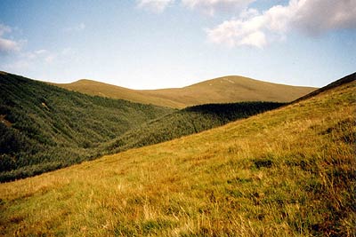
Click image to visit gallery of 3 images.
Broad Law is the second highest summit in the Southern Uplands of Scotland at 840 metres and ranks as a Corbett. Like most of the hills in this area it is rounded and grassy offering fine views once height is gained.
The start is from the Megget Stone (Grid ref. NT151203) on the minor road from Tweedsmuir to St Mary's Loch between the Megget and Talla Reservoirs. From the cattlegrid adjacent to the Megget Stone follow the fence in a northerly direction up onto the spur of Fans Law. The onward route continues onto Cairns Law.
In poor visibility it is essential that you do not head mistakenly for Talla Cleuch Head where the fence forks just below Cairn Law. From this latter minor summit continue along the fence in a northerly direction towards the summit of Broad Law, which is sadly home to a Air Traffic Control Beacon and a Police Radio Tower. However despite this ironmongery the views are superb with the whole of the Southern Uplands on view.
The return route is to retrace your steps to the Megget Stone.
Maps 

| Ordnance Survey Explorer 330 | Sheet Map | 1:25k | BUY |
| Anquet OS Explorer 330 | Digital Map | 1:25k | BUY |
| Ordnance Survey Explorer 336 | Sheet Map | 1:25k | BUY |
| Anquet OS Explorer 336 | Digital Map | 1:25k | BUY |
| Ordnance Survey Digital Map Subscription | |||
| Latest Ordnance Survey Discounts | |||
Other walks nearby
| Walk 2006 | Grey Mare's Tail & White Coomb | mod/hard | 7.2 miles |
| Walk 3759 | St. Mary's Loch Circular | easy/mod | 7.5 miles |
| Walk 2008 | Hart Fell via Saddle Yoke & the Black Hope Horseshoe | mod/hard | 8.5 miles |
| Walk 3612 | Ettrick Hills Horseshoe | mod/hard | 8.0 miles |
| Walk 2268 | Annandale Way | moderate | 9.0 miles |
| Walk 2050 | The Crown of Scotland | moderate | 9.0 miles |
| Walk 2035 | Hart Fell via Hartfell Spa | moderate | 7.2 miles |
| Walk 2280 | Hart Fell & Whitehope Heights | moderate | 8.4 miles |
| Walk 2045 | Capel Fell via Sailfoot Law & Broken Back Hill | moderate | 5.8 miles |
| Walk 2135 | Camps Reservoir Circular | easy | 5.8 miles |
Recommended Books & eBooks
Walking in the Southern Uplands
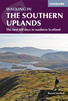 Guidebook to 44 varied day walks and over 100 summits in the Southern Uplands of Scotland, stretching south-west from Edinburgh to the English border, including the Galloway and Pentland Hills. Between 2 and 29km, there is something for all seasons and all abilities in remote and rugged hill country.
More information
The Borders Abbeys Way
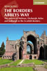 Guidebook to the Borders Abbeys Way, a 68 mile circuit in the Scottish Borders, taking in 4 of Britain's grandest ruined medieval abbeys. Beginning and ending in Tweedbank, the route, which is described over 6 stages, is as rich in history as it is in pastoral charm. Relatively flat, it is suitable for people with a moderate level of fitness.
More information
