Cromford to Bakewell
Peak District Walk
Nat Park - Peak District - Bakewell Monsal Trail
County/Area - Derbyshire
Author - Paul Taylor
Length - 11.5 miles / 18.7 km Ascent - 1800 feet / 545 metres
Time - 7 hours 30 minutes Grade - moderate
Maps 

| Ordnance Survey Explorer OL24 | Sheet Map | 1:25k | BUY |
| Anquet OS Explorer OL24 | Digital Map | 1:25k | BUY |
| Ordnance Survey Landranger 119 | Sheet Map | 1:50k | BUY |
| Anquet OS Landranger 119 | Digital Map | 1:50k | BUY |
Walk Route Description
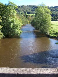
Click image to visit gallery of 5 images.
This walk continues from where walk 2619 ended, Cromford Railway Station (grid ref SK303574). It features three different rivers, Industrial Heritage, a popular TV location, UFO sightings, Standing Stones, A Medieval Tudor Hall and the Peak District's main town.
From Cromford station exit onto the road and continue in the same direction towards Arkwrights Mill. Continue past the mill keeping to the path alongside the road to reach the junction with the A6. Use the crossing to your right and cross straight over the A6 and continue onward toward Cromford village centre.
After only 40 yards we reach a small car park near a the Bell Inn. Turn right along the single lane road to pass the Boat Inn. At this point Cromford Pond appears to your left. Keep on a few yards to reach Scarthin Books on your right, a wonderful bookshop, that is well worth a look and/or a cuppa. Continue for a further 100 yards to reach a main road (Grid ref. SK 292570). Turn right uphill for 150 yards and right again into a lane - Chapel Hill. Walk uphill with the houses to your right.
Eventually the lane ends and becomes a woodland path. Follow this until you come to a single lane track where you turn right and follow it as it winds its way uphill. Do be careful as there is a drop into a quarry to your left, which is well fenced off. This section from Chapel Hill past the quarry to where it opens out into hilltop views is a fairly continuous steep uphill walk.
Eventually the path opens out into fields and surrounding views. You round a bend and there below you is the village of Bonsall, well worth a visit in its own right. As the path turns into a road - Church St - you continue into the village centre. You find the Village Cross as well as the Kings Head pub. Fans of the ITV show 'Peak Practice' will remember this part of the town as it doubled for the fictional village of Cardale.
Bonsall is also famous for UFO sightings. NASA purchased footage from one local of film taken of a suspected UFO. Many other sightings have been recorded and even 'Countryfile' came here for a UFO walk. The Landlord of the Barley Mow organises walks on Bank Holidays throughout the year.
Walking uphill along High Street you can admire the buildings with some over three hundred years old. Eventually the buildings diminish and as you carry along uphill toward Bonsall Moor fields return to either side of the road. At the point where the road meets another on the right - Nailors Lane (Grid ref. SK 270592) - keep straight on for 15 yards and you will see a cutting in the wall. Go through this cutting and follow the path across small fields, negotiating stile after stile.
At the top of the hill - the highest point of the walk - views toward Stanton Moor and the Chatsworth Estate open out in front of you. At this point the village of Wensley, our next destination, can be seen below. The map shows a path but in reality it comes and goes. However as long as you continue toward Wensley village you soon find it again.
As you follow the path into the village itself you reach the main road. Turn left uphill and at the end of the village just past a pub car park you see a footpath sign (Grid ref. SK 260610). Turn right following the path uphill through the field and then downhill toward the bottom right hand corner where you see a stile. Continue over the stile and down a steep hill keeping to the somewhat slippery path to the bottom of the hill. Cross over the stream and bear right, uphill along a track.
As you reach a single lane road, turn sharp left uphill along another track, which is tree lined for the most part. Continue on this track for about twenty minutes until the view opens up with fields to both sides of the track. Reaching a footpath on your right signed for the pleasant village of Birchover. Follow this path, although we do not go into the village itself (unless you prefer the detour). Continue north past Barn Farm (Grid ref. SK 2446123) and up onto a single lane road.
Turn right and after 50 yards we go through a gate onto Stanton Moor. Keep to this path going straight through the centre of the moor. After stopping to admire the famous 'Nine Ladies' standing stones continue walking to pass through a gate onto a road. Turn left and continue down into Stanton-in-the Peak. The view now includes Haddon Hall and behind it Bakewell our eventual destination.
Passing through the village turn right into School Lane. Walk past the Primary School with the track leading into path which meanders its way around trees (to your left as you pass) and then downhill to the bottom left corner of the field where you see a stile. Cross over this stile into a larger field. Another stile lies along the middle of the wall opposite. Climb over and turn left along a lane towards the A6 main road.
At the A6 cross over and walk left past Haddon Hall, which you can see hiding through the trees. About 200 yards beyond Haddon Hall's car park we see a gap in the wall. Go through this and follow the path which leads to a peaceful walk alongside the River Wye. Continue past the Agricultural Centre and into Bakewell itself. You've made it!
All that remains now is to explore Bakewell and perhaps choose a pub to quench your thirst. To return to Cromford you need to catch the 'TP' (Trans Peak) express bus on the edge of town. The Peak District Park Information Centre in Bakewell centre has details on bus times and can help you find the correct bus stop.
A further extension to this route can be found at Walk 2798 taking you through to Edale.
Further Notes Tony Manville has suggested the following improvement to the final stages of this walk - "Enjoyed this pleasant walk on Saturday. The final section can be improved by continuing straight on at School Lane, Stanton-in-Peak, to leave the village and turn right opposite the lodge (Grid ref. SK237643) onto a footpath that crosses an open field to a stile at the diagonally opposite corner and then passes through a further field before descending through trees to the B5056. Turn right to cross at the junction with the Youlgrave Road and take the driveway opposite to ascend through trees for approximately 100 yards before branching right on the footpath that leads over open pasture to the edge of the plantation from where you descend to the Haddon Hall car park. This detour reduces to a minimum the time spent walking beside the busy A6."
Other walks nearby
| Walk 2899 | Cromford Canal & Black Rocks from High Peak Junction | easy/mod | 6.8 miles |
| Walk 2218 | Cocking Tor from near Matlock | moderate | 9.5 miles |
| Walk 2993 | Carsington, Brassington & Cromford and High Peak Railway from Middleton | moderate | 9.5 miles |
| Walk 2559 | Stanton Moor & The Nine Ladies Stones from Winster | moderate | 9.0 miles |
| Walk 3196 | Stanton Moor and Robin Hood's Stride from Winster | easy/mod | 7.0 miles |
| Walk 2136 | Wensley & Brightgate | easy/mod | 6.2 miles |
| Walk 2701 | Harboro Rocks & Brassington | easy/mod | 6.5 miles |
| Walk 1378 | Carsington Circular | easy | 4.5 miles |
| Walk 1379 | Carsington and Harboro Rocks | easy/mod | 5.8 miles |
| Walk 3672 | Carsington Water, Hognaston & Madge Hill | easy/mod | 5.5 miles |
Recommended Books & eBooks
Walking in the Peak District - White Peak East
 Guidebook describing 42 half-day and day walks in the limestone landscapes of Derbyshire's White Peak, part of the Peak District National Park. One of two volumes, this book covers the east of the region, with potential bases including Bakewell, Eyam, Castleton, Birchover, Matlock and Wirksworth.
More information
Great Mountain Days in the Pennines
 An inspirational guidebook to 50 classic walks on the rolling Pennine landscape. The graded routes, between 6 and 13 miles in length, cover classic Pennine fells and moorland such as Whernside, Ilkley Moor and Pendle Hill; exploring the North and South Pennines, Yorkshire Dales, Howgills and Dark Peak. Many routes are also suited to fell running.
More information
Messaging & Social Media
Message Walking Britain and follow the latest news.

Mountain Weather
Stay safe on the mountains with detailed weather forecasts - for iOS devices or for Android devices.