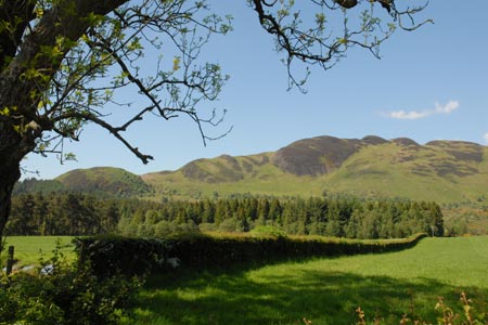
Conic Hill from Balmaha
Loch Lomond and Trossachs Walk
Nat Park - Loch Lomond and Trossachs
County/Area - Stirling
Author - Lou Johnson
Length - 4.0 miles / 6.5 km Ascent - 1400 feet / 424 metres
Time - 3 hours 20 minutes Grade - easy/mod
Maps 

| Ordnance Survey Explorer OL38 | Sheet Map | 1:25k | BUY |
| Anquet OS Explorer OL38 | Digital Map | 1:25k | BUY |
| Ordnance Survey Landranger 56 | Sheet Map | 1:50k | BUY |
| Anquet OS Landranger 56 | Digital Map | 1:50k | BUY |
Walk Route Description
Click image to visit gallery of 9 images.
Loch Lomond is one of the scenic jewels of Scotland. This walk enables you to enjoy some excellent views of the lake both from above and from the lochside. Using a section of the West Highland Way the way does involve some uphill work but the views compensate for the effort. Conic Hill is the summit of ridge consisting of a number of rounded hills made from puddingstone (conglomerate).
The start is the large and free car park (at least in 2009!) by the Loch Lomond and Trossachs National Park Visitor Centre (toilets) on the east side of the B837 road at Balmaha (grid ref. NS420909). The car park is also served by buses from Balloch railway station which has frequent direct trains from Glasgow. The walk starts at the back of the car park where you should locate the West Highland Way. This is followed back towards Milngavie. Initially the path passes through woodland but soon emerges into more open country on the eastern flank of the Conic Hill ridge.
The climb starts in earnest here and you soon arrive at an open col, Bealach Ard. The path bears right and now on the opposite flank of the hill continues its uphill progress still following the West Highland Way. After just over 600 metres, look out for a steeper path veering right. This climbs to what seems to be the accepted summit of Conic Hill. It is not the highest point but probably offers the best view west over Loch Lomond and a nice background panorama of mountains. Also in view to the north is Ben Lomond.
To reach the highest point, leave the popular summit and continue northeast parallel to the West Highland Way. Descend to a col, go over a minor 'lump' to another col and then climb to true summit. The view is not much different but you can enjoy the peace and quiet or perhaps have a picnic without throngs of people.
To descend return to the last col. Instead of going over the minor 'lump' bear right and descend to the West Highland Way. Go left on this National Trail and continue to descend as far as Bealach Ard. Instead of taking the WHW directly to the car park at Balmaha, veer 10 metres or so to your right and continue along the obvious grassy ridge. There is a path and this leads you to the end of the ridge. The path descends steeply and leads out onto the road.
Cross the road to the lochside and follow the clear path keeping Loch Lomond of your right. You have the option of staying level with the loch or clambering up to the viewpoint of Craigie Fort. Whichever option you take the routes rejoin and lead you back to the centre of Balmaha where there are refreshments in season.
Other walks nearby
| Walk 2347 | Duncryne from Gartocharn | easy | 2.0 miles |
| Walk 1492 | WHW - Day 2 - Dryden to Rowardennan | moderate | 15.0 miles |
| Walk 1296 | Beinn Eich & Doune Hill | mod/hard | 8.0 miles |
| Walk 3009 | Ben Lomond | mod/hard | 7.5 miles |
| Walk 1493 | WHW - Day 3 - Rowardennan to Inverarnan | moderate | 14.0 miles |
| Walk 2413 | Ben Venue from Loch Achray | moderate | 8.2 miles |
| Walk 2309 | Ben A'an from Loch Achray | easy/mod | 2.5 miles |
| Walk 1298 | The Cobbler | mod/hard | 7.5 miles |
| Walk 1459 | Ben Arthur ("The Cobbler") | mod/hard | 7.5 miles |
| Walk 2552 | West Highland Way Experience | moderate | 95.0 miles |
Recommended Books & eBooks
The West Highland Way
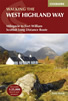 Guidebook to walking the West Highland Way National Trail, a 95 mile Scottish long-distance route from Milngavie near Glasgow to Fort William, passing Loch Lomond and crossing Rannoch Moor. Suggested itineraries over 6 to 9 days. Includes accommodation guide and pull-out 1:25K OS map booklet.
More information
West Highland Way Map Booklet
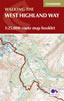 This compact booklet of maps shows the full route of the 95 mile West Highland Way Scottish Long Distance Route, via Loch Lomond and Rannoch Moor. This booklet is included with the Cicerone guidebook to the trail, and shows the full route on Ordnance Survey 1:25,000 maps.
More information
Messaging & Social Media
Message Walking Britain and follow the latest news.

Mountain Weather
Stay safe on the mountains with detailed weather forecasts - for iOS devices or for Android devices.