Beacon Hill and Warnford from Exton
Hampshire Walk
County/Area - Hampshire
Author - Lou Johnson
Length - 6.0 miles / 9.8 km Ascent - 600 feet / 182 metres
Time - 3 hours 40 minutes Grade - easy/mod
Maps 

| Ordnance Survey Explorer OL3 | Sheet Map | 1:25k | BUY |
| Anquet OS Explorer OL3 | Digital Map | 1:25k | BUY |
| Ordnance Survey Explorer OL32 | Sheet Map | 1:25k | BUY |
| Anquet OS Explorer OL32 | Digital Map | 1:25k | BUY |
| Ordnance Survey Landranger 185 | Sheet Map | 1:50k | BUY |
| Anquet OS Landranger 185 | Digital Map | 1:50k | BUY |
Walk Route Description
Click image to visit gallery of 12 images.
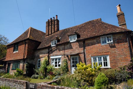
The village of Exton lies in the attractive Meon Valley just off the A32 main road. The start is a small parking area (grid ref. SU617212) which is reached by turning off the A32 and taking the northernmost of the two lanes off the main road into the village. Immediately after turning off the A32 the small parking area is evident on your left. Note that in fine weather and busy periods that this may get full quite quickly.
After parking, walk into the village with the River Meon on your left. The lane bears sharp right. If you want to have some food or refreshments there is a pub down the lane to your left, but for the walk you need to continue along the lane passing the parish church which will be on your right. The road gradually bends left. After approximately 200 metres look out for a South Downs Way sign on the right (grid ref. SU611210). Follow this sign and enter open farmland. Ahead lies the first objective, namely Beacon Hill.
The onward route is clear. You cross an access track and begin to climb more steeply with an improving view behind you. Reaching a lane, turn right. It is worth looking left as you have an excellent panorama that includes the Solent and the Isle of Wight beyond. After a short way along the lane a signed path on the right (grid ref. SU601223) should be followed to the trig point on Beacon Hill. The view is particularly fine over the Meon Valley.
From the trig point take the clear track that heads north-west to a car park and road junction (gird ref. SU598227). Turn right here and walk through pleasant woodland. You are now on the Monarch's Way. Follow the well signed path as you descend gradually towards Warnford. In places the landowner has perhaps provided rather too much signage but this is better than none! Reaching a road, turn right into Warnford. As you reach the main road note the watercress ponds on your left.
At the A32 turn left, walk past the pub to reach a road junction (grid ref. SU624231). Turn right up this lane climbing a little in the process. After just over half a mile you reach a bridge over the old railway (grid ref. SU633228). Take the path on the left hand side of the road and descend to the old trackbed. Turn back on yourself and walk under the road. You now have a straightforward walk on a well graded path. This railway was called the Watercress Line and a section to the north of here is now preserved with steam trains in operation.
Crossing the lane to Peake farm (grid ref. SU628218) is about the half way point to where we will leave the old railway. This is good walking and you can keep a good pace along this section. At grid ref. SU624211 you leave the old railway and follow the signed South Downs Way back to the start. This last section does not encourage you to step out as there are some tree roots and other minor obstructions to negotiate. Reaching the main road, take care and cross to the parking area opposite.
Other walks nearby
| Walk 1034 | Beacon and Old Winchester Hills on the South Downs | moderate | 10.5 miles |
| Walk 2533 | East Meon to Old Winchester Hill | moderate | 12.0 miles |
| Walk 2394 | East Meon & Wether Down | easy/mod | 8.0 miles |
| Walk 2373 | Hambledon Circular | easy/mod | 6.1 miles |
| Walk 3324 | Cheriton Mill & Tichborne from Cheriton | easy | 5.7 miles |
| Walk 3260 | Butser Hill Circular | easy/mod | 6.9 miles |
| Walk 2383 | Upham & Owslebury Circular | easy/mod | 6.5 miles |
| Walk 2422 | Butser Hill and Wether Down from Buriton | moderate | 12.5 miles |
| Walk 1964 | Abbotstone from Old Alresford | easy | 5.1 miles |
| Walk 1976 | Noar Hill from Selborne | easy/mod | 5.0 miles |
Recommended Books & eBooks
The South Downs Way
 Guidebook to walking the South Downs Way National Trail, a 100 mile (160km) route between Winchester and Eastbourne through the South Downs National Park, described in both directions over 12 stages. Easy walking on ancient and historical tracks, taking in wooded areas, delightful river valleys and pretty villages. With 1:25K OS map booklet.
More information
Walking Hampshire's Test Way
 Guidebook to walking the 71km (44 mile) Test Way in Hampshire from high on the chalk downs of Inkpen Beacon to the Eling Tide Mill near Southampton Water. Following the beautiful, crystal clear River Test, it passes picturesque villages and fascinating historic sites. Also includes 15 day walks to explore this lovely part of pastoral England.
More information
Messaging & Social Media
Message Walking Britain and follow the latest news.

Mountain Weather
Stay safe on the mountains with detailed weather forecasts - for iOS devices or for Android devices.