Ysgyryd Fawr (The Skirrid) near Abergavenny Walk
Walk 2670 - Route Maps
Route Map
Digital Maps - Copyright © 2011-2024. All rights reserved.
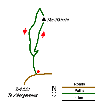
Sketch Map
Suggested Maps 

| Ordnance Survey Explorer OL13 | Sheet Map | 1:25k | BUY |
| Anquet OS Explorer OL13 | Digital Map | 1:25k | BUY |
| Ordnance Survey Landranger 161 | Sheet Map | 1:50k | BUY |
| Anquet OS Landranger 161 | Digital Map | 1:50k | BUY |
It is recommended you take a map. The preferred scale is 1:25k.
Start Point Details
Ordnance Survey Grid Ref SO328163
Latitude 51.841242 Longitude -2.976811
Postcode NP7 8AP
what3words start jogged.boardroom.image
Walk description may contain detailed information on the start point for this walk.
Further Information
Brecon Beacons
Walking in the Brecon Beacons National Park (Bannau Brycheiniog) covers a wide area in South Wales. The high summits of the Beacons themselves tell only part the story as, like most National Parks, there is a varied range of scenery to be enjoyed within its boundaries. Brecon Beacons Walking Guide
Walk grading - Learn how each walk is assessed and select a walk to suit your ability and experience by going to Walk Grading Details.
Messaging & Social Media
Message Walking Britain and follow the latest news.

Mountain Weather
Stay safe on the mountains with detailed weather forecasts - for iOS devices or for Android devices.