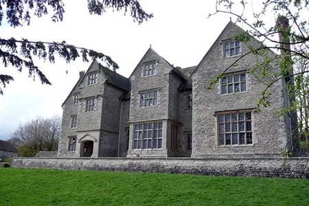
Wenlock Edge & Broadstone from Wilderhope Manor
Shropshire Hills Walk
Region - Shropshire Hills
County/Area - Shropshire
Author - Lou Johnson
Length - 6.4 miles / 10.4 km Ascent - 700 feet / 212 metres
Time - 3 hours 50 minutes Grade - easy/mod
Maps 

| Ordnance Survey Explorer 217 | Sheet Map | 1:25k | BUY |
| Anquet OS Explorer 217 | Digital Map | 1:25k | BUY |
Walk Route Description
Click image to see photo description.
Wenlock Edge is one of the scenic highlights of Shropshire and is rightly included with the Shropshire Hills Area of Outstanding Natural Beauty. The start is Wilderhope Manor (grid ref. SO545929), which is reached off the B4371 between Much Wenlock and Church Stretton.
After parking follow the Shropshire Way south west for two miles. This section of the route is also part of the Jack Mytton Way. Reaching the road at Roman Bank (grid ref. SO520908), turn right to Topley (grid ref. SO527905). Here bear half left onto the Jack Mytton Way which follows a meandering course south-east to reach the B4368 (grid ref. SO542897).
Cross the main road and take the lane opposite turning left almost immediately onto a footpath that leads to Broadstone Chapel (grid ref. SO544897). Continue straight ahead here following a path across a footbridge and in a further 400 metres to reach a path junction (grid ref. SO548899). Turn left (north) and pass through the grounds of Broadstone Mill to reach the B4368. Turn right along this main road and 400 metres to Hopescross (grid ref. SO548904).
Turn left up the lane to Longville. Where the lane bends to the left take the Shropshire Way on your right through the Stanway Valley to return to the start.
Other walks nearby
| Walk 3447 | Caer Caradoc, Hope Bowdler & Willstone Hills | moderate | 7.0 miles |
| Walk 2633 | Brown Clee Hill | easy/mod | 6.3 miles |
| Walk 2345 | Clee Hills | easy/mod | 6.8 miles |
| Walk 2296 | Brown Clee Hill Circular | easy/mod | 4.5 miles |
| Walk 1097 | Caer Caradoc | easy/mod | 3.5 miles |
| Walk 2022 | Wenlock Edge & Aston Munslow | moderate | 7.8 miles |
| Walk 1321 | Caer Caradoc & Hope Bowder Hill | moderate | 9.0 miles |
| Walk 3048 | Caer Caradoc & The Lawley | moderate | 10.0 miles |
| Walk 3308 | Ragleth and the Long Mynd | mod/hard | 11.0 miles |
| Walk 3449 | Ragleth, the Long Mynd & Ratlinghope | hard | 18.0 miles |
Recommended Books & eBooks
Hillwalking in Shropshire
 Guidebook to 32 walking routes in Shropshire in the West Midlands. The routes range from 3 miles (5km) to 12 miles (19km), taking in highlights such as The Wrekin, Wenlock Edge, Long Mynd and Stiperstones, Castle Ring and Bury Ditches. Many routes start near delightful towns and villages including Church Stretton, Ludlow and Bishops Castle.
More information
Messaging & Social Media
Message Walking Britain and follow the latest news.

Mountain Weather
Stay safe on the mountains with detailed weather forecasts - for iOS devices or for Android devices.