Falmer to Pyecombe & Blackcap by South Downs Way
South Downs Walk
Nat Park - South Downs
County/Area - East Sussex & West Sussex
Author - Barry Mackie
Length - 8.8 miles / 14.2 km Ascent - 1080 feet / 327 metres
Time - 5 hours 30 minutes Grade - moderate
Maps 

| Ordnance Survey Explorer OL11 | Sheet Map | 1:25k | BUY |
| Anquet OS Explorer OL11 | Digital Map | 1:25k | BUY |
| Ordnance Survey Landranger 198 | Sheet Map | 1:50k | BUY |
| Anquet OS Landranger 198 | Digital Map | 1:50k | BUY |
Walk Route Description
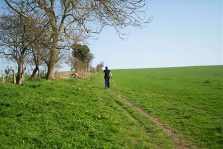
Click image to visit gallery of 12 images.
This Sussex walk along the South Downs Way begins on the side road that runs parallel to the main A27 trunk road between Falmer and Lewes near to Housedean Farm (grid ref TQ369092). To the right side of the farm, the SDW waymarker, with its distinctive acorn motif, directs you towards the sleep slope that rises in a northerly direction up the somewhat aptly named Long Hill. This is a fairly stiff start to the walk but there is a bit of help to be had here with the few steps cut into the bank. Do not be put off by this initial bit of exertion though, the rest of the walk is on much easier slopes and the only things likely to leave you breathless are those wonderful views that await you!
Go through the gate at the top of the steps and then alongside the edge of the field with the hedgerow on your left, to reach the woods at Bunkershill Plantation. Follow the path through the left side of the woods to come out at the northern end with the way now veering to the East as it heads along the narrow path between the fences of the fields on either side. The route goes to the left at grid ref TQ375102 in a NNW direction over Balmer Down to reach grid ref TQ364115 where you turn right.
It will be along here that you will see the first of several dew ponds and there is the occasional information board alongside some of the ponds detailing their history and purpose (also see the footnote at the end of this description). Continue in a NNE direction and amongst the views something might just start to catch your eye to the right side on the skyline in the distance. Surely that's not a trig pillar? A quick look at your map will show it is the summit of Blackcap, 206 m high and located at grid ref TQ374125, which is no more than a short diversion off the main route.
Blackcap gets a mention because it really is well worth a visit but also because it is a perfect example of what the South Downs are all about. Such is the astonishing array of interesting sights and glorious scenery that there is a real temptation to follow your eyes and go off and explore this fascinating countryside in every direction. Of course you probably can't do this, but given enough time, fitness and provisions, the odd straying off the way will only make this great day out even better. Instead of turning left with the SDW at the gate, go right and through the gate into the National Trust area also called Blackcap and then up the gentle grassed incline to the summit point and enjoy more of those wonderful views all around you. Close by is a small plaque commemorating the planting of the woodland here in 1953. Retrace your steps and return to the gates and the SDW.
From here the way continues in a westerly direction along the crest of the escarpment with the steep slopes to your right and beyond them the Weald of Sussex. This line and the associated scenery is what the South Downs represents and it remains like this for the much of the remainder of this walk. After another kilometre Plumpton Plain is reached and directly below the slopes to your right is the village of Plumpton and close by its large agricultural college. From here, the way meanders along and up and down the gentlest of slopes to cross a minor road, with a dew pond alongside. Go through the car park and up to the summit and trig pillar of Ditchling Beacon, with the town of Ditchling itself directly below. At 248m this is the county top of East Sussex and the highest point on the SDW, although not of the South Downs. For those of you with an interest in hill classification, Ditchling Beacon, like Firle Beacon that we stood upon in section 2 of the SDW, is a Marilyn (See footnote).
Leaving Ditchling Beacon, the way continues in a westerly direction. The next important crossing is the county border as we step over from East to West Sussex. No marker here to spoil or otherwise hinder the views but grid ref TQ315128 is the spot. Maintaining direction the path starts to gradually lose height. The steep slopes and views to the right begin to disappear, but by way of compensation, another great sight starts to appear as you travel over the brow of the hill in front of you. It is the sails of a windmill (Jack) and soon to be seen the sails of another smaller windmill (Jill). Also known as the Clayton Windmills, "Jack and Jill" are rightly considered to be one of the most famous landmarks on the South Downs. During the great storm of 1987 millions of trees in the region were damaged. It is also worth stating that "Jill" was also virtually destroyed that night, but you would not know that now.
The way passes very close to the windmills, which are now part of a private residence before heading south through New Barn Farm. Then turn right and down the slope through the golf course to the A273 road at grid ref TQ294129. Cross the road and take the path that goes left (south) to reach the village of Pyecombe. Turn right into the village street and then left to reach the bottom of the quiet road and the welcome sight of the Plough Inn, which after a nice sunny day on the downs, is a great place to finish this walk.
Footnote - The dew ponds on the downs are man-made structures that were originally constructed to provide water for the livestock that graze in the region. In spite of their name, dew is not the main source of water; as generally, rainfall is equal or more than the combined loss by evaporation and livestock consumption.
A Marilyn is a hill of any height with a drop of 150m or more on all sides. In other words, not necessarily that high a hill itself, it is relatively high in relation to its surroundings.
Transport to back to Falmer or Lewes - there are bus stops to both Brighton and Haywards Heath near to the Plough Inn. A handy website for planning your trip is at www.visitsouthdowns.com. When this walk was being researched we were heading to Rodmell and called a taxi from nearby Hassocks. Expect to pay approx £ 24 for this length of journey at 2007 prices. This is more expensive than public transport, but easier and much quicker.
Other walks nearby
| Walk 2903 | Stanmer to Streat | moderate | 12.5 miles |
| Walk 1770 | Southease or Rodmell to Falmer | easy/mod | 6.8 miles |
| Walk 2236 | Wolstonbury Hill and Pyecombe from Patcham | moderate | 11.0 miles |
| Walk 2486 | Plumpton Green & South Downs | easy/mod | 7.7 miles |
| Walk 2419 | Southease, Ditchling Beacon & Lewes | mod/hard | 17.0 miles |
| Walk 1038 | Firle Beacon | moderate | 13.3 miles |
| Walk 3213 | Pyecombe, Devil's Dyke & Upper Beeding | easy/mod | 8.0 miles |
| Walk 3487 | Edburton Hill & Devil's Dyke from Saddlescombe | hard | 10.5 miles |
| Walk 1633 | Charleston Farm & Firle Beacon | easy/mod | 4.6 miles |
| Walk 3488 | Devil's Dyke Circular | easy | 2.5 miles |
Recommended Books & eBooks
Walks in the South Downs National Park
 Guidebook with 40 circular walks throughout the South Downs National Park, exploring the beautiful chalk hills between Eastbourne and Winchester. The walks range from under 5 miles to 11 miles, including Beachy Head and the Seven Sisters, Ditchling Beacon and hundreds of prehistoric sites. Accessible all year, but wild flowers best in spring.
More information
The South Downs Way
 Guidebook to walking the South Downs Way National Trail, a 100 mile (160km) route between Winchester and Eastbourne through the South Downs National Park, described in both directions over 12 stages. Easy walking on ancient and historical tracks, taking in wooded areas, delightful river valleys and pretty villages. With 1:25K OS map booklet.
More information
Messaging & Social Media
Message Walking Britain and follow the latest news.

Mountain Weather
Stay safe on the mountains with detailed weather forecasts - for iOS devices or for Android devices.