 Walking Britain
Whitten Pond Circular from Burley
New Forest Walk
Pub Walk + Heathland + Woodland
Nat Park - New Forest
County/Area - Hampshire
Author - Lou Johnson
Length - 5.4 miles / 8.8 km Ascent - 350 feet / 106 metres
Time - 2 hours 50 minutes Grade - easy
Walk Route Description
Click image to see photo description.
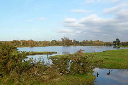
A circular walk from Burley exploring a New Forest landscape of undulating heathland and wooded inclosures with the chance of seeing ponies. The route crosses two small hills, visits Whitten Pond and can easily be combined with a visit to the Queens Head either before or after the walk.
The start is Burley Cricket car park (grid ref. SU213029) on the north side of Wilverley Road 350 metres east from the Queens Head. After parking exit the car park, cross the road, and turn left a short distance to turn right onto a track with adjacent Forestry England sign. After 60 metres turn left onto a clear track which descends to cross Turk Hill. The track then descends into a shallow valley and crosses the former railway. Just after the railway (grid ref. SU219015) you reach a fork where you bear right. The path loops round to the right to head west soon joining other tracks.
A kilometre from the railway you reach a fork (grid ref. SU209010). Keep ahead and descend to the shores of Whitten Pool. Roughly halfway along the shore veer left and follow a path to Pound Lane (grid ref. SU201013). Go straight across the lane and follow a clear track. When the track forks after 300 metres bear left and continue to Dur Hill Inclosure. Go straight across a cross track and keep ahead at the next junction. The track then arcs right and heads northwest towards the old railway.
Just before the footbridge over the railway turn right and follow a grassy path and track running roughly parallel to the railway on your left. Continue to Pound Lane (grid ref. SU201017) and turn left. Cross the railway and turn right into Burbush car park. Aim left towards overhead cables and then after 50 metres bear right on a grassy path between trees. Cross a stream into open heathland and head up a slope to join a clear track. Bear left and follow the track northeast and then north to return to Wilverley Road in Burley. Turn right to the car park which is a short distance away on the left.
Maps 
| Ordnance Survey Explorer OL22 | Sheet Map | 1:25k | BUY |
| Get Ordnance Survey Digital Map Subscription | |||
| Latest Ordnance Survey Discounts | |||
Other walks nearby
| Walk 3561 | Burley & Castle Hill | easy | 4.3 miles |
| Walk 3538 | RAF Holmsley South near Bransgore | easy | 2.5 miles |
| Walk 3567 | Wilverley Inclosure & Naked Man | easy | 5.4 miles |
| Walk 3560 | Blackwater Tall Tree trail near Lyndhurst | easy | 2.2 miles |
| Walk 3639 | Rhinefield Walk near Brockenhurst | easy | 5.6 miles |
Start Point Details
Ordnance Survey Grid Ref SU213029
Latitude 50.8252510 Longitude -1.6989610
Postcode BH24 4AA
what3words start fulfilled.tuck.bike
Walk description may contain detailed information on the start point for this walk.
Further Information
New Forest Walking
The New Forest became a National Park in 2005, the first for many years and the first ever in South East England. Located between the urban areas of Southampton and Bournemouth it is bounded by the Solent. The National Park is dominated by open expanses of semi-natural vegetation including heathland, bogs, woodlands and streams. This environment is maintained through the grazing of thousands of New Forest ponies and cattle.
Walking GuideAccommodation
Find Accommodation nearby by using the regional accommodation lists
Go to regional accommodation lists
Self Catering & Cottage Holidays
Properties throughout the UK & Europe
Messaging & Social Media
Message Walking Britain and follow the latest news.


Mountain Weather
Stay safe on the mountains with detailed weather forecasts - for iOS devices.