Thixendale & Kirby Underdale
Yorkshire Wolds Walk
Region - Yorkshire Wolds
County/Area - North Yorkshire & East Yorkshire - Yorkshire Wolds
Author - Donald Morton
Length - 8.5 miles / 13.8 km Ascent - 1100 feet / 333 metres
Time - 5 hours 20 minutes Grade - easy/mod
Maps 

| Ordnance Survey Explorer 294 | Sheet Map | 1:25k | BUY |
| Anquet OS Explorer 294 | Digital Map | 1:25k | BUY |
| Ordnance Survey Landranger 100 | Sheet Map | 1:50k | BUY |
| Anquet OS Landranger 100 | Digital Map | 1:50k | BUY |
| Ordnance Survey Landranger 106 | Sheet Map | 1:50k | BUY |
| Anquet OS Landranger 106 | Digital Map | 1:50k | BUY |
Walk Route Description
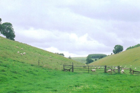
Click image to visit gallery of 4 images.
The Yorkshire Wolds is one of those less frequented places which when found are truly rewarding. The Wolds is a chalk plateau crisscrossed by dales which on the western and northern sides are deep, steep-sided and winding. They provide secret secluded places while the plateau provides a feeling of space and at the scarp edges wide views. This walk is a mixture, starting up Thixendale from the eponymous village, walking on the scarp edge overlooking the Vale of York and returning down some other delightful dales. Some of it is on roads, but they are very quiet, and it was our experience that the local drivers are very considerate of walkers.
Park outside the church in Thixendale village (Not shown on OS Landranger 100 but at grid ref. SE843611). With the church on your left walk out of the village, passing the village shop on the right and the road to Uncleby. Look for a bridleway sign post on the left just before the road swings right. Follow this bridleway soon swinging further left (waymark) up Thixendale. Follow the valley bottom: where it divides take the right fork through a gate. Continue following the valley bottom and at the top reach Thixendale Grange. Go through a gate, turn left and follow the farm drive out to the road.
Turn left along the road. Now to the right you can look over the Vale of York. Look out for a finger post on the left pointing right. Here turn right and follow the footpath down the field edge - hedge right - now facing over the Vale of York. At the end of the field turn left and continue to follow the field edge to a gate. Turn right through the gate and follow a line of hawthorns down to a gate and then still straight on to a second gate. Here turn left and then right to follow the field edge - hedge on left - still downhill to a cross path. Turn left through a gate and go over a field to join a farm track which is followed straight on to a road. (When you dip down to cross a small brook, this almost insignificant feature is the boundary between the ancient North and East Ridings and you have now passed from one to the other.)
When you reach the road turn right and, at the next junction, left to go through the small village of Kirby Underdale. Follow this road through the village, mentioned in the Domesday Book, down past the church on the left, and then up through the hamlet of Painsthorpe to a T-junction. Turn left and again there are views over the Vale of York. Very soon turn right up the first farm track and follow this bridleway past Painsthorpe Wold Farm. Follow it round when it turns left but when it turns right leave it to go straight on through a hedge gap and then turn right (back into the North Riding) to follow the field edge - hedge on right. Look out for a gate in the hedge with waymarks.
Go through this and turn left to go under a large tree where you should pick up a disused cart track and you leave the plateau, going down into Worndale on you left. Follow this little used dale along its floor until you go through a gate and come to a junction of dales. To the right is Bradeham Dale but you turn left to follow the Wolds Way along the floor of Grass Dale through a couple of gates straight on to a road. At the road turn right and, after passing two roads coming in from the right turn left back into Thixendale village.
Other walks nearby
| Walk 3515 | Deepdale and the deserted village of Wharram St. Percy | easy | 5.0 miles |
| Walk 3434 | North Grimston, Birdsall & Wharram Percy | moderate | 12.1 miles |
| Walk 1738 | The deserted village of Wharram St Percy | easy | 2.7 miles |
| Walk 2655 | Wayram To Fridaythorpe Circular | easy/mod | 7.5 miles |
| Walk 2906 | Circular from Wayrham Through Painsthorpe | moderate | 8.5 miles |
| Walk 1990 | Settrington from North Grimston | easy/mod | 7.3 miles |
| Walk 3349 | Pasture Dale, Frendal Dale and Horsedale from Huggate | easy/mod | 9.1 miles |
| Walk 1779 | Horse Dale, Holm Dale, Tun Dale and Frendal Dale from Huggate | easy/mod | 9.0 miles |
| Walk 3127 | Bishop Wilton & Millington | moderate | 13.4 miles |
| Walk 3126 | Kirkham Priory & Pretty Wood from Low Hutton | moderate | 11.0 miles |
Recommended Books & eBooks
Trail and Fell Running in the Yorkshire Dales
 Guidebook to 40 of the best trail and fell runs in the Yorkshire Dales National Park. Ranging from 5 to 24 miles, the graded runs start from bases such as Ribblehead, Dent, Sedbergh, Malham and Grassington and take in the region's diverse delights, from castles and waterfalls to iconic mountains such as Whernside, Ingleborough and Pen Y Ghent.
More information
Messaging & Social Media
Message Walking Britain and follow the latest news.

Mountain Weather
Stay safe on the mountains with detailed weather forecasts - for iOS devices or for Android devices.