The Scafells from Wasdale Head
Lake District Walk
Nat Park - Lake District - Lake District Southern Fells
Wainwrights - Scafell, Scafell Pike
County/Area - Cumbria
Author - Peter Smyly
Length - 9.0 miles / 14.6 km Ascent - 4000 feet / 1212 metres
Time - 8 hours 30 minutes Grade - mod/hard
Maps 

| Ordnance Survey Explorer OL6 | Sheet Map | 1:25k | BUY |
| Anquet OS Explorer OL6 | Digital Map | 1:25k | BUY |
| Ordnance Survey Landranger 90 | Sheet Map | 1:50k | BUY |
| Anquet OS Landranger 90 | Digital Map | 1:50k | BUY |
Walk Route Description
Click image to visit gallery of 6 images.
Several walking routes lead to the top of Scafell and Scafell Pike, the two highest peaks in England, and the shortest distance "as the crow flies" is this one.
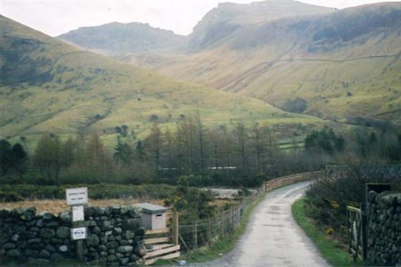
This wonderful Lake District walk starts from the car park at Wasdale Head and cross the bridge over Lingmell Beck .The twin objectives of the two Scafells dominate the view ahead, either side of the col of Mickledore and, in good visibility at least, route-finding should present no difficulties. A clear track leads, steeply in places, up past Lingmell Gill, crossing it at one point, on the way towards Brown Tongue and Hollow Stones below the cliffs at the front of Scafell Pike, Pikes Crag. The summit is out of sight from this angle, a few hundred yards beyond Pikes Crag. While one option is to skirt round to the left between Scafell Pike and Lingmell, for this walk, the next objective is to climb up Mickledore. The cliffs of Scafell dominate the view to the right on approaching Mickledore, This is a stiff climb which gets even steeper, the higher up you get to the point where hands as well as feet may be needed in the latter stages until Mickledore is reached. From Mickledore, a path winds its way up to the summit of Scafell Pike. The very top features a raised area, accessible by a short flight of steps and it is likely that, especially in good weather, other walkers will already be there. After drinking in the all-round views, reverse the route back down to Mickledore. Tempting though the more direct approach via Lord's Rake is to the right, this idea should be avoided since there is a risk of rock fall, therefore this is a "no go" area. From Mickledore, you need to lose a few hundred feet in height to the left that then has to be regained as you descend steeply to reach a point where you have gone beyond the insurmountable rock face of Broad Stand.
Conveniently, a gully to the left of Broad Stand provides access by means of an easy scramble up a gully alongside a stream which leads up to diminutive Foxes Tarn. A giant boulder presides over the tarn which must be one of the smallest in the Lake District to have a name. Another steep uphill walk to the north-west on loose stones leads to the Scafell summit plateau from where it is an easy walk to the top itself. Now descend to the south-west with Burnmoor Tarn seen below to the left of Illgill Head. The area around the edges of the tarn is liable to be boggy underfoot but in any case, before you get there, a path leads away to the right at the bottom of the slopes off Scafell and takes you back to the walk's start point at Wasdale Head.
Other walks nearby
| Walk 1176 | Yewbarrow | moderate | 4.5 miles |
| Walk 2341 | Circuit of Nether Beck and Over Beck from Wasdale | hard | 11.3 miles |
| Walk 1690 | Netherbeck Horseshoe - Middle Fell, Steeple & Red Pike from Wasdale Head | mod/hard | 12.5 miles |
| Walk 1303 | Buckbarrow, Seatallan & Middle Fell from Loweswater | moderate | 7.0 miles |
| Walk 3489 | Scale Bridge & Low Wood from Greendale | easy | 5.2 miles |
| Walk 3485 | High Birkhow & Low Wood from Wast Water | easy | 4.2 miles |
| Walk 1114 | Scafell Pike via Corridor Route | hard | 9.5 miles |
| Walk 1236 | Styhead Tarn and Seathwaite Fell | moderate | 7.0 miles |
| Walk 1306 | Base Brown & Great Gable | mod/hard | 6.0 miles |
| Walk 2046 | Great End via the north west face from Seathwaite | very hard | 7.0 miles |
Recommended Books & eBooks
Lake District: Low Level and Lake Walks
 This guidebook describes 30 of the best low-level walks in the Lake District. From delightful wooded glades and sparkling tarns, to waterfalls and glacier-carved valleys towered over by craggy mountains. The walks described aim to seek out the best walking that the lower areas of the Lake District have to offer.
More information
Walking the Lake District Fells - Wasdale
 Part of the Walking the Lake District Fells series, this guidebook covers a wide range of routes to 25 Lakeland summits that can be climbed from the Wasdale, Eskdale and Ennerdale valleys, with highlights including Scafell Pike, Great Gable and Pillar. Suggestions for longer ridge routes are also included.
More information
Messaging & Social Media
Message Walking Britain and follow the latest news.

Mountain Weather
Stay safe on the mountains with detailed weather forecasts - for iOS devices or for Android devices.