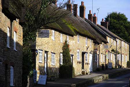
Rodden & Langton Herring from Abbotsbury
Jurassic Coast Walk
Region - Jurassic Coast
County/Area - Dorset
Author - Lou Johnson
Length - 9.2 miles / 15 km Ascent - 800 feet / 242 metres
Time - 5 hours 20 minutes Grade - easy/mod
Maps 

| Ordnance Survey Explorer OL15 | Sheet Map | 1:25k | BUY |
| Anquet OS Explorer OL15 | Digital Map | 1:25k | BUY |
Walk Route Description
Click image to see photo description.
The pretty Dorset village of Abbotsbury provides a perfect starting point for this walk. There is a pay and display car park on the south side of the B3157 just east of the village centre (grid ref. SY579852). Refreshments are available in Abbotsbury and there is a pub in Langton Herring (check opening hours before starting).
After parking exit the car park and turn right along the B3157. Continue along this road for about 600 metres to reach a signed bridleway on your right (grid ref. SY583851). Follow this clear route - The Ridge Bridleway - and continue east to West Elworth which is reached in about a mile. Reaching the lane through this hamlet (grid ref. SY597847) turn right and continue along the lane for just over 300 metres. Turn left onto the continuation of the Ridge Bridleway and continue to a lane at Rodden (grid ref. SY610842).
Turn right down the lane and then take the first footpath on the left (grid ref. SY609841). This path leads across pastures in a shallow valley to a lane (grid ref. SY609832). Turn right down the lane and continue into the centre of Langton Herring. Turn right down Shop Lane, passing the parish church on your right, and locate the footpath (an enclosed track) that heads south towards the sea. Reaching the northern edge of Under Edge Planation bear left and stay on the track which runs alongside the eastern edge of this woodland.
Reaching the shores of West Fleet (grid ref. SY615813), turn right onto the South West Coast Path. To your left across the lagoon is Chesil Beach. The South West Coast Path is well signed and this is followed all the way back to Abbotsbury. Despite its name this long distance footpath does not follow the coast on this section turning inland around the Perimeter of Wkye Wood before climbing onto a ridge running west between Merry Hill and Linton Hill. This section offers some fine views south to Chesil Beach and the English Channel.
Reaching a lane (grid ref. SY579846) close to Horsepool Farm, bear right and then in a short distance leave the lane and continue following the South West Coast Path as it passes beneath the eastern slopes of Chapel Hill on your left. If you have enough energy, then the short climb up to St Catherine's Chapel is worth the effort. Whatever your choice, continue north the short distance back to Abbotsbury and some well-earned refreshment. Also remember to allow time to explore the village which is full of interest.
Other walks nearby
| Walk 2289 | Abbotsbury Castle and Chesil Beach | easy/mod | 6.0 miles |
| Walk 3523 | Abbotsbury & Portesham Circular | easy | 5.2 miles |
| Walk 2370 | The Fleet from Langton Herring | easy/mod | 7.0 miles |
| Walk 3629 | Eggardon Hill from Loders | moderate | 8.4 miles |
| Walk 2391 | West Bay & Burton Cliff | easy | 4.5 miles |
| Walk 3265 | Eggardon Hill from Powerstock | easy/mod | 6.3 miles |
| Walk 1597 | The White Horse & Sutton Poyntz from Osmington | easy/mod | 4.0 miles |
| Walk 2440 | White Nothe & Moigns Down from Osmington | moderate | 10.5 miles |
| Walk 1549 | Golden Cap from Seatown | easy/mod | 4.0 miles |
| Walk 1889 | White Nothe from Ringstead Bay | easy/mod | 5.8 miles |
Recommended Books & eBooks
The South West Coast Path
 Guidebook to walking the entire South West Coast Path National Trail. The route runs for 630 miles from Minehead to Poole along the north Devon, Cornish, south Devon and Dorset coastline. Divided into 45 stages, this long-distance coastal trek could be completed within 4 weeks, or walked in sections. Guide includes maps and essential information.
More information
South West Coast Path Map Booklet - St Ives to Plymouth
 Map of part of the southern section of the 630 mile (1014km) South West Coast Path National Trail. Covers the trail from St Ives to Plymouth along the west Cornwall and Devon coastline. This convenient and compact booklet of Ordnance Survey 1:25,000 maps shows the route, providing all of the mapping you need to walk the trail in either direction.
More information
Messaging & Social Media
Message Walking Britain and follow the latest news.

Mountain Weather
Stay safe on the mountains with detailed weather forecasts - for iOS devices or for Android devices.