 Walking Britain
Walk Photo 287801

The descent path from Criffel's summit approaching the forest above Ardwall.
Caption - The good path used on the descent from Criffel's summit approaching the forest above Ardwall. The onward route uses tracks and path to reach the shores of Loch Kindar before continuing to New Abbey.
Walk 2878 : Criffel from New Abbey
Photographer : Anthony Foster
Use back button to return to the photo gallery lists.
Further Information
Location Map
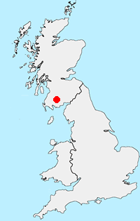
Dumfries and Galloway
Dumfries and Galloway is located in south-west Scotland and shares a short border with England. The area has a lengthy coastline including along the Solway Firth. Inland there are ranges of hills including Merrick the highest hill rising to 843 metres above sea level. Long distance footpaths include the Southern Upland Way.
Messaging & Social Media
Message Walking Britain and follow the latest news.



Mountain Weather
Stay safe on the mountains with detailed weather forecasts - for iOS devices.