Circular from Wayrham Through Painsthorpe
Yorkshire Wolds Walk
Region - Yorkshire Wolds
County/Area - East Yorkshire & North Yorkshire - Yorkshire Wolds
Author - Donald Morton
Length - 8.5 miles / 13.8 km Ascent - 1500 feet / 455 metres
Time - 5 hours 50 minutes Grade - moderate
Maps 

| Ordnance Survey Explorer 294 | Sheet Map | 1:25k | BUY |
| Anquet OS Explorer 294 | Digital Map | 1:25k | BUY |
| Ordnance Survey Landranger 100 | Sheet Map | 1:50k | BUY |
| Anquet OS Landranger 100 | Digital Map | 1:50k | BUY |
| Ordnance Survey Landranger 106 | Sheet Map | 1:50k | BUY |
| Anquet OS Landranger 106 | Digital Map | 1:50k | BUY |
Walk Route Description
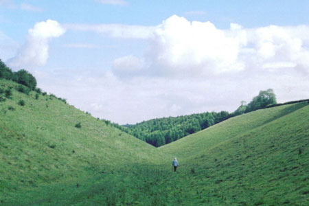
Click image to visit gallery of 5 images.
This walk starts at the car park and picnic site just off the A166 at grid reference SE835568 between Stanford Bridge and Fridaythorpe (3 miles to the east).
Facing the car park take the footpath on the left going up to the A166. On reaching the A166 cross diagonally right to a driveway. Do not go down the driveway but take the footpath which starts off parallel to the A166 and then swings left to enter open access Wayrham Dale via a gateway. Walk down the floor of the dale to a second gate. Go through this into woods and continue, still on the valley floor, as it swings right and then left through Bradeham Dale. Go through a third gate, ignoring a path coming in from the right, and soon afterwards come to a finger post. Here turn left on the bridleway going up Worn Dale. Towards the top the path leaves the bottom of the valley at a waymark and climbs half left up a disused cart track. It becomes a bit obscure at the top, but maintaining the line you come to a hedge and find a rather hidden gate on the right.
You are now leave the grazing land of the dales and coming onto the plateau given over to arable crops. Go through the gate and immediately turn left along a field edge - hedge on left. When a crossing hedge is reached, turn left through a hedge gap and quickly join a track going forward. It soon turns right and goes past Painsthorpe Wold Farm. Just past here, extensive views open up over the Vale of York. The track comes out to a road. Turn left and in 100 meters turn right down a quiet country lane. (Do not miss the view of the delightful Painsthorpe Dale through a gap in the trees on the right.) Half a mile or so later going downhill, the lane turns right. Here go straight on down a no through road. Where the tarmac ends at a farm on the left, go straight on - slightly right - down an enclosed track. Ignore the path going right through a gate to Kirby Underdale seen over the field. Instead bear left through a hedge gap and then immediately turn right down the field - hedge on right. At the bottom go over the bridge, through the gate and turn left to the bridle gate seen ahead. Through this, turn right up the field edge - hedge on right - to a gate leading into a tree lined track. Turn left and follow this track for nearly 1 mile out to the A166 (Grid Ref SE 809 567).
Cross the A166 and continue straight on down the narrow lane opposite. This goes down the dale to Bishop Wilton, but look out for steps on the left just after the road enters woodland. Go up the steps and follow the path along the top of the dale, arable fields to the left, grazing down in the dale on the right, with long views ahead over the Humber and into Lincolnshire. When you come to some woods turn left along their edge. When the woods finish go ahead over a stile and straight on to a road. Cross the road straight onto a gravel track which leads round and down into Deep Dale. Do not enter the open access land on the left until a waymark at a gateway points left down steep steps. At the bottom go through the right hand gate of a pair facing you and then bear right up the hill. Go through a strip of scrub and straight on across the field to a hedge where you turn left to follow a track to a road. Turn left along this (Roman) road. Just past a patch of woodland turn right on a footpath along an enclosed drove route. When it reaches a field follow the hedge on the right straight on and then curving left to come to the road to the East of the start car park which is reached by turning left along the road.
Other walks nearby
| Walk 2703 | Thixendale & Kirby Underdale | easy/mod | 8.5 miles |
| Walk 3349 | Pasture Dale, Frendal Dale and Horsedale from Huggate | easy/mod | 9.1 miles |
| Walk 1779 | Horse Dale, Holm Dale, Tun Dale and Frendal Dale from Huggate | easy/mod | 9.0 miles |
| Walk 3127 | Bishop Wilton & Millington | moderate | 13.4 miles |
| Walk 3515 | Deepdale and the deserted village of Wharram St. Percy | easy | 5.0 miles |
| Walk 3434 | North Grimston, Birdsall & Wharram Percy | moderate | 12.1 miles |
| Walk 1738 | The deserted village of Wharram St Percy | easy | 2.7 miles |
| Walk 1990 | Settrington from North Grimston | easy/mod | 7.3 miles |
| Walk 1842 | Buttercrambe & Youlthorpe from Stamford Bridge | moderate | 11.8 miles |
| Walk 2727 | Pocklington Canal from Allerthorpe Wood | moderate | 11.0 miles |
Recommended Books & eBooks
No suggestions for this area.Messaging & Social Media
Message Walking Britain and follow the latest news.

Mountain Weather
Stay safe on the mountains with detailed weather forecasts - for iOS devices or for Android devices.