Roseberry Topping from Newton under Roseberry Walk
Walk 2930 - Route Maps
Route Map
Digital Maps - Copyright © 2011-2024. All rights reserved.
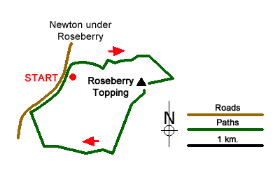
Sketch Map
Suggested Maps 

| Ordnance Survey Explorer OL26 | Sheet Map | 1:25k | BUY |
| Anquet OS Explorer OL26 | Digital Map | 1:25k | BUY |
It is recommended you take a map. The preferred scale is 1:25k.
Start Point Details
Ordnance Survey Grid Ref NZ570128
Latitude 54.507317 Longitude -1.121217
Postcode TS9 6QS
what3words start churn.stub.hips
Walk description may contain detailed information on the start point for this walk.
Further Information
North York Moors
Walking in the North York Moors National Park combines dramatic coastal scenery and wild upland moorland with beautiful rural scenery and interesting villages. In addition to these basic ingredients, there are many points of interest from industrial heritage to ruined abbeys and a steam railway. With a well developed network of footpaths and bridle ways this National Park provides a wonderful range of walks. North York Moors Walking Guide
Walk grading - Learn how each walk is assessed and select a walk to suit your ability and experience by going to Walk Grading Details.
Messaging & Social Media
Message Walking Britain and follow the latest news.

Mountain Weather
Stay safe on the mountains with detailed weather forecasts - for iOS devices or for Android devices.