Bleaklow Stones from Derwent Valley
Peak District Walk
Nat Park - Peak District - Bleaklow Longendale
County/Area - Derbyshire
Author - Lou Johnson
Length - 12.0 miles / 19.5 km Ascent - 1900 feet / 576 metres
Time - 7 hours 50 minutes Grade - mod/hard
Maps 

| Ordnance Survey Explorer OL1 | Sheet Map | 1:25k | BUY |
| Anquet OS Explorer OL1 | Digital Map | 1:25k | BUY |
| Ordnance Survey Landranger 110 | Sheet Map | 1:50k | BUY |
| Anquet OS Landranger 110 | Digital Map | 1:50k | BUY |
Walk Route Description
Click image to visit gallery of 12 images.
The moors to the north of the Derwent Reservoir provide miles of quiet walking. This Peak Disrict walk is not for those unaccustomed to moorland walks especially if the weather and visibility is poor. There are sections that need high skills of navigation with little chance of 'escape' to easier terrain. In addition it is recommended this walk is kept for a day of good visibility after a week or so without rain or, in winter, for a clear frosty day.
To reach the start leave the A57 Sheffield to Glossop road and head north up the western side of Ladybower Reservoir to the end of the road. (Access to the section of the Derwent Valley north of Fairholme is restricted at weekends throughout the year with a bus service operating from the Fairholme car park. The possibility of missing the bus for your return to Fairholme should not be underestimated as it adds nearly 6 miles to the distance. If you feel you are likely to miss the bus make a decision early and use a more direct route into Fairholme during your descent.)
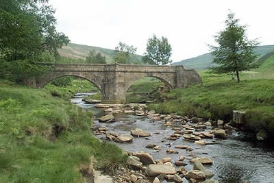
From the end of the road (grid ref SK167938) follow the track north crossing Slippery Stones Bridge to follow the east bank of the River Derwent to Oaken Bank. Here a footpath on the right leads up the hillside in a series of zig-zags to put you on course for Crow Stones Edge. Note that in places the path fades so if in doubt head uphill. From the Crow Stones head north on a clear path to reach the Rocking Stones. Continue north along the same path as it descends to cross the stream in Stainery Clough making sure you do not lose too much height. Having crossed the stream turn northeast and follow dry ground until you reach the main watershed path near Cat Cloughs Head.
Turn left along this path. In general it is easy to follow but there are some places where you can go astray especially when crossing deep groughs. Even in good weather continually check your position so that if the cloud comes in you know exactly where you are. The path stays on an westerly course and progress is fast and you arrive at Swains Head surprisingly quickly.
You are now about to start on the hardest section of the route. The path crosses numerous groughs and, although it is marked by a series of poles, navigation can be difficult. At first the path heads west but soon turns south before finally trending west again. In good weather this is no problem as you can see the Bleaklow Stones ahead but don't get confused with the Barrow Stones which are also in view on occasions especially just after leaving Swains Head.
Assuming your navigation and route finding is good you will be able to appreciate the intricate weathering of Bleaklow Stones, perhaps using them as a shelter against the weather! Turn back here taking a clear path that descends east (to the right of the inward path) and then contours around the hillside to reach Grinah Stones. Continue from here north to Barrow Stones turning east to follow a clear descending path over Round Hill and down to a wide level area. The path fades but the next key objective is the end of the landrover track (grid ref. 140955), which comes up from the valley to the south and ends in the middle of the moor.
A wide disused dike (drain) goes southeast from this point and should be followed for a kilometre. There is an intermittent path and the going is fairly easy. After roughly a kilometre you need to head due east across open moor using sheep trods wherever possible to reach the upper reaches of Linch Clough. There is a clear path on the northern side of the stream. Note that the path does not follow the stream as it descends but stays high on Ox Hey moor until almost reaching the forest. The path then drops steeply towards the track. This is the track used on the outward route and turning right you will soon be back at the start.
Other walks nearby
| Walk 1098 | Howden Edge & Derwent Valley | mod/hard | 14.0 miles |
| Walk 1213 | Alport Castles | moderate | 8.5 miles |
| Walk 1219 | Back Tor & the Wheel Stones | moderate | 10.3 miles |
| Walk 2591 | Crook Hill & Ladybower Reservoir | easy/mod | 7.5 miles |
| Walk 1489 | Blackden Brook, Kinder & Upper Ashop | moderate | 6.8 miles |
| Walk 1116 | Grains in the Water & Alport Castles | mod/hard | 12.0 miles |
| Walk 1227 | Fair Brook & Kinder Northern Edges | moderate | 8.5 miles |
| Walk 2514 | Fair Brook & Kinder Downfall | moderate | 8.0 miles |
| Walk 2982 | Bleaklow & Higher Shelf Stones from the Snake Pass | mod/hard | 9.5 miles |
| Walk 3238 | Fairbrook Naze & Ashop Head from Birchen Clough | moderate | 9.3 miles |
Recommended Books & eBooks
Dark Peak Walks
 Guidebook to 40 walks in the Dark Peak area of the Peak District National Park. 35 circular routes for most abilities, from 8km to 19km, around Edale, Marsden, Fairholmes, Baslow and Castleton, including Kinder Scout and Mam Tor, and 5 longer (25km to 45km) routes highlighting the best of the Gritstone Edges, High Moorland and Deep Valleys.
More information
Great Mountain Days in the Pennines
 An inspirational guidebook to 50 classic walks on the rolling Pennine landscape. The graded routes, between 6 and 13 miles in length, cover classic Pennine fells and moorland such as Whernside, Ilkley Moor and Pendle Hill; exploring the North and South Pennines, Yorkshire Dales, Howgills and Dark Peak. Many routes are also suited to fell running.
More information
Messaging & Social Media
Message Walking Britain and follow the latest news.

Mountain Weather
Stay safe on the mountains with detailed weather forecasts - for iOS devices or for Android devices.