Cissbury Ring & Chanctonbury Ring from Washington
South Downs Walk
Nat Park - South Downs
County/Area - West Sussex
Author - Donald Morton
Length - 8.3 miles / 13.4 km Ascent - 1150 feet / 348 metres
Time - 5 hours 20 minutes Grade - easy/mod
Maps 

| Ordnance Survey Explorer OL10 | Sheet Map | 1:25k | BUY |
| Anquet OS Explorer OL10 | Digital Map | 1:25k | BUY |
| Ordnance Survey Landranger 198 | Sheet Map | 1:50k | BUY |
| Anquet OS Landranger 198 | Digital Map | 1:50k | BUY |
Walk Route Description
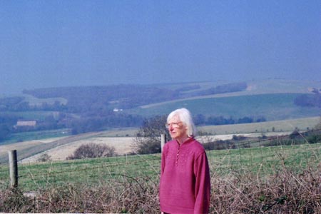
Click image to visit gallery of 5 images.
This South Downs walk as described starts at the car park just south of Washington (Grid ref TQ121120). This can be reached from TQ119 118 on the A24 going South (NOT going North) or from the Old London Road going South out of Washington. The entrance to the car park is up a track signed only as part of the South Downs Way. (There is also a car park at TQ139085 below Cissbury Ring and reached via Findon but unsigned and takes only about a dozen cars so not recommended except at very off peak times. It would also be possible to combine this walk with 1858 to give a longer route from Chanctonbury Ring to Cissbury Ring.)
Starting from the car park south of Washington, continue out of it on the South Downs Way and keep on this going uphill until reaching a T-junction where the SDW turns left. Leave the SDW by turning right and following the broad gravel track down a shoulder to a cross track where straight ahead becomes grassy. Turn left here and still continue down hill. Look out for a bridle gate on the right and go through to continue diagonally up over the paddock to a road. Cross the road and continue the same line, still up, over another paddock to a crossing track. Go over this to the track which continues straight on and soon starts going down through the extensive buildings of Gallops Farm. As you reach houses and the track becomes tarmac at the edge of Findon turn left on a restricted byway. After about 300m turn right and follow this track down and out to a road in about 600m. Turn left on the road and after a long 1km reach the junction below Cissbury Hill. There is an information board about this ancient hill fort and a gate giving access if you wish to ascend.
Otherwise the walk turns left at this point (past the small car park) and continues on a wide gravel track, more or less northerly and more or less straight, over the Monarch's Way, over a second cross junction, and ignoring any path to left or right, until it comes again to the South Downs Way. Turn left and climb up towards Chanctonbury Ring. It is possible to detour into the ring, but the South Downs Way passes just below it to the left. It soon arrives at the first junction mentioned in the walk description. Turning right with the SDW and following it down hill leads back to the car park south of Washington.
Other walks nearby
| Walk 3310 | Washington to Littleton Farm by the South Downs Way | moderate | 13.0 miles |
| Walk 1782 | Steyning Round Hill and No Man's Land | moderate | 7.5 miles |
| Walk 1858 | Cissbury Ring and Chanctonbury Ring | moderate | 10.5 miles |
| Walk 1667 | Blackpatch Hill & Harrow Hill from near Storrington | easy/mod | 7.2 miles |
| Walk 3464 | Rackham Hill & Kithurst Hill Circular | easy/mod | 6.7 miles |
| Walk 1888 | Cissbury Ring, Chanctonbury Ring & Coombes | moderate | 12.5 miles |
| Walk 2109 | Upper Beeding to Washington by the South Downs Way | easy/mod | 7.0 miles |
| Walk 3305 | Amberley Mount and Wepham Down | easy/mod | 8.0 miles |
| Walk 1917 | Rackham Hill from Amberley | easy/mod | 6.5 miles |
| Walk 1615 | Amberley & East Dean Circular | mod/hard | 21.0 miles |
Recommended Books & eBooks
Walks in the South Downs National Park
 Guidebook with 40 circular walks throughout the South Downs National Park, exploring the beautiful chalk hills between Eastbourne and Winchester. The walks range from under 5 miles to 11 miles, including Beachy Head and the Seven Sisters, Ditchling Beacon and hundreds of prehistoric sites. Accessible all year, but wild flowers best in spring.
More information
The South Downs Way
 Guidebook to walking the South Downs Way National Trail, a 100 mile (160km) route between Winchester and Eastbourne through the South Downs National Park, described in both directions over 12 stages. Easy walking on ancient and historical tracks, taking in wooded areas, delightful river valleys and pretty villages. With 1:25K OS map booklet.
More information
Messaging & Social Media
Message Walking Britain and follow the latest news.

Mountain Weather
Stay safe on the mountains with detailed weather forecasts - for iOS devices or for Android devices.