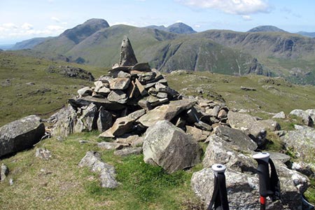
Glaramara & Allen Crags from Seathwaite
Lake District Walk
Nat Park - Lake District - Lake District Southern Fells
Wainwrights - Allen Crags, Glaramara
County/Area - Cumbria
Author - Lou Johnson
Length - 8.1 miles / 13.2 km Ascent - 2500 feet / 758 metres
Time - 6 hours 30 minutes Grade - moderate
Maps 

| Ordnance Survey Explorer OL6 | Sheet Map | 1:25k | BUY |
| Anquet OS Explorer OL6 | Digital Map | 1:25k | BUY |
Walk Route Description
Click image to see photo description.
Glaramara and Allen Crags are connected by a high-level path which Alfred Wainwright described as a 'delightful walk' with 'excellent views'. Starting from Seathwaite, this Lake District walk follows the valley north to Thorneywaite Farm to start the ascent close to Strands Bridge. A delightful ascent to Glaramara's summit is followed by the ridge walk from where you can admire many of the Lake District summits. A descent down to near Esk Hause is followed by a descent alongside Grains Gill back to the start.
Park at Seathwaite (grid ref. NY235121) where space can be at a premium on busy days even in winter. Walk south through the farmyard and bear left after the last building on the left to pick up the well-trodden path to Strands Bridge. The path initially passes through fields before following the intake wall to join a track leading to Thorneywaite Farm. Before reaching the farm, the path bears right across fields to join the farm access road. Continue along this towards Strands Bridge. Where the access road bears left continue ahead on a clear path which swings south and starts to climb.
Stay on the path taking care to bear right where the path forks at grid ref. NY250127 (just past a sheepfold on the opposite side of the stream in to your left). The path is interesting with developing views. Just before reaching the cairn on Thornythwaite Fell (grid ref. NY245118) you get you first view of Glaramara's summit. A short detour at this point offers a good view of nearby Raven Crag. Continue climbing on the clear path finally reaching the summit of Glaramara after negotiating a rocky step. One other short diversion during the climb onto Glaramara is to climb across to the cairn on Combe Head (grid ref. NY249109) from where there is a dramatic view into the Combe.
Leave the summit in a south south westerly direction passing a small tarn on your left, the second of Glaramara's summit to your right and a third top on your left. The path then meanders along the ridge with great views to keep you entertained. The path passes close to Lincomb Tarns and beautiful High House Tarn (grid ref. NY241093) which is a perfect spot for a picnic. Continue along the ridge rising gradually to reach the cairns on top of Allen Crags. Again, you have a wonderful view to enjoy with the massive crags on the northeast face of Great End particularly notable.
Descend more steeply from Allen Crags down towards Esk Hause on a clear path. Once down, at the first path junction (grid ref. NY234083), turn right descending steadily alongside Ruddy Gill. After just over 600 metres turn right and descend more steeply down a ravine soon reaching a footbridge across Grains Gill. Continue north to Stockley Bridge (grid ref. NY234109). Turn right over the bridge and follow the wide path back down to Seathwaite and some well-earned refreshments.
Other walks nearby
| Walk 1065 | Haystacks | moderate | 5.5 miles |
| Walk 1112 | Great Gable | hard | 7.3 miles |
| Walk 1245 | Castle Crag & Grange | easy/mod | 6.0 miles |
| Walk 1175 | Combe Gill Circuit | moderate | 5.5 miles |
| Walk 3328 | Eagle Crag & Seargeant's Crag from Stonethwaite | moderate | 7.0 miles |
| Walk 3133 | Ullscarf and Watendlath from Stonethwaite | mod/hard | 10.0 miles |
| Walk 1693 | Grange & Watendlath from Rosthwaite | easy/mod | 7.6 miles |
| Walk 1444 | Great Gable (Borrowdale route) | hard | 12.0 miles |
| Walk 1153 | The High Stile Ridge | hard | 10.0 miles |
| Walk 1289 | Fleetwith Pike & Haystacks | moderate | 5.5 miles |
Recommended Books & eBooks
Walking the Lake District Fells - Keswick
 Part of the Walking the Lake District Fells series, this guidebook covers a wide range of routes to 30 Lakeland summits that can be climbed from Keswick, Whinlatter, Bassenthwaite, Caldbeck, Mungrisdale and Threlkeld, with highlights including Skiddaw and Blencathra. Includes suggestions for longer ridge routes.
More information
Great Mountain Days in the Lake District
 An inspirational guidebook to 50 challenging walks on the high fells of the Lake District. The graded circular routes, between 4 and 14 miles in length, cover classic Lakeland summits like Fairfield, Scafell Pike, Great Gable and Blencathra, to the lesser-known High Spy, King's How and Brund Fell.
More information
Messaging & Social Media
Message Walking Britain and follow the latest news.

Mountain Weather
Stay safe on the mountains with detailed weather forecasts - for iOS devices or for Android devices.