Flasby Fell from Flasby
Yorkshire Dales Walk
Nat Park - Yorkshire Dales - Malhamdale
County/Area - North Yorkshire
Author - Allan Friswell
Length - 6.5 miles / 10.6 km Ascent - 1000 feet / 303 metres
Time - 4 hours 20 minutes Grade - easy/mod
Maps 

| Ordnance Survey Explorer OL2 | Sheet Map | 1:25k | BUY |
| Anquet OS Explorer OL2 | Digital Map | 1:25k | BUY |
| Ordnance Survey Landranger 103 | Sheet Map | 1:50k | BUY |
| Anquet OS Landranger 103 | Digital Map | 1:50k | BUY |
Walk Route Description
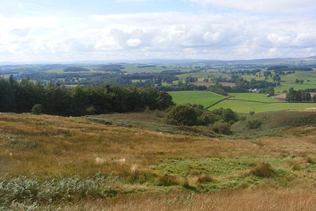
Click image to visit gallery of 4 images.
This walk starts with paths across heather and bracken moorland. The remainder of the route includes lush grassland, conifer and deciduous woods which makes this as varied a ramble as you could wish for!
The start is the village of Flasby(Grid ref. SD947566), signposted and easily reached from the Skipton end of Gargrave. Parking can be very difficult in this hamlet. Local residents tend to erect barriers to keep your car off the public verge. I myself just take them down but you may feel more self-conscious! Your best bet is to do the walk on a day when most people are at work! Whatever you do, please do not restrict access or obstruct access to properties.
Cross the bridge over Flasby Beck and walk uphill, passing the farm. Where the track divides you should carry on ahead along the less well-marked one and then go through the kissing gate signed Grassington Road 2 ½. Follow the enclosed path uphill to a couple of gates and, passing through these, continue ahead to a third gate (Grid ref SD953563). Veer half left over the field to a metal gate which leads you on to Flasby Fell proper. The path from here is usually pretty well walked; keep fairly close to the left hand wall as you steadily climb.
After passing through a belt of bracken, level with where the wall veers left, the path bears to the left of and then over the outcrop of rocks. From there the final few yards to the summit of Rough Haw with its cairn are easy (Grid ref. SD963558). The view from here is wonderful. The Three Peaks of Ingleborough, Pen-y-Ghent and Whernside, as well as Pendle Hill are all plainly in sight on a clear day. Sharp Haw, the slightly higher twin of the hill of Rough Haw, stands alongside you.
From the cairn follow the pretty clear path down in the direction of Sharp Haw. This soon turns sharp right, and then descends easily and visibly left to the bridle gate at the foot of the Haw (Grid ref. SD961556). The path is now very easy to follow along level grassland, and eventually, after passing through a gate, it descends gently to a stony track where you turn right (SD974540). This Forestry Commission track bends sharp left as it enters the conifers, then right, passing by a large area of sapling growth. The Commission have cleared a large area on the left, which offers fine views across the Leeds & Liverpool Canal and the Aire to Gargrave and, in the middle distance, Flambers Hill with the massive bulk of Pendle Hill way behind.
When you come to the obvious division of paths (Grid ref. SD966540) follow the right hand one up the hill making for the left of the gritstone outcrops. The path levels out and takes you through the gentle deciduous trees of Crag Wood. When the path bends sharply left you should follow the smaller one indicated by the sign "Flasby 1 mile". This takes you through the ankle-catching roots of rhododendrons to a clearer path that you follow to the right. At the end of High Wood go through the gate (Grid ref. SD953559) and descend the field in a large arc to the left, reaching a gate, an enclosed track and then a bridge. Pass the house and sheds on your right and drop down into Flasby, where you bear left and find your car.
Other walks nearby
| Walk 2066 | Winterburn Reservoir circular | easy | 6.0 miles |
| Walk 3307 | Gargrave to Flasby | easy/mod | 6.5 miles |
| Walk 3109 | Rylstone Edges & Cracoe from Rylstone | easy/mod | 6.0 miles |
| Walk 1811 | Sharp Haw in Airedale | easy/mod | 7.0 miles |
| Walk 1377 | Calton and Hanlith Moors | easy/mod | 6.5 miles |
| Walk 2385 | Airton & Bell Busk Circular | easy/mod | 6.8 miles |
| Walk 1701 | Bordley Hall & Malham Moor from Threshfield Moor | easy/mod | 7.0 miles |
| Walk 1576 | Embsay Reservoir | easy | 1.0 miles |
| Walk 2304 | East Marton and the Drumlins | easy/mod | 5.5 miles |
| Walk 1051 | Gordale Scar & Malham Cove (Route 2) | moderate | 7.0 miles |
Recommended Books & eBooks
Trail and Fell Running in the Yorkshire Dales
 Guidebook to 40 of the best trail and fell runs in the Yorkshire Dales National Park. Ranging from 5 to 24 miles, the graded runs start from bases such as Ribblehead, Dent, Sedbergh, Malham and Grassington and take in the region's diverse delights, from castles and waterfalls to iconic mountains such as Whernside, Ingleborough and Pen Y Ghent.
More information
Walking in the Yorkshire Dales: South and West
 Part of a two-book set, this guidebook describes 44 walks in the southern and western Yorkshire Dales, including the famous 23 mile Three Peaks circuit over Pen-y-Ghent, Whernside and Ingleborough. The other, mostly circular routes of 3½ to 13 miles cover the scenic region between Sedbergh, Kirkby Lonsdale, Settle, Skipton and Grassington.
More information
Messaging & Social Media
Message Walking Britain and follow the latest news.

Mountain Weather
Stay safe on the mountains with detailed weather forecasts - for iOS devices or for Android devices.