The Old Man of Coniston & Dow Crag from Torver
Lake District Walk
Nat Park - Lake District - Lake District Southern Fells
Wainwrights - Coniston Old Man, Dow Crag
County/Area - Cumbria
Author - Lou Johnson
Length - 8.5 miles / 13.8 km Ascent - 3000 feet / 909 metres
Time - 7 hours 20 minutes Grade - mod/hard
Maps 

| Ordnance Survey Explorer OL6 | Sheet Map | 1:25k | BUY |
| Anquet OS Explorer OL6 | Digital Map | 1:25k | BUY |
| Ordnance Survey Landranger 90 | Sheet Map | 1:50k | BUY |
| Anquet OS Landranger 90 | Digital Map | 1:50k | BUY |
Walk Route Description
Click image to visit gallery of 12 images.
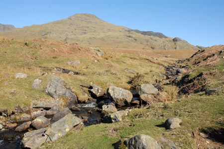
The Old Man of Coniston dominates the scene in the southern section of the Lake District National Park. The popular route for ascending, what used to be the highest mountain in Lancashire (before County reorganisation), starts from Coniston and can be busy. This route takes a quieter and in many ways more pleasant route from the south arriving at the summit in the opposite direction from the crowds on the tourist path. In addition the walk passes Goat's Water and provides a chance to visit the summits of Dow Crag, Buck Pike and Brown Pike to make an excellent day hike.
The start of this Lake District walk is the lay-by on the main A593 a few miles south of Coniston at Little Arrow (grid ref. SD290949). From here take the signed footpath on the north side of the road. The path is well waymarked and climbs steadily to reach the Walna Scar Road (SD273964) with Little Arrow Moor, often mistaken for the Old Man from this point, towering above you. The path on this section from the main road is hard to describe in detail but is generally obvious if you keep the beck somewhere on your left hand side.
Reaching the Walna Scar Road fork right for Goat's Water. It is also worth making a mental note of where you reach the Walna Scar Road as you need to leave it at about the same point on your descent. My method is to build a small cairn as a marker. The path now starts to climb more steeply and it always seems a long way until you actually see the water of this beautifully located lake. On the opposite side you get a wonderful view of Dow Crag with its deep gullies. Look carefully and you could well see climbers on the crags. Continue on the rocky path beside the lake and start to climb in earnest to Goat's Hause (grid ref. SD266982). On reaching this col turn right and continue to climb on the clear path to the summit of the Old Man of Coniston.
The view in good weather justifies all the effort expended in reaching the top with many of Lakeland's best known fells filling the grand panorama. To continue retrace your steps down to Goat's Hause and then start the climb on the main path to Dow Crag's airy summit. Wainwright thought this to be one of the best summits in the Lake District and it certainly rates as one of the best in the UK requiring 'hands on rock' to gain the true top. It is worth noting that in icy conditions that extreme care is taken on the path leading up to Dow Crag especially if you are of an inquisitive nature and like peering down the gullies - one slip and you would be in Goat's Water far below!
Continue along the edge to Buck Pike losing a little height in the process. The views remain good with the Old Man see across Goat's Water and on your right the Duddon Valley can be seen almost in its entirety. Continuing to lose height you soon reach Brown Pike from where you get good views of secretive Blind Tarn on the fells eastern flank. The descent continues down to the Walna Scar Road where you turn left.
This road is rough in places and many walkers prefer to walk 'off piste' across the grassy fell. It is certainly an easier option to the rocky track. Reaching Cove Bridge (grid ref. SD271964) the path on the western side of Torver Beck was very wet underfoot and hard to follow and obviously seeing much less use these days. This meant using the easier to follow path on the other side of the beck was a better option so we continued to our carefully paced cairn and turned right of the Walna Scar Road and descended through the spoil heaps to a footbridge over Torver Beck (grid ref. SD280958). Cross this bridge and then follow the walled lane back to Torver. On reaching the main road turn left and use the tarmac footpath that runs alongside the road for most of the way back to the car.
Other walks nearby
| Walk 1911 | Coniston's Magnificent Seven | hard | 13.0 miles |
| Walk 1217 | Dow Crag & the Old Man of Coniston | mod/hard | 8.5 miles |
| Walk 1761 | Tom Heights and Tarn Hows | easy/mod | 7.0 miles |
| Walk 3028 | Tarn Hows & Tom Gill | easy/mod | 6.5 miles |
| Walk 3220 | Wetherlam via Red Dell | moderate | 7.0 miles |
| Walk 1058 | Beacon Fell & Beacon Tarn Circular | easy/mod | 4.0 miles |
| Walk 1124 | Beacon Tarn & The Beacon from near Torver | easy/mod | 4.0 miles |
| Walk 3320 | Grizedale Tarn circular | easy | 2.5 miles |
| Walk 3638 | Satterthwaite Bridge Circular | easy | 3.2 miles |
| Walk 2033 | Tilberthwaite & Wetherlam | moderate | 5.0 miles |
Recommended Books & eBooks
The Cumbria Way
 A guidebook to the 73 mile Cumbria Way, an easy long-distance walk though the heart of the Lake District National Park, from Ulverston in the south to Carlisle in the north, with good transport links to either end. The route is largely low-level but this guide offers alternative mountain days to climb some of the famous fells en route.
More information
Outdoor Adventures with Children - Lake District
 Guidebook to 40 outdoor adventures in the Lake District with children under 12, including walking, cycling, orienteering, paddling, boating, hostelling and more. Graded activities for varying age ranges or for families with children of different ages.
More information
Messaging & Social Media
Message Walking Britain and follow the latest news.

Mountain Weather
Stay safe on the mountains with detailed weather forecasts - for iOS devices or for Android devices.