Canterbury to Whitstable
Kent Walk
County/Area - Kent
Author - Mick Gall
Length - 10.5 miles / 17.1 km Ascent - 700 feet / 212 metres
Time - 6 hours 0 minutes Grade - easy/mod
Maps 

| Ordnance Survey Explorer 150 | Sheet Map | 1:25k | BUY |
| Anquet OS Explorer 150 | Digital Map | 1:25k | BUY |
| Ordnance Survey Landranger 179 | Sheet Map | 1:50k | BUY |
| Anquet OS Landranger 179 | Digital Map | 1:50k | BUY |
Walk Route Description
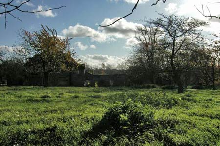
Click image to visit gallery of 15 images.
This is a linear walk from the Cathedral City of Canterbury to the seaside at Whitstable. The route offers much of interest including an Iron Age hill fort, Ancient woods and a section of disused railway. It is easy walking through the Kent countryside although in some places careful attention to navigation is needed and you are recommended to use the 1:25000 map.
The walk starts in Canterbury (grid ref. TR144576) on Rheims Way, which is part of Canterbury ring road. From here follow the footpath sign across Whitehall meadow, over the river Stour through the small car park and then turn left onto the single track Whitehall Road. Follow this road, crossing over the railway level crossing, then under the underpass for the A2. You are now on the flood plain of the Great Stour River. The footpath passes through orchards on either side and after a few hundred yards Tonford Manor and Tonford Manor Farm are reached. As the name suggests there was a ford over the river here and this is the area where it is believed the Legions of Julius Caesar fought their first battle after marching inland from the coast in 54BC.
Tonford Manor was a fortified manor house, (one of many such moated houses in Kent). Today it lies in ruins but it was built around 1449 by Sir Thomas Browne, Comptroller and Treasurer to King Henry VI. Henry VIII and Katherine of Aragon once spent time here. The footpath comes to a single track road here where you turn right (grid ref. TR124570). The road climbs steadily, although not severely. Follow the road around to the right at grid ref. TR119573. The hill and woods to your left are part of Bigbury Hill Fort. Keep going until you reach the junction (grid ref. TR120575). You are now following the eastern edge of the fort. Here you can take the second road on the left or follow the footpath straight in front. Either way, you eventually arrive at the North Downs Way at grid ref. TR120577. Turn left. This part of the path follows the northern edge of the fort and in places it is possible to gain access. However do note that the whole hill is the fort and parts of it are private land - for example Bigbury Farm. Also be aware that it is also a nature reserve. The fort is believed to date from 800BC and was built as a defence against the attacks of the Belgae, who settled in Kent after invading from northern France. It was also attacked by Caesar after he crossed the Stour at Tonford. He described the battle in his writings on the Gallic Wars thus
"We marched by night (from Deal) for about 12 miles before coming in sight of the enemy forces. They had moved with their cavalry and chariots down from the higher ground (Bigbury) to a river (the Stour near Tonford) and were trying to stop our progress and engage us in battle. When our cavalry drove them back they hid in the wood where they enjoyed a position with extremely good man made defences for some war between themselves because many trees had been cut down and used to block entrances to it. The Britons came out of the woods in small groups to fight and tried to stop our men penetrating their defences. But the men of the Seventh Legion holding up their shields to form a protective shell piled up earth against the fortifications and captured the place. I forbade them to pursue far because I was unfamiliar with the terrain."
Finds here have included slave chains and collars, plough shares and pottery. It is believed to have been finally abandoned around 42AD. After nearly 3000 years and being covered by trees, the ditches and terraces are still impressive. At the crossroads (grid ref. TR115576) turn right and follow the path down hill. It passes through a typical Kent hop garden and arrives at a small stream where there is a footbridge. Cross the bridge and follow the path uphill through an orchard, keep going until you reach the road bridge over the A2 (grid ref. TR112583). Cross the bridge and follow the road to the junction at grid ref. TR112584. Here there is a small hall that belongs to the Harbledown village association and just to the right there is the footpath that you need to take.
You now enter Willow Woods; this is part of an area called The Blean and was once a huge forest that stretched West, North and East of Canterbury. The name now refers to an area of villages, countryside and woods. Care needs to be taken now with navigation because although it is much reduced in size it is still a large wood and easy to get lost. The path follows a stream on the right and after approx 100m it crosses over the stream by a bridge made of two railway sleepers (grid ref. TR112586) but the crossing is very easy to miss. Once over the stream the path becomes clearer, although if there has been heavy rain the path might seem like a stream. Care still needs to be taken with navigation so keep checking the path. Eventually the path comes to a T-junction (grid ref. TR112593). Turn right and then after approx 50m the path turns left by a group of four large Beech trees (grid ref. TR113593). On the map this seems obvious but out in the wood it's not quite so easy.
It is now a pleasant walk through the woods. Crossing over the path called New Road at grid ref. TR115596 to an intersection of five paths (grid ref. TR118600). Here take the footpath on the right. This is well marked. Continue along the path, crossing over a small stream until you come to another intersection of paths (grid ref. TR124600). This is quite confusing and not as marked on the map. A slightly gravelled path goes off to the right and behind, approx 20m in front there is a bench and very obvious path to the right with a marker post. The path we need keeps to the left of the bench and appears to fizzle out in the wood. However it does not disappear. Keep following to the left and eventually it becomes a clear path, although it is a bit tricky at first. The path eventually leads through the back of some houses and comes to the A290 road (grid ref. TR126600). On the map this is a very obvious cross roads but out on the ground the footpath signs are missing and if you got a bit lost on the last section but managed to find the A290 you would not find this cross roads!
Cross the A290 here keeping the school gate to your right. The path goes through the hedge to the right of the telegraph pole. The path runs for approx 200m and is quite over grown. Turn left at grid ref. TR129602. You are now on National Cycle Path No 1 and it is very well signposted and will be followed to Whitstable. After 500m the church of St Cosmus and St Damian in the Blean is reached. This is a small church built on the old Roman road from Seasalter to Canterbury and was first mentioned in the Doomsday Book in 1086, although there is evidence of a Roman villa having been on the site. The church is named after two Arab brothers who converted to Christianity and were martyred in AD 303. They are reputed to have carried out the first transplant operation, grafting the leg of a slave onto a prince who had been injured in battle.
Continue on for approx 1 km to grid ref. TR123619. Turn right. Then turn left at grid ref. TR126626. There is a small picnic area here. This is now the track bed of the old Canterbury to Whitstable Railway or "The Crab and Winkle Line". Built in 1830, it was the first passenger railway in the world. At grid ref. TR125637 the path splits, bear to the right as straight on leads to an embankment that stops short of the New Thanet Way (A299). Cross the bridge over the A299 and continue through South Street, going under the art deco Southern Railway bridge under the Old Thanet Way (A2990). Keep following the path until you come to Whitstable railway station in Old Bridge Road. Cross over the footbridge. Turn left into Railway Avenue and follow this to Cromwell Road. Turn right and follow the road onto Whitstable seafront.
Whitstable is a fishing port and seaside resort but without the kiss-me-quick hats of its bigger neighbours Herne Bay and Margate. There are many restaurants, pubs, hotels and B&B's - as there are in Canterbury. In fact both Canterbury and Whitstable are excellent places from which to explore the surrounding countryside. Whitstable is famous for its oysters and there is an annual oyster fair in the last week of July.
Other walks nearby
| Walk 3617 | The Wye Downs and Crundale | easy/mod | 6.0 miles |
| Walk 2444 | Wye, Crundale & Wye Downs | moderate | 8.6 miles |
| Walk 2249 | Reculver & St Nicholas at Wade | easy/mod | 8.2 miles |
| Walk 2805 | Chilham circular from Wye | moderate | 17.0 miles |
| Walk 1044 | Wye and the Crundale Downs | moderate | 9.2 miles |
| Walk 1637 | Rivers Swale & Oare | easy | 5.0 miles |
| Walk 1895 | Kent Coast Path from Deal | easy/mod | 8.2 miles |
| Walk 2923 | Folkestone to Dover along the North Downs Way | easy/mod | 8.2 miles |
| Walk 1561 | Ramsgate to Margate, Isle of Thanet | easy/mod | 7.8 miles |
| Walk 2381 | St Margaret's at Cliffe from Kingsdown | easy/mod | 6.3 miles |
Recommended Books & eBooks
Walking in Kent
 A guidebook describing 40 walks in the county of Kent. Covering west Kent and The Weald and north and east Kent, including the Kent Downs and the Greensand Hills. Walks of 5 to 9 miles explore rivers and coastline, beautiful countryside and historic villages. With outlines of 11 longer walks ranging from 15 to 163 miles.
More information
Messaging & Social Media
Message Walking Britain and follow the latest news.

Mountain Weather
Stay safe on the mountains with detailed weather forecasts - for iOS devices or for Android devices.