Warren Hill, Gors Lydan & Moelfre Hill
Powys Walk
County/Area - Powys - Powys Central
Author - Lou Johnson
Length - 6.0 miles / 9.8 km Ascent - 900 feet / 273 metres
Time - 3 hours 50 minutes Grade - easy/mod
Maps 

| Ordnance Survey Explorer 214 | Sheet Map | 1:25k | BUY |
| Anquet OS Explorer 214 | Digital Map | 1:25k | BUY |
Walk Route Description
Click image to see photo description.
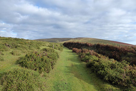
This Mid Wales walk near Llanbister (Powys) crosses undulating moorland visiting several minor summits. The area sees few walkers, yet the glorious scenery and solitude make this an enjoyable and relaxing route. The walk follows paths, tracks across the landscape, and includes Newhouse Hill, Warren Hill, Gors Lydan and Moelfre Hill which all rise about 1700 feet above sea level.
To reach the start follow the B4356 from the A483 at Llanbister north-east. Just over three miles from the A483 after crossing an area of open moorland on your left, turn left on a minor road signed to Llanbadarn Fynydd (this is the first road on the left after leaving the built-up area of Llanbister). Follow this road for two kilometres across open moorland ignoring the left fork. Reaching the first fenced field on the right, continue a short way and park on the left-hand side of the road in a small quarry (grid ref. SO120753).
After parking follow the road south-east (with the fenced field on your left) and continue ahead over the first junction to where the road bends right (grid ref. SO134747). Turn left here on the track leading top Cwmllechwedd Fawr. Continue ahead passing Cwmllechwedd Fawr on your right. After 600 metres the track bends right. Continue ahead with the hedge on your right and maintain direction past a gap in the hedge to reach open moorland (grid ref. SO141759).
Initially the bridleway heads northeast but after 300 metres turns north. After 500 metres you reach a corner of a field enclosed by hedges (grid ref. SO142766). The onward path initially follows a hedge on your right but soon tends north across the eastern flank of Newhouse Hill to reach a junction of five tracks and paths at a ford (grid ref. SO144733). Turn left here and head across the western flank of Warren Hill. About 700 metres from the ford, you reach a group of trees (grid ref. SO140779).
Follow the track beside the trees (on your right) and continue for 200 metres to fork left onto a grassy path on your left. This grassy path heads west and after 600 metres leads onto a more distinct track (grid ref. SO133780). Follow this track for 1.4 km. to reach Gors Lydan, the summit of which is on your right. Continue south-south-west aiming to the left of Moelfre Hill to reach the corner of an enclosed field (grid ref. SO124761). Keep the field boundary on your left and continue ahead to pass Little Moelfre on your left. You soon reach a road. Turn left, cross the cattle grid, ignore the lane on the left and continue back to the start.
Other walks nearby
| Walk 2472 | Abbeycwmhir Circular | easy/mod | 7.2 miles |
| Walk 1785 | Newcastle on Clun circular | moderate | 7.5 miles |
| Walk 3696 | Newtown (Y Drenewydd) & Gregynog Circular | mod/hard | 10.3 miles |
| Walk 3705 | Newtown (Y Drenewydd) & Bettws Cedewain Circular | mod/hard | 10.1 miles |
| Walk 3706 | Newtown (Y Drenewydd), Brimmin Wood & Kerry | moderate | 8.3 miles |
| Walk 3707 | Fachwen Pool from Newtown (Y Drenewydd) | easy/mod | 6.0 miles |
| Walk 3708 | Bwlch y ffridd & Fachwen Pool from Newtown | moderate | 9.0 miles |
| Walk 3735 | Newtown (Y Drenewydd) - Waterways & Town | easy | 5.3 miles |
| Walk 3736 | Ffrydd Farm & Penshwa Lane from Newtown (Y Drenewydd) | easy | 4.3 miles |
| Walk 3631 | Panpunton Hill & Stowe from Knighton | moderate | 7.8 miles |
Recommended Books & eBooks
The Cambrian Way
 Guidebook to the Cambrian Way, a challenging three-week mountain trek through Wales from Cardiff to Conwy. The 470km un-waymarked route is presented from south to north. Often sticking to long, beautiful ridgelines, it crosses wild and rugged terrain and visits many of Wales's highest mountains, including Snowdon.
More information
Messaging & Social Media
Message Walking Britain and follow the latest news.

Mountain Weather
Stay safe on the mountains with detailed weather forecasts - for iOS devices or for Android devices.