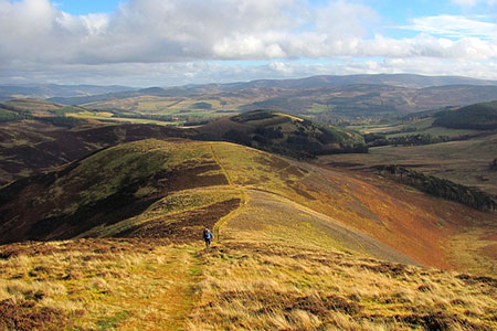
Trahenna Hill from Broughton
Scottish Borders Walk
County/Area - Scottish Borders
Author - Lou Johnson
Length - 7.1 miles / 11.5 km Ascent - 1500 feet / 455 metres
Time - 5 hours 0 minutes Grade - moderate
Maps 

| Ordnance Survey Explorer 336 | Sheet Map | 1:25k | BUY |
| Anquet OS Explorer 336 | Digital Map | 1:25k | BUY |
Walk Route Description
Click image to see photo description.
A walk from Broughton (Scottish Borders) that takes you onto a fine ridge running north from Trahenna Hill (549 m.). The route crosses the eastern flank of Clover Law following a section of the John Buchan Way. Reaching a broad col, the walk turns south across Hammer Head, Green Lairs, ands Grey Yade to arrive on the summit of Trahenna Hill. Excellent views can be enjoyed along the route especially into the Upper Tweed valley. The walk mostly follows good paths and tracks.
The start is Broughton which lies on the A701 north of Moffat. On street parking is available in the village (grid ref. NT112365) although please park with consideration. After parking walk north through the village and take the first lane on the right over a small stone bridge signed to Broughton Place with a fingerpost on the left side of the main road. Follow the lane (John Buchan Way) through a pleasant avenue of trees passing a farm and Broughton Place along the way to reach a small car park by a cottage (grid ref. NT120375).
Go through the gate and follow the rising track across the east flank of Clover Law to arrive at a broad col between Broomy Side and Hammer Head (grid ref. NT127392). Turn right and follow the fence to the summit of Hammer Head (513 m.), which is the start of an undulating ridge that terminates at Trahenna Hill. Continue by the fence over Green Lairs and Grey Yade. A final climb leads to the summit of Trahenna Hill which is on the south side of a wall (grid ref. NT136674).
Descend due south from Trahenna Hill along the south ridge for about a kilometre. Then head half left (southeast) down towards the farm buildings at Dreva (grid ref. NT140359). Turn right along the road and where the road forks, bear right, and follow the upper road back to Broughton.
Other walks nearby
| Walk 3751 | Tinto (northern approach) | moderate | 4.5 miles |
| Walk 3752 | Tinto from Wiston (southern approach) | moderate | 4.2 miles |
| Walk 2618 | Broad Law & Megget Stone | moderate | 5.0 miles |
| Walk 2135 | Camps Reservoir Circular | easy | 5.8 miles |
| Walk 3759 | St. Mary's Loch Circular | easy/mod | 7.5 miles |
| Walk 2006 | Grey Mare's Tail & White Coomb | mod/hard | 7.2 miles |
| Walk 2268 | Annandale Way | moderate | 9.0 miles |
| Walk 1944 | Yarrow Valley Five Hills Circular | mod/hard | 11.4 miles |
| Walk 2050 | The Crown of Scotland | moderate | 9.0 miles |
| Walk 1936 | Scald Law and Pentland Hills Ridge from near Penicuik | mod/hard | 7.4 miles |
Recommended Books & eBooks
The Borders Abbeys Way
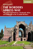 Guidebook to the Borders Abbeys Way, a 68 mile circuit in the Scottish Borders, taking in 4 of Britain's grandest ruined medieval abbeys. Beginning and ending in Tweedbank, the route, which is described over 6 stages, is as rich in history as it is in pastoral charm. Relatively flat, it is suitable for people with a moderate level of fitness.
More information
Walking in the Southern Uplands
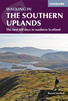 Guidebook to 44 varied day walks and over 100 summits in the Southern Uplands of Scotland, stretching south-west from Edinburgh to the English border, including the Galloway and Pentland Hills. Between 2 and 29km, there is something for all seasons and all abilities in remote and rugged hill country.
More information
Messaging & Social Media
Message Walking Britain and follow the latest news.

Mountain Weather
Stay safe on the mountains with detailed weather forecasts - for iOS devices or for Android devices.