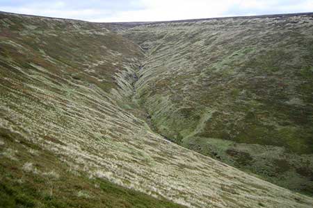
Oyster Clough & Blackden Edge from Birchen Clough
Peak District Walk
Nat Park - Peak District - Kinder Scout Edale
County/Area - Derbyshire
Author - Andy Chaplin
Length - 11.4 miles / 18.5 km Ascent - 2000 feet / 606 metres
Time - 7 hours 40 minutes Grade - moderate
Maps 

| Ordnance Survey Explorer OL1 | Sheet Map | 1:25k | BUY |
| Anquet OS Explorer OL1 | Digital Map | 1:25k | BUY |
| Ordnance Survey Landranger 110 | Sheet Map | 1:50k | BUY |
| Anquet OS Landranger 110 | Digital Map | 1:50k | BUY |
Walk Route Description
Click image to visit gallery of 4 images.
This Peak District walk comes with several warnings. Firstly, the walk back down Oyster Clough involves some, relatively easy, off path walking. Secondly the path above Blackden Edge involves a section at the side of the steep Blackden Edge. Thirdly the Fair Brook must be waded or you need to go up the bank towards Nether Seal Clough to find rocks to step across. Problems apart, it is a good chance to see more of the northern edge of Kinder after the relatively easy ascent up Crookstone Out Moor.
After parking at Birchen Clough Bridge (grid ref. SK109914) take the path signed Alport Bridge and follow the Roman road south-eastwards through the woods. When you come out of the trees behind the Snake Pass Inn either continue along the track to the sheepfold (grid ref. SK120905) or take the path up Oyster Clough to the shooting cabin at the top of the valley. It is well worth the detour - so if you do go that way then cross over the streams after the cabin then follow a sheep track that runs just below the moor/heather edge on the east side of the clough. When the sheepfolds become visible again make your way down the hillside towards them and pick up the Roman road again and follow it to Alport Bridge.
Cross over the A57 and take the track which goes past the house at Upper Ashop and follow it uphill towards Blackley Clough. As the track bends to the right when you approach the clough look out for a faint path that leads off the track uphill after the Blackley Clough stream - it is easier to see it's route up Crookstone Hill from a distance than when you have got to it. This is a short cut to the main path up Crookstone Out Moor to Kinder. Just head uphill at right angles to the track after Blackley Clough and aim for the trees and signpost that are on the Crookstone-Kinder path.
Just before the top turn right on the path between the two outcrops of rocks then follow the Kinder edge path right and then around Crookstone Knoll. At this point stay on paths along the northern edge of Kinder and follow them towards Blackden Edge. The views are dramatic but, personally, I am always happier when Blackden Brook is behind me and I am not quite so close to the rather steep edge down into the Ashop valley. You can normally rely on an off-the-hill wind at this point too!
Follow the path around Seal Stones then look for a small stile over the wire fence just above an outcrop of rocks. You will be above Gate Side Clough which heads down the Ashop Valley and will see Oyster Clough going up on the other side - so, in good weather it is pretty easy to locate. The path follows an old stone wall straight downhill, part of which has been made into grouse butts, and then, after some plank bridges it picks up a moors track which clings to the side of the clough. Do vehicles drive up here, I wonder?
At the bottom, there is only a ford over the Fair Brook but it was possible to make your way upstream past Nether Seal Clough and get over without wet feet - although it did require throwing some stream bed sand onto slippery rocks to get a grip before stepping over. Come back to the footbridge over the Ashop at SK114902, cross it, then immediately turn off on an unofficial path along the northern bank of the river between the fence and the river bank. Continue to the point where the Snake Path meets the path from the Snake Road and the path from the Birchen Clough car park (grid ref. SK108907). Just after this point part of the path had been washed away in late 2016 - so some care is needed to get around the very narrow part that is remaining - but it is possible. Finally, follow the path back along the Birchen Clough stream for 600 metres back to the car park.
Other walks nearby
| Walk 1489 | Blackden Brook, Kinder & Upper Ashop | moderate | 6.8 miles |
| Walk 3049 | Bleaklow Stones from Derwent Valley | mod/hard | 12.0 miles |
| Walk 1159 | Grindsbrook & Edale Head | moderate | 7.5 miles |
| Walk 1264 | Rushup Edge & Crowden Tower | moderate | 10.0 miles |
| Walk 1295 | Ringing Roger & Edale Cross | moderate | 10.0 miles |
| Walk 2595 | Castleton Great Ridge from Edale | moderate | 8.5 miles |
| Walk 2615 | The Kinder Edges | mod/hard | 18.0 miles |
| Walk 3350 | Kinder Scout Summit | moderate | 8.5 miles |
| Walk 1113 | Ringing Roger & Grindslow Knoll | moderate | 5.5 miles |
| Walk 1300 | Hope Cross & Ringing Roger | moderate | 8.0 miles |
Recommended Books & eBooks
Walking in the Peak District - White Peak East
 Guidebook describing 42 half-day and day walks in the limestone landscapes of Derbyshire's White Peak, part of the Peak District National Park. One of two volumes, this book covers the east of the region, with potential bases including Bakewell, Eyam, Castleton, Birchover, Matlock and Wirksworth.
More information
Dark Peak Walks
 Guidebook to 40 walks in the Dark Peak area of the Peak District National Park. 35 circular routes for most abilities, from 8km to 19km, around Edale, Marsden, Fairholmes, Baslow and Castleton, including Kinder Scout and Mam Tor, and 5 longer (25km to 45km) routes highlighting the best of the Gritstone Edges, High Moorland and Deep Valleys.
More information
Messaging & Social Media
Message Walking Britain and follow the latest news.

Mountain Weather
Stay safe on the mountains with detailed weather forecasts - for iOS devices or for Android devices.