Amberley Mount and Wepham Down from Burpham
South Downs Walk
Nat Park - South Downs
County/Area - West Sussex
Author - Lou Johnson
Length - 8.0 miles / 13 km Ascent - 900 feet / 273 metres
Time - 4 hours 50 minutes Grade - easy/mod
Maps 

| Ordnance Survey Explorer OL10 | Sheet Map | 1:25k | BUY |
| Anquet OS Explorer OL10 | Digital Map | 1:25k | BUY |
| Ordnance Survey Landranger 198 | Sheet Map | 1:50k | BUY |
| Anquet OS Landranger 198 | Digital Map | 1:50k | BUY |
Walk Route Description
Click image to visit gallery of 12 images.
This West Sussex walk explores the South Downs to the north of Burpham village. Using a mixture of tracks and field paths the route offers some fine views typical of this National Park. In the early stages of the walk the view south and west over the Arun valley includes Arundel Castle in its lofty position above the river. As the countryside changes with the deep valleys on the southern flank of Amberley Mount. Turning east on the South Downs Way, the views north across the Weald are outstanding. Finally as the walk turns south the route crosses typical downland.
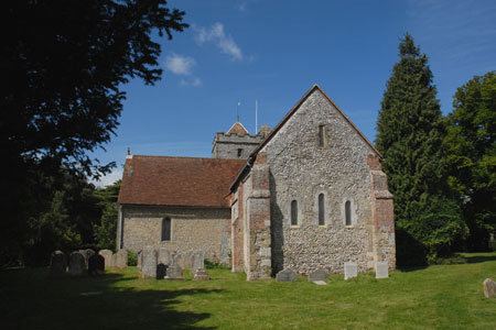
The start is the car park (grid ref. TQ039089) adjacent to the village hall in Burpham village. Exit the car park onto the lane and bear left. Go left into the churchyard, bearing right to pass along the side of the church (which will be on your left). Exit the church yard via a stile and follow the signed path across a field with the boundary on your right to reach a lane (grid ref. TQ042092). Turn left along the lane with improving views to the Arun valley on your left.
Continue past Peppering High Barn keeping straight ahead and ignoring the signed footpath on the right. This track leads you easily uphill to reach a fork in the track. Fork right, with the wood on your left. After about 100 metres, turn left through the wood on a narrow path to reach a track (grid ref. TQ044110). Go straight across following a clear path northwards with the field boundary on your right. Reaching a track keep straight ahead following a track as it descends into a valley. Stay on the track as it climbs steadily uphill to reach the South Downs Way (grid ref. TQ038124).
Turn right along the South Downs Way. After a short way you can leave the enclosed path and cross a stile on your left and walk through the field adjacent to the path. Doing this provides unobstructed views north across the Weald and also along the South Downs in both directions. Continuing in westerly direction the path climbs gently onto Rackham Hill after which you need to return to the main path before crossing Springhead Hill. Descending from the latter, the path descends to a complex junction of paths and a road (grid ref. TQ070124).
Turn sharp right here and follow the signed bridleway in a southwest direction. At the next path junction (grid ref. TQ061110) continue straight ahead. Soon the path goes right and shortly after reaches a junction of bridleways (grid ref. TQ060109). Turn left here and continue for about 300 metres south. Go through an opening and turn right to follow a path with the hedge on your right. This leads downhill into a large meadow where it is better to stay high on the right hand side and continue along the boundary to reach a grassy track that descends across the slope. This leads into an enclosed lane (grid ref. TQ048092). Go past the water treatment facility and a large house on your left to reach a lane (grid ref. TQ043090). Turn right and walk up the lane bearing left after a short way. Follow this lane past the hotel to a t-junction. Turn right and then left past the pub to the car park.
Other walks nearby
| Walk 3080 | Arundel Park and the River Arun | easy/mod | 7.2 miles |
| Walk 2835 | Arundel to Amberley | easy | 6.2 miles |
| Walk 1423 | Midhurst Way - Arundel to Midhurst | mod/hard | 19.0 miles |
| Walk 1917 | Rackham Hill from Amberley | easy/mod | 6.5 miles |
| Walk 1615 | Amberley & East Dean Circular | mod/hard | 21.0 miles |
| Walk 1466 | Amberley and Arundel Circular | moderate | 13.0 miles |
| Walk 1628 | Bignor Hill and The Denture from Amberley | moderate | 8.7 miles |
| Walk 1629 | The River Arun & South Stoke | easy | 4.6 miles |
| Walk 1667 | Blackpatch Hill & Harrow Hill from near Storrington | easy/mod | 7.2 miles |
| Walk 3464 | Rackham Hill & Kithurst Hill Circular | easy/mod | 6.7 miles |
Recommended Books & eBooks
The South Downs Way
 Guidebook to walking the South Downs Way National Trail, a 100 mile (160km) route between Winchester and Eastbourne through the South Downs National Park, described in both directions over 12 stages. Easy walking on ancient and historical tracks, taking in wooded areas, delightful river valleys and pretty villages. With 1:25K OS map booklet.
More information
Walks in the South Downs National Park
 Guidebook with 40 circular walks throughout the South Downs National Park, exploring the beautiful chalk hills between Eastbourne and Winchester. The walks range from under 5 miles to 11 miles, including Beachy Head and the Seven Sisters, Ditchling Beacon and hundreds of prehistoric sites. Accessible all year, but wild flowers best in spring.
More information
Messaging & Social Media
Message Walking Britain and follow the latest news.

Mountain Weather
Stay safe on the mountains with detailed weather forecasts - for iOS devices or for Android devices.