Woolsthorpe and Stenwith
Lincolnshire Walk
County/Area - Lincolnshire
Author - Hugh Marrows
Length - 3.7 miles / 6.1 km
Ascent - nominal or unknown
Time - 1 hours 50 minutes Grade - easy
Maps 

| Ordnance Survey Explorer 247 | Sheet Map | 1:25k | BUY |
| Anquet OS Explorer 247 | Digital Map | 1:25k | BUY |
| Ordnance Survey Landranger 130 | Sheet Map | 1:50k | BUY |
| Anquet OS Landranger 130 | Digital Map | 1:50k | BUY |
Walk Route Description
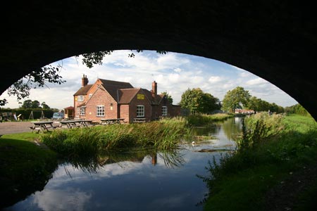
Click image to visit gallery of 5 images.
This walk follows part of the Viking Way as it runs alongside the Grantham Canal. The rest of the walk is along field paths in the valley of the River Devon. To locate the start turn down the lane just north of Woolsthorpe-by-Belvoir village at the "Dirty Duck". Parking is possible on the verges along this approach lane, over the canal bridge or ask at the inn (grid ref SK843351).
The 33-mile long canal linking Grantham with the River Trent at Nottingham was constructed between 1793 and mid 1797 when it opened and secured Grantham's prosperity for over 50 years until the first railway reached the town in 1851. Eventually the Great Northern Railway bought the canal company but, seeing it as competition to its primary business, allowed its decline, a process aided by the advent of road transport. The First World War saw an increase in traffic but it was finally closed in 1929.
When ironstone was first quarried locally near Woolsthorpe at Brewers Grave, behind the woods to the south of the Dirty Duck inn, in the 1870's and the ore was transported by tramway to Woolsthorpe Wharf and shipped out by barges. However production soon outstripped what the canal could cope with and so an extensive railway system was developed from1883 onwards, beginning with a branch line from Belvoir Junction to Woolsthorpe. This was soon extended as other deposits were exploited and by 1916 the line had reached Denton and Harlaxton. When quarrying ceased in 1974 so of course did the "raison d'etre" of the railway. Traces of old embankments remain where the cycleway begins near Lock 18 (Woolsthorpe Top) and there was initially a wooden trestle bridge here. However once the canal had closed a proper embankment was built and its removal was an early project when canal restoration began.
Stenwith, now a hamlet, was actually a sizeable village in mediaeval times and appeared in the Domesday Book record of AD1086. The mediaeval village has long since disappeared although the OS map shows a moat site; though it's unseen from the walk.
The final part of the walk back to Woolsthorpe following the towpath from Muston Bridge (Number 59) coincides with the Viking Way. It is all on grass and of interest because of the number of locks passed. The first of these (Lock 12) is seen immediately after leaving Muston Bridge and marks the end of a 20-mile pound (i.e. a lock-free section of canal) - the previous lock being beside the Fosse Way (A46) in Nottinghamshire. Lock 12 (Woolsthorpe Bottom) is also the first of the Woolsthorpe Flight, which is made up of seven locks numbered twelve to eighteen, all within 1 ½ miles and which between them raise the canal about 59 feet. When built they cost £ 950 each including all construction costs, labour and materials.
The Dirty Duck inn (Rutland Arms) also dates from the time of the canals heyday when it was much frequented by the bargee's.
Route Guide
From the inn return down the approach lane to the road, cross over and turn left along the pavement. Just before Woolsthorpe village, near the 30-mph speed limit sign, double back down steps to take the signed field path on your right. Cross an arable field (the path is usually well marked) keeping forward through the far hedge and maintaining the same line over a second field to join a farm track.
Cross this and continue along a grassy field edge with the tiny River Devon now on your left. Keep close by this until the path enters some trees and comes to an old brick bridge. Cross this and turn right, now keeping the river on your right. Cross several stiles, always near the river until after a final meadow you reach a stile at a road.
Turn left along this following it to the canal at Muston Bridge. Cross the canal and turn right to descend onto the towpath. A pleasant canal-side stroll now returns you to Woolsthorpe Wharf. (Beyond the bridge (Number 61) are the final locks of the Woolsthorpe Flight and the site if the railway bridge.)
Other walks nearby
| Walk 1026 | Ropsley, Scotland & the Humbys | easy/mod | 8.5 miles |
| Walk 1391 | Colston Bassett & Cropwell Bishop from Kinoulton | easy/mod | 8.5 miles |
| Walk 1133 | Gunthorpe & Caythorpe from Hoveringham | easy/mod | 7.0 miles |
| Walk 2312 | Culverthorpe | easy | 4.0 miles |
| Walk 3586 | Rolleston & Morton from Fiskerton | easy | 6.3 miles |
| Walk 1436 | High Wood and North Rauceby | easy | 4.8 miles |
| Walk 1437 | South Rauceby and Rauceby Hall | easy | 4.0 miles |
| Walk 2379 | Sempringham Circular from Folkingham | easy | 6.0 miles |
| Walk 2463 | Hoby & Gaddesby Circular | easy/mod | 8.6 miles |
| Walk 1429 | Sleaford riverside circular | easy | 6.4 miles |
Recommended Books & eBooks
No suggestions for this area.Messaging & Social Media
Message Walking Britain and follow the latest news.

Mountain Weather
Stay safe on the mountains with detailed weather forecasts - for iOS devices or for Android devices.