Rockcliffe to Kippford
Dumfries and Galloway Walk
County/Area - Dumfries and Galloway
Author - Mike Bexley
Length - 3.0 miles / 4.9 km Ascent - 250 feet / 76 metres
Time - 1 hours 50 minutes Grade - easy
Maps 

| Ordnance Survey Explorer 313 | Sheet Map | 1:25k | BUY |
| Anquet OS Explorer 313 | Digital Map | 1:25k | BUY |
| Ordnance Survey Landranger 84 | Sheet Map | 1:50k | BUY |
| Anquet OS Landranger 84 | Digital Map | 1:50k | BUY |
Walk Route Description
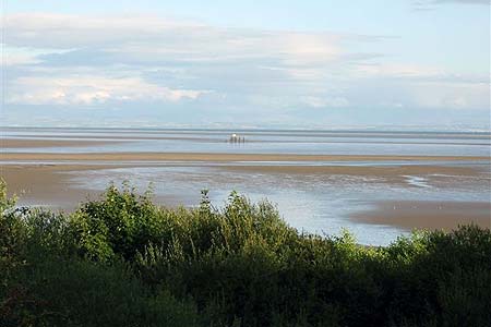
Click image to visit gallery of 6 images.
This short beautiful circular walk from Rockcliffe follows The Muckle Walk & Jubilee Path through old woods with the option of visiting the Mote of Mark. It then passes a collection of curios on the way back. Although I have quoted map grid references, a map is not required just follow this description. The advantage of starting from Rockcliffe as against Kippford is the ease of parking and the option of a refreshing drink and or meal mid-way.
The seaside village of Rockcliffe is situated off the main A710 Dumfries to Dalbeattie road. This walk starts from the large car park on the left just as you drop down to the village (Grid ref. NX847537). Exit the car park and take the narrow lane opposite with its views across the bay, continue straight along this lane to its end and into the woods. On the left is signed The Mote of Mark the site of a 6th century AD fort. It is a short steep climb to the top and the views are fantastic. Use the same path to descend the hill and rejoin the main path. This path, with it's many benches and seats, is very clear. Do not be tempted or confused by the many paths joining this path. Just keep straight ahead. You emerge from the woods onto a road leading down to the gift shop (Grid ref. NX837549) and the river front of Kippford. Turn right for the Anchor Inn.
To proceed with the walk, return to the gift shop and walk along the road with the river estuary on your right. It is along this road that you pass an interesting collection of objects, animals and people made out of stones and drift wood. Towards the end look out for a lane on your left, just after Elm Cottage. The path climbs steeply up into the woods. Again keep to the main path, with the estuary always on your right. The path joins a lane prior to a footbridge then its swing gates, cattle grids and green meadows leading to Rockcliffe (the toilet block in fact). Turn left then right along the front and up the hill passing the Tearooms to the car park.
Other walks nearby
| Walk 3552 | Grune Point from Silloth | easy | 4.7 miles |
| Walk 1302 | Low Fell and Fellbarrow from Loweswater | easy/mod | 6.0 miles |
| Walk 3558 | St Bees to Whitehaven coast path | easy/mod | 7.4 miles |
| Walk 1671 | Grike & Crag Fell | easy/mod | 6.6 miles |
| Walk 1290 | Mellbreak | moderate | 7.0 miles |
| Walk 3676 | Hen Comb from Loweswater | moderate | 5.4 miles |
| Walk 2658 | The Machars Peninsula - St Ninian's Cave | easy | 2.0 miles |
| Walk 1676 | Ullock Pike, Long Side and Carl Side | moderate | 5.5 miles |
| Walk 2058 | Ennerdale Skyline incl. Steeple & other fells | mod/hard | 13.8 miles |
| Walk 3667 | Ennerdale Water Circular | moderate | 7.1 miles |
Recommended Books & eBooks
No suggestions for this area.Messaging & Social Media
Message Walking Britain and follow the latest news.

Mountain Weather
Stay safe on the mountains with detailed weather forecasts - for iOS devices or for Android devices.