Grizedale Tarn circular
Lake District Walk
Nat Park - Lake District - Lake District Lesser Fells
County/Area - Cumbria
Author - Peter Smyly
Length - 2.5 miles / 4.1 km Ascent - 400 feet / 121 metres
Time - 1 hours 40 minutes Grade - easy
Maps 

| Ordnance Survey Explorer OL6 | Sheet Map | 1:25k | BUY |
| Anquet OS Explorer OL6 | Digital Map | 1:25k | BUY |
| Ordnance Survey Landranger 90 | Sheet Map | 1:50k | BUY |
| Anquet OS Landranger 90 | Digital Map | 1:50k | BUY |
Walk Route Description
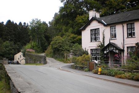
Click image to visit gallery of 6 images.
Grizedale Forest is situated three miles to the south of Hawkshead and is the largest forest in the Lake District. The Visitor Centre is the usual starting point for the various waymarked trails in the forest and it is the white waymarked trail that leads to Grizedale Tarn, the only natural tarn in the forest. Although there are more than twenty tarns in the forest, many of them do not have public access rights. The Visitor Centre has been upgraded as a result of National Lottery funding and its café, adventure playground, and relocated information centre and shop make a popular place for families with young children even if they do not venture far into the forest Even a walk of a few hundred yards into the forest offers the chance to see some of the sculptures including some musical ones. One of the forest trails could be considered a walk option on a day when the tops are affected by rain and cloud. However, the trails also offer pleasant walking in good weather and should not simply be seen as a "wet weather option" in my opinion. The size of the forest and the number of trails, mean that even a full day would be insufficient to see all of it in any case.
This is a Lake District circular walk which can be completed in around two hours. Grizedale Tarn is not to be confused with the better-known and much larger Grisedale Tarn, spelt with an "s" rather than a "z" between Seat Sandal and Dollywagon Pike. As the crow flies, Grizedale Tarn is only about half a mile from the Visitor Centre, but the walking trail goes there by a more circuitous route. The white waymarked trail goes east and then south initially before looping round to head roughly north. While one option is to follow the white waymarker trail throughout, this route takes a short cut to the north east at the start to meet up with the white waymarked trail. In terms of terrain, there are a few fairly steep sections along stony or rocky paths or trails but for the most part, gradients are either level or gentle up and down. From a route-finding point of view, the key is to pay careful attention to detail where there is a choice of ways ahead, a good basic principle for any walk. A map showing walking trails in the forest can be obtained from the information centre.
Start by parking at the car park to the south of the Visitor Centre. Head north up the hill with The Yan (Education Centre) on the right and the Visitor Centre on your left. Passing the road briefly on your left, now follow the rocky trail ahead as it goes uphill with a dry stone wall, moss-covered in places, on your right and trees either side. After a few minutes, a view opens out to the right of the Grizedale Valley. The trail continues onwards and upwards, passing a few sculptures on the way, until it meets with another forest trail. Turn right here as the going becomes easier underfoot and the forest now has a more semi-open aspect to it. After a few hundred yards, the trail turns to the right and meets with another trail at a T junction of paths. Turn left here as the trail follows a straight course between a mixture of coniferous and deciduous trees and a couple of ponds soon appear just off the path to the left. As the track rises slightly, the next landmark to look out for is a sculptured red sandstone fox set back from the path on the left. Just after this point, turn right at a Y junction. Occasional green and white waymarkers act as a guide and cyclists may be seen on the trail. Views of the Fairfield Horseshoe can be seen beyond the Y junction. A little further along the track you may spot another sculpture, a "Feathersaurus" on the right, set back from the trees along a muddy path. Continue to follow the main trail ahead as you pass through a mixture of trees, though mostly evergreens rather than deciduous, some of it dense with carpets of pine needles underneath. The path loses height as it winds its way through the forest and just before a Y junction is reached, a green and white waymarker to the left of the trail marks a point where a short rocky staircase leads to a narrow path through the trees for about twenty yards and the secluded but pretty Grizedale Tarn appears just ahead. Alternatively, if you follow the main trail ahead for a similar number of yards to a Y junction, another path on the left, which is much narrower than the main trail, leads diagonally back to the tarn. Fringed by reeds in places and rather small, this tarn is the only natural one in the forest. It has a wooden platform on the side nearest the approach paths and some water lilies on its surface. The tarn was used as an emergency water supply for Grizedale Hall in the Second World War, at a time when the Hall was being used as an officers' Prisoner of War camp.
To continue the walk, return to the main path and take the track to the right at the Y junction. A right turning shortly after this by way of a much narrower path leads downhill to cross a trickle of a stream. Continuing up the other side of the stream, follow the way ahead to descend via a "staircase " with steps held in by pieces of wood, to meet a broad forest trail at a T junction of paths. Turn left here and after about half a mile, another waymarked right turn down a narrow path leads downhill and out into the open briefly with a view across the fields of the Grizedale valley with Carron Crag, the highest point in the forest is seen on the other side of the valley. The car park can also just be seen beyond trees from here. The rest of the walk needs little explanation as the trail goes back to the start point via the white waymarked trail with some interesting sculptures to look out for on the way back.
Bird watchers may be interested in trying to spot red kites, some of which have recently been reintroduced into the forest (Summer 2011). At that time there was also an interesting exhibition of stuffed animals at The Yan, which was well worth a visit. Those who prefer an adrenalin rush can try the "Go ape" tree top experience; more information can be obtained from the kiosk behind the café next to the "Guardian of the Forest".
Other walks nearby
| Walk 3638 | Satterthwaite Bridge Circular | easy | 3.2 miles |
| Walk 2053 | Claife Heights & Near Sawrey | easy | 2.5 miles |
| Walk 3410 | Latterbarrow from Hawkshead | easy | 4.0 miles |
| Walk 1217 | Dow Crag & the Old Man of Coniston | mod/hard | 8.5 miles |
| Walk 1761 | Tom Heights and Tarn Hows | easy/mod | 7.0 miles |
| Walk 3028 | Tarn Hows & Tom Gill | easy/mod | 6.5 miles |
| Walk 3220 | Wetherlam via Red Dell | moderate | 7.0 miles |
| Walk 3110 | The Old Man of Coniston & Dow Crag from Torver | mod/hard | 8.5 miles |
| Walk 1911 | Coniston's Magnificent Seven | hard | 13.0 miles |
| Walk 1058 | Beacon Fell & Beacon Tarn Circular | easy/mod | 4.0 miles |
Recommended Books & eBooks
Walking the Lake District Fells - Mardale and the Far East
 Part of the Walking the Lake District Fells series, this guidebook covers a wide range of routes to 36 Lakeland summits that can be climbed from the Ullswater, Haweswater, Troutbeck, Kentmere and Longsleddale valleys, with highlights including High Street, Place Fell and the Kentmere fells. Suggestions for longer ridge routes are also included.
More information
Lake District: Low Level and Lake Walks
 This guidebook describes 30 of the best low-level walks in the Lake District. From delightful wooded glades and sparkling tarns, to waterfalls and glacier-carved valleys towered over by craggy mountains. The walks described aim to seek out the best walking that the lower areas of the Lake District have to offer.
More information
Messaging & Social Media
Message Walking Britain and follow the latest news.

Mountain Weather
Stay safe on the mountains with detailed weather forecasts - for iOS devices or for Android devices.