Ringlestone & High Wood from Harrietsham
Kent Walk
County/Area - Kent
Author - Lou Johnson
Length - 8.0 miles / 13 km Ascent - 450 feet / 136 metres
Time - 4 hours 30 minutes Grade - easy/mod
Maps 

| Ordnance Survey Explorer 148 | Sheet Map | 1:25k | BUY |
| Anquet OS Explorer 148 | Digital Map | 1:25k | BUY |
Walk Route Description
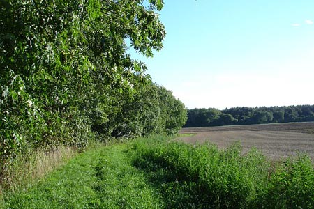
Click image to see photo description.
This walk explores the countryside to the north of Harrietsham and starts from the railway station (grid ref. TQ866529) which lies on the London Victoria to Canterbury West line. An hourly service also serves Ashford and Maidstone amongst other stations. From the station take the footpath heading towards Hillside Farm and the Pilgrims Way which follows an ancient track. Turn left along the Pilgrims Way and take the first footpath on the right. This leads across rising land to Lower Deans Farm (grid ref. TQ872545). Cross the farm access road and take the footpath opposite.
The path goes half right across a field to skirt a small wood which will be on your right, ignoring the path going left. The route continues around the small wood to its north-western corner from where it continues along the edge of a field (hedge to your left) to reach a lane (grid ref. TQ873552). Cross the lane and continue north-east across a large field to reach another lane at the Ringlestone Inn. Turn right along the lane and almost immediately left to walk along an access track. This leads into a footpath and a junction of paths. Ignore the path to the right instead walking ahead to cross fields to reach the access road to Park Farm. Cross this access road and take the footpath opposite walking half left. The path leads to a lane near Yewtree Farm (grid ref. TQ877569).
Turn right along the lane for approximately 150 metres and take the signed footpath on your left. Aim half left across two fields to the corner of a wood. Bear half right here aiming for the opposite field corner. Pass through a narrow strip of woodland and go left around an old chalk pit before veering to your right to follow the onward path. The path turn sharp right at grid ref. TQ868570) and crosses a field to reach Drake Lane. Turn left along this lane and follow to a Ringlestone Road (grid ref. TQ865557).
Bear left for a short way and then continue to follow Drake Lane on the right. Reaching the northern edge of Salisbury Wood, follow Drake Lane as it bends right. Continue to follow the lane through High Wood and down to the Pilgrims Way (grid ref. TQ853545). Turn left along the Pilgrims Way and follow the clear path for just over three-quarters of a mile to reach a footpath crossing (grid ref. TQ865540). Turn right and walk south to Goddington. Pass under the railway, Take the first footpath on your left and follow the railway back to the station in Harrietsham.
Other walks nearby
| Walk 1353 | Pluckley village circular | easy | 3.7 miles |
| Walk 2104 | Blue Bell Hill to Kit's Coty House | easy/mod | 8.8 miles |
| Walk 1637 | Rivers Swale & Oare | easy | 5.0 miles |
| Walk 2805 | Chilham circular from Wye | moderate | 17.0 miles |
| Walk 1044 | Wye and the Crundale Downs | moderate | 9.2 miles |
| Walk 2444 | Wye, Crundale & Wye Downs | moderate | 8.6 miles |
| Walk 2210 | Holly Hill & Coldrum Long Barrow | easy/mod | 5.0 miles |
| Walk 3617 | The Wye Downs and Crundale | easy/mod | 6.0 miles |
| Walk 2920 | Egypt Bay & St Mary's Bay from High Halstow | easy | 7.5 miles |
| Walk 3521 | Wittersham to Rye (High Weald Landscape Trail) | easy/mod | 7.5 miles |
Recommended Books & eBooks
Walking in Kent
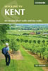 A guidebook describing 40 walks in the county of Kent. Covering west Kent and The Weald and north and east Kent, including the Kent Downs and the Greensand Hills. Walks of 5 to 9 miles explore rivers and coastline, beautiful countryside and historic villages. With outlines of 11 longer walks ranging from 15 to 163 miles.
More information
Messaging & Social Media
Message Walking Britain and follow the latest news.

Mountain Weather
Stay safe on the mountains with detailed weather forecasts - for iOS devices or for Android devices.