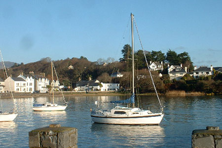
Morfa Bychan from Borth-y-Gest
Llyn Peninsula Walk
Region - Llyn Peninsula
County/Area - Gwynedd - Llyn Peninsula
Author - Lou Johnson
Length - 4.0 miles / 6.5 km Ascent - 300 feet / 91 metres
Time - 2 hours 20 minutes Grade - easy
Maps 

| Ordnance Survey Explorer 254 | Sheet Map | 1:25k | BUY |
| Anquet OS Explorer 254 | Digital Map | 1:25k | BUY |
Walk Route Description
Click image to see photo description.
This Llŷn Peninsula walk starts from Borth-y-Gest and follows the coast path to explore the rocky coves and sandy beaches west of the village. Reaching the extensive beach of Black Rock Sands, the route turns inland and follows paths through golf links and an attractive caravan park.
The start is the car park in Borth-y-Gest opposite the shop and café (grid ref. SH565375). After parking make your way to the far end of the car park and bear right following the blue signs for the Wales Coast Path up a tarmac path. Turn left and where the road forks, bear left alongside the sea. Where the road ends, continue ahead on the waymarked path. Pass a chapel on your right and continue ahead. Note there is a great view behind with Cnicht the prominent mountain.
Reaching a stepped path on the left, continue straight ahead ignoring other paths on the left to reach a fork in the path by a fingerpost. Bear right here and follow the path which soon passes houses on your left. Later you pass houses on your right to reach a fingerpost. Continue ahead, cross a track, and continue following the Wales Coast Path. Reaching a three-way finger past, turn left and continue down to reach the beach by a National Trust sign "Morfa Bychan".
The path then follows the top of the beach on your left. Note the white topped posts that clearly show the route of the Coast Path. Continue around the rocky outcrop of Ynys Cyngar to reach Black Rock Sands. Continue across the beach for about a kilometre to reach a blue cabin and sign. Turn right up the concrete track. Continue past the Glanaber pub on the left. Soon after, turn right into Y Ffridd. Where the road bends to the left, turn right onto the signed footpath.
Reaching the golf course, turn left to follow a gravel path across the course. After a sweeping bend you reach a tarmac road. Turn left and immediately right to walk beside a fence to reach a path heading uphill in trees. Stay on this path to reach a caravan park. Turn left and then after tennis courts go slightly left and then immediately right (pond on the right and a cabin on the left).
Follow this twisting road uphill eventually passing two wooden refuse bins. At the first caravan on your left and a sign for Borth-y-Gest and Beach ahead, turn right across a small grassy area to join a path through trees. Fork left. Go through the gate and follow the path downhill with a school on your right. Go through a kissing gate and turn right down to a road. Turn left along Mersey Street back to the start.
Other walks nearby
| Walk 2292 | Moel-y-Gest Porthmadog | easy/mod | 2.5 miles |
| Walk 3370 | Criccieth & Llanstumdwy Circular | easy | 4.5 miles |
| Walk 1173 | Moel Ysgyfarnogod & Foel Penolau | moderate | 6.5 miles |
| Walk 1127 | Cnicht | moderate | 6.3 miles |
| Walk 3035 | The Moelwyns | mod/hard | 7.5 miles |
| Walk 1010 | Cnicht, Moel Druman & Allt-fawr | moderate | 10.0 miles |
| Walk 1422 | Cnicht and Moelwyn Mawr | moderate | 8.0 miles |
| Walk 1191 | Rhinog Fawr & Gloyw Lyn from Cwm Bychan | mod/hard | 5.0 miles |
| Walk 2150 | Llyn Dinas and Cwm Bychan from Beddgelert | easy/mod | 6.0 miles |
| Walk 2560 | Moel Hebog, Moel yr Ogof & Moel Lefn from Beddgelert | mod/hard | 6.5 miles |
Recommended Books & eBooks
Snowdonia: 30 Low-level and easy walks - North
 Guidebook describing 30 walks in Snowdonia, Wales. Routes are mostly low level and on clear paths and showcase the region's beautiful scenery and rich history and culture. Part of a 2-volume set, this northern volume includes the Snowdon area, the Ogwen and Conwy Valleys, Betws-y-Coed, Beddgelert, Ffestiniog and the coast.
More information
Snowdonia: 30 Low-level and easy walks - South
 Guidebook describing 30 walks in Snowdonia, Wales. Routes are mostly low level and on clear paths and showcase the region's beautiful scenery and rich history and culture. Part of a 2-volume set, this southern volume includes Trawsfynydd, Bala, Dolgellau, Machynlleth, the Harlech Coast and the valleys of the Mawddach and Dyfi.
More information
Messaging & Social Media
Message Walking Britain and follow the latest news.

Mountain Weather
Stay safe on the mountains with detailed weather forecasts - for iOS devices or for Android devices.