High Melton & Cusworth Hall
South Yorkshire Walk
County/Area - South Yorkshire - Doncaster Rotherham
Author - Andy Chaplin
Length - 12.0 miles / 19.5 km Ascent - 600 feet / 182 metres
Time - 6 hours 40 minutes Grade - moderate
Maps 

| Ordnance Survey Explorer 279 | Sheet Map | 1:25k | BUY |
| Anquet OS Explorer 279 | Digital Map | 1:25k | BUY |
| Ordnance Survey Landranger 111 | Sheet Map | 1:50k | BUY |
| Anquet OS Landranger 111 | Digital Map | 1:50k | BUY |
Walk Route Description
Click image to visit gallery of 3 images.
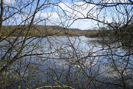
Another walk in South Yorkshire and another country house on route - this time Cusworth Hall and its parkland. The hall houses part of the Doncaster museums and, whilst the parkland looks out eastwards towards Doncaster, the lake, garden and parkland are pleasant retreats on the outskirts of the city.
Park at the eastern end of Melton Wood in the car park just off Sheep Lane (grid ref. SE517033) and take the track on the eastern edge of the wood for 150m until you see the main avenue heading off westwards through the trees. At a junction of 5 routes take the one that is closest to heading south and follow it out to the open fields south of the wood.
The path across the fields has been left as an unploughed border and it dog-legs south then west before heading south again on the Hangman Stone Lane track. Come out in High Melton on the Doncaster Road, turn right and take the pavement/footpath on the far side of the road. Shortly after this comes back to the roadside take the path off left across the fields, going south to Pasture lane.
Take Pasture Road alongside Denaby Ings Nature reserve and continue over the River Dearne. Take the track off on the left that then follows the river until you come to a footbridge over it - shortly before the Dearne meets the Don. Crossing by the footbridge, the path here heads gradually uphill away from the Don, passing the old Earth Centre site before coming back closer to the railway and river. Over on the other side of the valley is a good view of Conisborough Castle.
When the Trans Pennine Trail meets a road coming from the left and shortly after the railway has passed underneath in a tunnel, turn off right to go down to the river alongside the Conisborough Viaduct. The route now follows the Don all the way around to the A1 viaduct past Sprotbrough. The lock at Sprotborough is a reminder that the Don was used for commercial traffic and there is still evidence of wharves along the river adjacent to some of the quarries.
After the A1 bridge turn up the steps onto the old LNER mineral railway line that runs alongside the current branch line. After passing either side of the new housing in Newton turn left towards Cusworth and follow the path along the south side of the park/playground into the grounds of the hall. You come into the grounds via the old gamekeeper's cottage and fishponds then make your way up to the hall.
Carry on through the car park to the Back Lane road and follow it westwards. It can be relatively busy until you pass under the A1 and continue along Long Lane. From here you continue along Brand Lane and Sheep Lane back to the parking. There are no footpaths for sections along the road but it was possible to walk along the edges inside the fields to the north of the road as the fields are large and the hedges are not complete.
Other walks nearby
| Walk 1755 | Hooton Pagnell circular | easy/mod | 9.8 miles |
| Walk 2717 | Wentworth Woodhouse and its follies | easy/mod | 7.5 miles |
| Walk 1937 | Morthen & Upper Whiston from Ulley | easy/mod | 8.8 miles |
| Walk 1939 | River Don & New Junction Canal from Fishlake | moderate | 12.6 miles |
| Walk 2943 | Newmillerdam Country Park from Notton | easy | 5.7 miles |
| Walk 1935 | Birley Edge & Wharncliffe Wood | easy/mod | 9.4 miles |
| Walk 2725 | Chesterfield Canal and Anston Brook from Kiveton | moderate | 10.2 miles |
| Walk 1545 | Wortley circular including Wharncliffe Crags | easy/mod | 8.1 miles |
| Walk 2086 | Stainborough Castle, Wentworth Castle & Worsbrough | easy/mod | 8.9 miles |
| Walk 3436 | Hillsborough to Bradfield & Loxley Valley | moderate | 12.6 miles |
Recommended Books & eBooks
No suggestions for this area.Messaging & Social Media
Message Walking Britain and follow the latest news.

Mountain Weather
Stay safe on the mountains with detailed weather forecasts - for iOS devices or for Android devices.