From Langsett to Crowden via Woodhead
Peak District Walk
Nat Park - Peak District - Black Hill Dovestone
County/Area - South Yorkshire & Derbyshire
Author - Peter Schofield
Length - 11.0 miles / 17.9 km Ascent - 1700 feet / 515 metres
Time - 7 hours 10 minutes Grade - moderate
Maps 

| Ordnance Survey Explorer OL1 | Sheet Map | 1:25k | BUY |
| Anquet OS Explorer OL1 | Digital Map | 1:25k | BUY |
| Ordnance Survey Landranger 110 | Sheet Map | 1:50k | BUY |
| Anquet OS Landranger 110 | Digital Map | 1:50k | BUY |
Walk Route Description
Click image to visit gallery of 3 images.
The Woodhead Pass in the north of the Peak District National Park has been a major transport artery since mediaeval times and still is today. While this walk parallels it, it is far enough away for much of its length as not to be affected while at the same time offering some fine Dark Peak moorland walking.
This Peak District walk starts from the car park at Langsett (Grid ref. SE211004). From the SW corner of the car park, follow the high level path along Langsett Bank to a junction of five paths at Crookland Wood (Grid ref. SE197007) and continue straight on through an area of cleared woodland to arrive at a barn after a further 400m. Bear left and go through a gate, continuing down through the wood to reach the Little Don river at the bottom of Fox Clough.
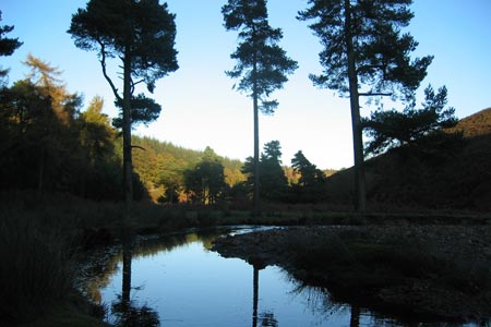
Cross the clough by the bridge and continue up the valley of the Little Don which to my mind is one of the most beautiful and unspoilt parts of the Dark Peak. At a wall corner at Grid ref. SK189999 take the left hand path which drops down to the river bank and passes a solidly built stone sheepfold below Hordron Farm. The farm is now in ruins, having been evacuated when Langsett Reservoir was constructed in the early 1900s. The path meanders along the bank for a further kilometre before reaching a footbridge at the foot of Near Cat Clough.
Go over the bridge and take the clear path up Near Cat Clough which serves a number of grouse butts. As you reach the top, the oddly shaped Rocking Stones come into view before reaching the Derwent Skyline path at a red post (Grid ref. SK169980). Turn right and continue along the spectacular but sometimes boggy Derwent Skyline path over the aptly named Featherbed Moss. Extensive views open out both to the north over West Yorkshire and to the south towards the Derwent Valley, while ahead the brooding hulk of Bleaklow looms up with Barrow Stones a prominent feature on the skyline.
After four kilometres, the path arrives at a stile at Swains Head (Grid ref. SK132982). Take a look around you; as the peat stretches away endlessly in every direction, it's hard to believe that the fence actually marks the boundary of the cities of Sheffield and Barnsley!
Cross over the stile and after approximately 600m where the path takes a pronounced turn to the south (Grid ref. SK126981), head due west for 300m across the open moor to meet a clear path above Far Black Clough. Turn right and follow the path as it descends Far Black Clough, one of the Dark Peak's little known treasures. As the path descends, it becomes a vehicle track before crossing the clough at a ford. Continue along the track for a further 500m before turning right over a bridge across the infant River Etherow.
Go left through the gate to descend to the west entrance of the disused Woodhead rail tunnels. The right hand bore was opened in 1954 but enjoyed a working life of little more than twenty five years before the railway was closed. The original Victorian left hand bore is now used to carry a National Grid high voltage power line under the Pennines. It's a pity that the rest of Longdendale is so disfigured by pylons on the approach to the tunnel.
It's now easy walking along the Trans Pennine Trail for four kilometres until it reaches the B6105 just beyond Woodhead Reservoir. Leave the trail at Grid ref. SK080992 and cross the road to join the concessionary path which winds around the upper end of Torside Reservoir before reaching the A628 opposite Crowden Youth Hostel where the walk ends.
Public transport is infrequent along the A628 which may require the use of two cars to do this walk. However National Express service 350 operates three times daily between Manchester and Sheffield and stops at both Crowden and Langsett. At the time of writing, a coach was leaving Crowden at the fairly convenient time of 0950 arriving at Langsett at 1005. The coach stop at Crowden is located at the bottom of the track to the campsite (Grid ref. SK071991) and full details of times and fares can be found on www.nationalexpress.com.
Other walks nearby
| Walk 1581 | Langsett Reservoir | easy | 3.0 miles |
| Walk 1401 | Hordron Road and the Little Don | easy/mod | 5.0 miles |
| Walk 2231 | The Eastern Edges | hard | 25.0 miles |
| Walk 1526 | Cats Clough Head & Outer Edge | moderate | 9.0 miles |
| Walk 1695 | Flouch & Winscar circular | easy/mod | 9.0 miles |
| Walk 2328 | Penistone to Shepley linear | easy/mod | 8.0 miles |
| Walk 2726 | Penistone Circular from Scout Dike Reservoir | moderate | 8.3 miles |
| Walk 1523 | Broomhead Moor & Ewden Beck | easy/mod | 6.0 miles |
| Walk 2826 | Winscar Reservoir circuit from Dunford Bridge | moderate | 8.9 miles |
| Walk 2238 | Thurgoland Boundary Walk Oxspring | easy/mod | 8.6 miles |
Recommended Books & eBooks
Great Mountain Days in the Pennines
 An inspirational guidebook to 50 classic walks on the rolling Pennine landscape. The graded routes, between 6 and 13 miles in length, cover classic Pennine fells and moorland such as Whernside, Ilkley Moor and Pendle Hill; exploring the North and South Pennines, Yorkshire Dales, Howgills and Dark Peak. Many routes are also suited to fell running.
More information
Walking in the Peak District - White Peak East
 Guidebook describing 42 half-day and day walks in the limestone landscapes of Derbyshire's White Peak, part of the Peak District National Park. One of two volumes, this book covers the east of the region, with potential bases including Bakewell, Eyam, Castleton, Birchover, Matlock and Wirksworth.
More information
Messaging & Social Media
Message Walking Britain and follow the latest news.

Mountain Weather
Stay safe on the mountains with detailed weather forecasts - for iOS devices or for Android devices.