Boynton from Rudston Circular
Yorkshire Wolds Walk
Region - Yorkshire Wolds
County/Area - East Yorkshire - Yorkshire Wolds
Author - Lou Johnson
Length - 6.5 miles / 10.6 km Ascent - 370 feet / 112 metres
Time - 3 hours 40 minutes Grade - easy
Maps 

| Ordnance Survey Explorer 295 | Sheet Map | 1:25k | BUY |
| Anquet OS Explorer 295 | Digital Map | 1:25k | BUY |
Walk Route Description
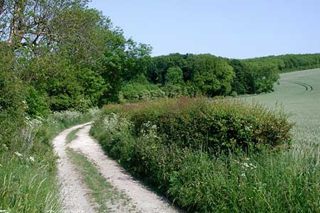
Click image to see photo description.
This pleasant walk in the East Riding of Yorkshire captures the flavour of the rolling countryside of the Yorkshire Wolds. The route starts in the village of Rudston (grid ref. TA095672) where on-street parking is available near the village centre. Please remember to park with consideration for local residents.
After parking return to the crossroads and turn south along Burton Agnes Balk. Almost immediately turn left into South Side Lane. This soon becomes an unsurfaced track heading east. Reaching woodland, the track bears right and then reaches a junction of tracks at grid ref. TA103671. Ignore the track on your right and continue straight ahead with woodland on your right. This track continues along the edge of the wood (Zigzag Plantation), turns sharp left and crosses two fields to another area of woodland. Here the track goes half right and after briefly passing through trees follows the edges of fields to reach the old Roman Road (grid ref. TA114662).
Turn left along the old Roman Road. After about one and a half miles, and after passing Sands Wood on your left, you reach a finger post on your left. Follow this path across fields to Boynton. Cross the Gypsey Race stream and at grid ref. TA135679 turn left onto a footpath across fields to reach the B1253. There are grass verges on this road. However, the verges are not well maintained and the traffic can be fast. Continue along the road for about a mile and quarter. After passing a caravan site behind a stone wall on your left you will see a finger post on your right. Ignore this and continue a short way to reach a finger post on your left by a wooden fence. Turn left and follow this path across fields to join a tarmac road. Continue straight ahead back into the centre of Rudston village.
Other walks nearby
| Walk 1433 | Martin & Metheringham circular | easy | 6.3 miles |
| Walk 2482 | Fordon and Dales Circular | easy/mod | 5.2 miles |
| Walk 2264 | Bridlington & Flamborough Head | easy/mod | 6.8 miles |
| Walk 3247 | Stockingdale and Muston from Hunmanby | easy/mod | 7.8 miles |
| Walk 3740 | Cowlam & Cottam Circular | easy/mod | 8.0 miles |
| Walk 1630 | Filey, Camp Dale & Hunmanby | moderate | 10.5 miles |
| Walk 1620 | Flamborough Head | easy/mod | 9.7 miles |
| Walk 2921 | Bempton Cliffs | easy/mod | 6.7 miles |
| Walk 1575 | Tophill Reservoir | easy | 3.0 miles |
| Walk 1631 | Scarborough to Filey | moderate | 10.2 miles |
Recommended Books & eBooks
No suggestions for this area.Messaging & Social Media
Message Walking Britain and follow the latest news.

Mountain Weather
Stay safe on the mountains with detailed weather forecasts - for iOS devices or for Android devices.