Yorkshire Three Peaks from Horton-in-Ribblesdale
Yorkshire Dales Walk
Nat Park - Yorkshire Dales - Three Peaks Country
County/Area - North Yorkshire
Author - Barry Mackie
Length - 24.5 miles / 39.8 km Ascent - 5000 feet / 1515 metres
Time - 17 hours 20 minutes Grade - very hard
Maps 

| Ordnance Survey Explorer OL2 | Sheet Map | 1:25k | BUY |
| Anquet OS Explorer OL2 | Digital Map | 1:25k | BUY |
Walk Route Description
Click image to visit gallery of 8 images.
This is a circular Yorkshire Dales walk, starting and finishing at Horton-In-Ribbledale, completed in an anti clockwise direction. There are alternative start/finish places, but Horton is preferred due to its plentiful parking (£4 pay and display in 2016) and toilet facilities. There is also a cafe which has a 'clocking in and out' system where you can log your start and finish times. Going anti clockwise is preferred as the awkward ground on Pen-y-ghent is climbed early in the walk when you are fresh, rather than descended near the end when you will be very tired.
There are 3 places along the route, as well as the above-mentioned cafe, where it may be possible to get refreshments, but sharing a personal experience when this walk was done on a nice day in late July, 2016, none of them were open. Given this, it's a good idea that you carry enough for the entire trip, or get someone to meet you along the way. If they are open, the caravan in the layby to your right near the viaduct, the farm in Philpin Lane and the Old Hill Inn, when you pass, treat it as a welcome bonus. Kit wise, be prepared for everything and take enough of the right gear.
The way is well marked, but a map, compass and route card will help to make sure you don't get lost.
Horton to Pen-y-ghent (2.5 miles/4kms)
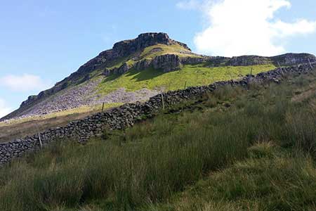
Go right out of the car park and along the road past the cafe (clocking in if you wish) to reach the church on your left just past the bend. Turn left onto the lane to reach the footbridge over the river, with a finger post pointing to Pen-y-ghent via Brackenbottom Scar. Cross the bridge, then immediately turn left onto the road, which soon becomes a farm track. Turn left again through a stile just before you reach the farm to follow a track generally alongside a dry-stone wall on your left. The walk is now over moorland, steadily gaining height on unmade paths with Pen-y-ghent ahead of you.
The path, now veering to the right, becomes well paved and starts to steepen as you approach the broken ground. You will need to pick your route with a bit of care with some easy scrambling required in a couple of places. This short section is probably as technically difficult as it will get underfoot on the day, but you are fresh now and it should present no problems. Take your time and soon the wide summit plateau is reached, with the approach to the top an amble over a very well constructed paved path. On reaching the summit, marked by the trig pillar, a dry-stone wall and a rudimentary seating place, there are fabulous views in every direction. At 694m, Pen-y-ghent is now climbed and it is impossible to ignore a rightly felt sense of satisfaction. You've been walking for maybe some 75-90 minutes and you are well on your way.
Pen-y-ghent to Whernside 12miles/19.2 kms
Go through the gap in the wall and follow the path initially in a northerly direction losing height rapidly as you head down the slope. The next stage is initially a long walk across the moors with the occasional uphill section until you reach Nether Lodge. The route is generally in good condition and well signposted. Problems that would have been met in previous years, like negotiating Black Dubb Moss on Horton Moor have been somewhat reduced by rerouting through mostly firmer ground to the south. It will still be wet and muddy underfoot though in some of the unpaved places.
On reaching Nether Lodge, follow the farm track to reach the B6479 and turn right to reach and cross the B6995 main road with the Ribblehead Viaduct in front of you. It's easy walking along the road, but there is no footpath so be wary of the traffic.
Continue alongside the viaduct and then the railway line itself (on your left) staying on a defined path, to cross the line by the ford with some spectacular waterfalls soon to be seen on your left. The path climbs steadily and sweeps back to the left and generally follows alongside a stone wall on your right. The view of Ingleborough comes more and more into focus now as the summit of Whernside, 736m is reached, with the trig point and wind shelter accessed through the gap in the wall. Apparently with clear skies and a decent pair of binoculars, Blackpool Tower can be seen some 40 miles away.
With two summits now reached, a long, good, hard, albeit maybe bleary look across to Ingleborough and more than a fleeting thought. It looks very steep
Whernside to Ingleborough. (5 miles/8 kms)
Continue straight on, following the stone wall to where the path veers to the left and steepens. This section is slow and can be quite tricky given the nature of the broken ground. After the relatively stroll like walk up, this is more difficult underfoot, so take your time here. The slope eases and reaches a tarmac drive (Philpin Lane) to meet the main B6995 road which you had crossed earlier. Turn left and pass the Hill Inn PH and after a few yards go right through the stile, with Ingleborough now looming in front of you.
This section across the easy grassland and the limestone pavement has some spectacular limestone formations alongside and you may want to venture over to get a closer look. No problem if you don't as there is more of the same and much closer to your path on the way back to Horton from the summit. The route becomes paved and raised above some very wet ground as you head across Humphrey Bottom to reach the sharp incline up the flank of the mountain.
Hand holds may be needed as you gain height and the way ahead is obvious, to reach the summit (grid ref. SD741745).
Ingleborough to Horton (4.5 miles/7.2 kms)
From the summit plateau, retrace your steps and follow the path east which descends gradually following a reasonably obvious path through more interesting and close by limestone formations.
In poor visibility on the summit, follow a bearing of 70 degrees until the ground steepens and then 100 degrees.
The last section is across pasture land, with a few fingerposts showing you the way to reach and cross the tracks at the train station. It's now only a short walk down the road and around the sharp corner to reach the car park and starting point.
Other walks nearby
| Walk 3392 | Darnbrook Fell & Fountains Fell | moderate | 6.4 miles |
| Walk 1251 | The Norber Erratics & Sulber Gate | moderate | 8.0 miles |
| Walk 2620 | Sulber Gate & Crummack Dale from Austwick | moderate | 9.5 miles |
| Walk 2649 | Attermire Scar & Malham Tarn from Stainforth | mod/hard | 16.5 miles |
| Walk 1248 | Trow Gill, Ingleborough & Long Scar | moderate | 9.5 miles |
| Walk 2796 | Ingleborough via Gaping Gill & Norber | moderate | 13.0 miles |
| Walk 3599 | Clapham, Oxenber Woods, Feizor & Settle | easy/mod | 7.5 miles |
| Walk 3094 | Norber & Norber Erractics | easy/mod | 6.3 miles |
| Walk 2617 | Nappa Cross & Victoria Cave from Langcliffe | moderate | 9.5 miles |
| Walk 1404 | Oxenber and Wharfe Woods from Langcliffe | moderate | 10.5 miles |
Recommended Books & eBooks
Walking in the Yorkshire Dales: North and East
 This guidebook contains 43 circular day walks in the north and east Yorkshire Dales. It explores the dales, hills and moors between Kirkby Stephen and Pateley Bridge. Walking ranges from gentle 3 mile strolls to more strenuous day-long rambles across the Howgills, Wensleydale, Swaledale, Nidderdale, Mallerstang and Coverdale.
More information
Trail and Fell Running in the Yorkshire Dales
 Guidebook to 40 of the best trail and fell runs in the Yorkshire Dales National Park. Ranging from 5 to 24 miles, the graded runs start from bases such as Ribblehead, Dent, Sedbergh, Malham and Grassington and take in the region's diverse delights, from castles and waterfalls to iconic mountains such as Whernside, Ingleborough and Pen Y Ghent.
More information
Messaging & Social Media
Message Walking Britain and follow the latest news.

Mountain Weather
Stay safe on the mountains with detailed weather forecasts - for iOS devices or for Android devices.