North Grimston, Birdsall & Wharram Percy
Yorkshire Wolds Walk
Region - Yorkshire Wolds
County/Area - North Yorkshire - Yorkshire Wolds
Author - Andy Chaplin
Length - 12.1 miles / 19.7 km Ascent - 1100 feet / 333 metres
Time - 7 hours 10 minutes Grade - moderate
Maps 

| Ordnance Survey Explorer 300 | Sheet Map | 1:25k | BUY |
| Anquet OS Explorer 300 | Digital Map | 1:25k | BUY |
Walk Route Description
Click image to visit gallery of 3 images.
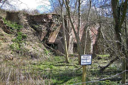
This walk follows sections of the Yorkshire Wolds Way and the Centenary Way (CW) so it is well signed and easy to follow. Part of the walk is on the old Malton to Driffield railway and it passes the site of the deserted village of Wharram Percy where there are English Heritage information boards about the site and its history.
Park at the car park (grid ref. SE866644) and walk westwards down towards the site of Wharram Percy. Cross the stream on the footbridge then head north along the old railway line - this is the Centenary Way (CW). After passing the old Wharram station house the CW goes up Station Road then north along the B1248. It then turns off on the Broad Balk track out of Wharram le Street.
The track goes over the hill, crossing the B1253 at the highest point from where there are good views of the surrounding countryside, then it dog-legs down to the Whitestone Beck. After a short climb up to a farm track to Wood House Farm, leave the CW and turn left, away from the farm house, on the track towards North Grimston.
A short walk on the main road into the village and past the Middleton Arms takes you to the point where the route of the Centenary Way (western loop) crosses the road. Turn off left along the CW at the side of (or sometimes in) the stream. In 2016 this part of the path was somewhat overgrown and a fallen tree was obstructing part of the route but it was still passable.
After crossing the old railway again, the path gets to be easier walking. The CW follows the Mill Beck across fields towards a road that then leads onto Toftings Lane and into Birdsall. The main road through Birdsall passes the church and the home farm of Birdsall House then the CW turns off left onto Salents Lane. When the lane bears left the CW heads off uphill on a track to the top of Birdsall brow.
From the top of the brow, at Toisland Farm, there are great views back towards Birdsall then as you continue to the top of the wold the CW then bears to the right, initially along the south edge and then along the east edge of Deep Dale. Again, there are good views into the dale for this section of the CW/Yorkshire Wolds Way.
Follow the edge of Deep Dale towards Wharram Percy past the remains of the church at the bottom of Drue Dale then come past the Wharram Percy village site and back along the track to the car park.
Other walks nearby
| Walk 2703 | Thixendale & Kirby Underdale | easy/mod | 8.5 miles |
| Walk 1990 | Settrington from North Grimston | easy/mod | 7.3 miles |
| Walk 2655 | Wayram To Fridaythorpe Circular | easy/mod | 7.5 miles |
| Walk 2906 | Circular from Wayrham Through Painsthorpe | moderate | 8.5 miles |
| Walk 3349 | Pasture Dale, Frendal Dale and Horsedale from Huggate | easy/mod | 9.1 miles |
| Walk 1779 | Horse Dale, Holm Dale, Tun Dale and Frendal Dale from Huggate | easy/mod | 9.0 miles |
| Walk 3740 | Cowlam & Cottam Circular | easy/mod | 8.0 miles |
| Walk 3126 | Kirkham Priory & Pretty Wood from Low Hutton | moderate | 11.0 miles |
| Walk 3127 | Bishop Wilton & Millington | moderate | 13.4 miles |
| Walk 3733 | Coneysthorpe & Castle Howard from Welburn | easy/mod | 9.0 miles |
Recommended Books & eBooks
Trail and Fell Running in the Yorkshire Dales
 Guidebook to 40 of the best trail and fell runs in the Yorkshire Dales National Park. Ranging from 5 to 24 miles, the graded runs start from bases such as Ribblehead, Dent, Sedbergh, Malham and Grassington and take in the region's diverse delights, from castles and waterfalls to iconic mountains such as Whernside, Ingleborough and Pen Y Ghent.
More information
Messaging & Social Media
Message Walking Britain and follow the latest news.

Mountain Weather
Stay safe on the mountains with detailed weather forecasts - for iOS devices or for Android devices.