Underbarrow, Lord's Lot and Crossthwaite
Lake District Walk
Nat Park - Lake District - Lake District Lesser Fells
County/Area - Cumbria
Author - Ian Henderson
Length - 5.6 miles / 9.1 km Ascent - 750 feet / 227 metres
Time - 3 hours 30 minutes Grade - easy/mod
Maps 

| Ordnance Survey Explorer OL7 | Sheet Map | 1:25k | BUY |
| Anquet OS Explorer OL7 | Digital Map | 1:25k | BUY |
Walk Route Description
Click image to see photo description.
This circular walk in the South Lakes explores an area lying west of Kendal and south of Windermere. The route traverses a variety of landscapes typical of the area. The walk starts from an excellent pub and passes another along the way.
The start is the Black Labrador pub at Underbarrow (grid ref. SD467921). Please ask for permission prior to parking and do use the pub either before or after the walk. From the start take the lane opposite signed to Crook. Follow this lane and bear right at the junction into Underbarrow village. Bear left past the Old School passing the church on your right. Descend to cross a bridge and then take the footpath on the left (grid ref. SD462925). Follow the path through a gate and enter a field. Follow the way marker to the right along the hedge. After 20 metres bear left. Cross the stile in the wall and cross the field keeping parallel to the fence on your left. Cross the next stile and head across the field to a ladder stile. Follow the path in front of cottages. Continue through a gate into the yard. Continue ahead by the cottage and exit through another gate (grid ref. SD58925).
Cross the road and take the track opposite through a gate. Continue uphill following track with a wall to your left. Cross a stream and continue up the track to a wall stile. Cross the stile and turn right down a track. After 60 metres turn left over a stile and follow this path which climbs steeply for a short distance. Cross the brow of the hill and follow the clear path. Where the path splits take the left-hand path running parallel to a wall on your left. Follow the wall round to the left to reach a track and a gate. Do not go through the gate but follow the rising track to the right. Leave the track before reaching the wall and use the ladder stile to the left of a small tree (grid ref. SD453933).
Continue ahead with a wall on your right. Head through a gap in the wall and follow a track over a hill. Before you reach Low Fold Farm, turn left and follow the signed path to Crossthwaite along a track for a short way. Leave the track to the left and cross a ladder stile across a wall. Maintain direction across a field between two grassy mounds. Continue across a stile over a fence (left of a wall) and continue along a narrow path through gorse bushes. The path soon drops down through bracken with the rising ground of Lord's Lot to your right. Continue across a wooden stile and head half-left. Continue along the track over a hill to a wooden gate. Turn right in front of the gate and follow the fence downhill until the fence becomes a wall. Turn left through a metal gate and then right along a tree lines track. Follow this to a lane (grid ref. SD436919).
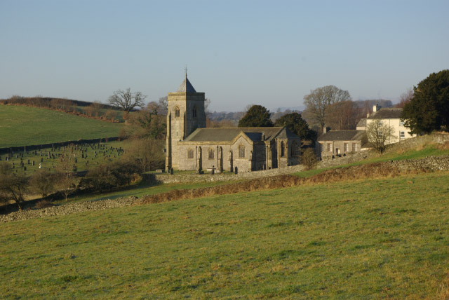
Turn left along the lane and continue into Crossthwaite. Reaching a T-junction, turn left and follow the road through Crossthwaite village. Continue past the Punch Bowl Inn (0n your right) to reach the church (also on your right). Continue out of the village to reach a road junction. Continue ahead and continue to pass the sign on your left at the entrance to Crossthwaite. Take the next lane on the left which is signed as a public footpath. Walk uphill past some cottage and continue onto a track. 300 metres along the lane, turn right onto a footpath marked with a yellow arrow. Cross the field to a gate and onto a lane (grid ref. SD455914).
Turn left and reaching High Blakebank, turn right along a tarmac lane with a fingerpost by the wall on your right. Continue to Middle Blakebank where you follow the yellow arrow straight ahead. At the end of the cottages, go left in front of the white cottage walking down the lawn to a gate. Pass through the gate and follow the path across the field, which follows the remains of a wall. Reaching the far side of the field, the walls on either side become closer together. Reaching a stream, go over the wall stile on your left. Continue along the wall on your right across this field. Cross the stile and maintain direction across the next field towards a barn. Continue through the gate to the left of the barn and cross yard. At the first house, turn right and then left between houses to join an access drive. Continue to a lane. Go straight across to join a signed path across a field which leads back to the start.
Other walks nearby
| Walk 2143 | Whitbarrow & Lord's Seat | easy/mod | 5.4 miles |
| Walk 2721 | Scout Scar Limestone Ridge | easy/mod | 5.0 miles |
| Walk 1555 | Brunt Knott from Staveley | easy/mod | 7.0 miles |
| Walk 1049 | Staveley Tarns circular | easy/mod | 6.0 miles |
| Walk 1148 | Scout Scar from Sizergh | moderate | 11.0 miles |
| Walk 2464 | Kentmere Valley Circular | moderate | 10.0 miles |
| Walk 3452 | Ghyll Head & Strawberry Bank Circular | moderate | 7.6 miles |
| Walk 1463 | School Knott & Grandsire from Ings | easy/mod | 6.5 miles |
| Walk 1045 | Levens Bridge to Kendal | easy/mod | 11.5 miles |
| Walk 3199 | Whitbarrow Fell from Mill Side | moderate | 7.0 miles |
Recommended Books & eBooks
Walking the Lake District Fells - Buttermere
 Part of the Walking the Lake District Fells series, this guidebook covers a wide range of routes to 32 Lakeland summits that can be climbed from the Buttermere, Lorton and Newlands valleys, with highlights including Haystacks, High Stile, Grasmoor and the fells of the Coledale Round. Suggestions for longer ridge routes are also included.
More information
Walking the Lake District Fells - Langdale
 Part of the Walking the Lake District Fells series, this guidebook covers a wide range of routes to 25 Lakeland summits that can be climbed from the Great Langdale valley, Ambleside and Grasmere, with highlights including Scafell Pike, Bowfell, the Langdale Pikes and Helm Crag (the Lion and the Lamb). Includes suggestions for longer ridge routes.
More information
Messaging & Social Media
Message Walking Britain and follow the latest news.

Mountain Weather
Stay safe on the mountains with detailed weather forecasts - for iOS devices or for Android devices.