Sharrah Pool from New Bridge
Dartmoor Walk
Nat Park - Dartmoor
County/Area - Devon
Author - Lou Johnson
Length - 3.4 miles / 5.5 km Ascent - 600 feet / 182 metres
Time - 2 hours 20 minutes Grade - easy
Maps 

| Ordnance Survey Explorer OL28 | Sheet Map | 1:25k | BUY |
| Anquet OS Explorer OL28 | Digital Map | 1:25k | BUY |
Walk Route Description
Click image to see photo description.
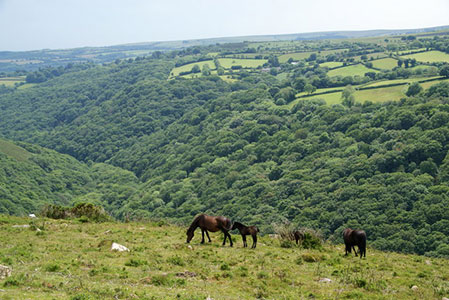
This linear Devon walk explores a section of the Dart Valley in the Dartmoor National Park. The route takes through pleasant woodland to Sharrah Pool. The start is the car park at New Bridge (grid ref. SX711708). The car park can be reached from the A38 at the southern end of Ashburton. Exit the A38 and take the B3352 signed to Ashburton. Continue straight head and you soon pass a brown sign on the left "New Bridge 3 miles". Continue ahead ignoring all side roads and turn left into the car park just after crossing the River Dart.
After parking, turn right along the "main road". Cross the bridge over River Dart and a second smaller bridge over a stream. On your right is a small car parking area. Turn into this and locate the path between wooden railings. Take this path, which is part of the Two Moors Way, and continue ahead for 650 metres to a path junction (grid ref. SX711703). Leave the Two Moors Way and take the right-hand fork and continue through woodland for just under 3 kilometres to reach Sharrah Pool. As you make progress up the valley the path becomes a wider track.
To return to the start, retrace your steps down the valley. However, do remember to fork left off the track to follow the path as you near Wellsfoot Island (grid ref. SX704701).
Other walks nearby
| Walk 1657 | Huntingdon Warren & Lud Gate from Scorriton | moderate | 7.0 miles |
| Walk 3463 | Sharp Tor, Corndon Tor & Yar Tor Circular | easy/mod | 3.4 miles |
| Walk 3757 | Buckland in the Moor Circular | easy/mod | 6.3 miles |
| Walk 3462 | Corndon Tor & Yar Tor Circular | easy/mod | 4.3 miles |
| Walk 1260 | Haytor Rocks & Hound Tor from Saddle Tor | moderate | 7.5 miles |
| Walk 3201 | Bellever Tor & Postbridge | easy/mod | 5.5 miles |
| Walk 3202 | Postbridge & Challacombe Down from Bellever | moderate | 9.8 miles |
| Walk 2838 | Laughing Tors | easy | 3.5 miles |
| Walk 3223 | Avon Dam Reservoir & White Barrows | easy/mod | 5.5 miles |
| Walk 2219 | The Avon Dam Reservoir from Shipley Bridge | easy | 3.5 miles |
Recommended Books & eBooks
No suggestions for this area.Messaging & Social Media
Message Walking Britain and follow the latest news.

Mountain Weather
Stay safe on the mountains with detailed weather forecasts - for iOS devices or for Android devices.