The Preseli Ridge along the Golden Road
Pembrokeshire Coast Walk
Nat Park - Pembrokeshire Coast
County/Area - Pembrokeshire
Author - Lou Johnson
Length - 6.4 miles / 10.4 km Ascent - 700 feet / 212 metres
Time - 3 hours 50 minutes Grade - moderate
Maps 

| Ordnance Survey Explorer OL35 | Sheet Map | 1:25k | BUY |
| Anquet OS Explorer OL35 | Digital Map | 1:25k | BUY |
Walk Route Description
Click image to see photo description.
This linear walk across the Preseli Hills follows the ridge path from Bwlch-gwynt to the Foel Drygarn hillfort. The route follows the Golden Road and offers some fine views over this part of the Pembrokeshire Coast National Park. The walk provides generally easy walking as you gradually lose height heading eastwards. Along the way there are many Iron Age relics to explore including the extensive hillfort at the end of the walk.
The start of the walk is at the Bwlch-gwynt car park (grid ref. SN075322) which lies on the east side of the B4329. The end of the walk is a small layby (grid ref. SN165331) on the minor road near Blaenbanon, which lies just over a kilometre from the A478 south of Crymych.
After parking head east along the clear path from the back of the car park. The path follows the northern edge of a plantation and descends gently to reach Bwlch Pennant. Continue along the rising path with plantation to your right. Reaching the end of the trees on your right, stay on the clear path following the ridge to reach Foel Feddau which at 467 metres above sea level is the highest point of the walk.
A steady descent takes you down to a shallow col from where a steeper ascent takes you to Carn Bica. Descend to Bwlch Ungwr and continue uphill for a short way to cross the northern flank of Carn Menyn. From here you have a clear view of the final objection, Foel Drygarn which can be seen ahead. Descend to the edge of a plantation.
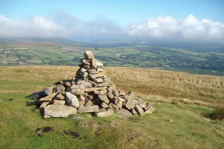
Follow the path with the trees to your right. At the end of the plantation leave the main path and turn left onto a path that heads for the summit of Foel Drygarn (363 metres). As you approach the top the gradient becomes steeper. Continue to the OS trig point from where you can enjoy the extensive view and explore the remains of the substantial hillfort.
To descend from the hill, walk east from the trig point to locate a clear path that descends, steeply at first, in a south easterly direction. This path leads downhill to the gate and information board. Go through the gate and follow the enclosed path back to a road with the parking area opposite.
Alternatively, you can return along the Golden Ridge back to the start. However, remember you have over 1,000 feet of ascent on the return leg of the walk.
Other walks nearby
| Walk 3469 | Foel Cwmcerwyn from Rosebush, Preseli Hills | moderate | 5.0 miles |
| Walk 2291 | Mynydd Carningli from Newport | easy/mod | 4.5 miles |
| Walk 3468 | Foel Drygarn Hillfort, Preseli Hills | easy | 1.8 miles |
| Walk 3467 | Foel Drygarn Hillfort circular, Preseli Hills | easy/mod | 3.7 miles |
| Walk 3474 | Dinas Island from Cwm-yr-Eglwys | easy | 3.0 miles |
| Walk 3494 | Pwllygranant & Cebwr Bay from Moylgrove | mod/hard | 8.5 miles |
| Walk 3490 | Cemaes Head & Clawddcam from Poppit Sands | moderate | 8.3 miles |
| Walk 3491 | Cwm yr Esgyr & Cemaes Head from Poppit Sands | moderate | 6.1 miles |
| Walk 3479 | Strumble Head & Garn Fawr Hillfort | moderate | 6.8 miles |
| Walk 3482 | Garn Fawr & Garn Fechan Hillforts | easy | 1.5 miles |
Recommended Books & eBooks
The Wales Coast Path
 A single guidebook to walking the whole Wales Coast Path - 1400km (870 miles) the length of Wales from Chester to Chepstow, including Anglesey, described in 57 stages. The route passes through the Snowdonia and Pembrokeshire National Parks and many AONBs and can be linked with the Offa's Dyke Path for a complete circuit of Wales.
More information
Messaging & Social Media
Message Walking Britain and follow the latest news.

Mountain Weather
Stay safe on the mountains with detailed weather forecasts - for iOS devices or for Android devices.