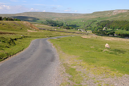
Cringley Hill & Scar House from Langthwaite
Yorkshire Dales Walk
Nat Park - Yorkshire Dales - Swaledale
County/Area - North Yorkshire
Author - Lou Johnson
Length - 4.8 miles / 7.8 km Ascent - 800 feet / 242 metres
Time - 3 hours 10 minutes Grade - easy/mod
Maps 

| Ordnance Survey Explorer OL30 | Sheet Map | 1:25k | BUY |
| Anquet OS Explorer OL30 | Digital Map | 1:25k | BUY |
Walk Route Description
Click image to see photo description.
This Arkengarthdale walk in the Yorkshire Dales National Park starts from the village of Langthwaite and explores the area to the south and west of Arkle Beck crossing the northern flank of Cringley Hill before returning to the valley at Scar House and a woodland walk.
The start of this walk is the small car park in the centre of Langthwaite village (Grid ref. NZ005023). Should this be full do ensure that you park considerately and avoid causing any obstructions to residents. After parking, walk back towards the river bridge. Before reaching the bridge bear left and walk past a cottage on your right and then bear half right to join the path on the eastern bank of Arkle Beck. Continue with the river to your left and pass a small sewage works on your left.
Turn right over the next footbridge (grid ref. NZ010021). Once across the bridge the path goes half right across two fields to a lane. Bear left up the lane to reach a road (Raw Bank). Turn left uphill to reach a cattle grid and gate after 250 metres. Turn right to follow signed footpath. Keep straight ahead soon crossing a track. Continue in a southerly direction to reach a clear track (grid ref. NZ008014). Turn right along the track and cross the northern side of Cringley Hill to reach a lane at Fore Gill Gate (grid ref. NY993009).
Turn right and either ford the beck or cross the adjacent footbridge. Continue uphill along the road, which is followed for about 1.5 kilometres across Turf Moor. Along the way you pass Bouldershaw House and have an excellent view across Arkengarthdale to the moors beyond. Beyond this you will reach a stone wall on your left. At the next fingerpost by a salt box, turn left and follow the track down to Cocker House. The onward path goes to the right on the house, turns right and descends to reach the valley road at the right-hand end of a school (grid ref. NZ000029).
Cross the road and take the narrow footpath opposite. The path initially follows a wall and then in the next field heads half left to a track. Follow the track to the left, cross Arkle Beck and follow the driveway to pass Scar House on your right and the right onto a footpath through woodland back to Langthwaite.
Other walks nearby
| Walk 1252 | Great Pinseat | easy/mod | 5.5 miles |
| Walk 2190 | Calver Hill & Reeth Low Moor | easy/mod | 6.0 miles |
| Walk 1056 | Gunnerside & Surrender Bridge | moderate | 10.3 miles |
| Walk 1197 | Gunnerside & Swinner Gills | moderate | 8.5 miles |
| Walk 3093 | Bunton Hush, Blakethwaite & Gunnerside Gill | easy/mod | 5.5 miles |
| Walk 2469 | Great Allotment & God's Bridge | moderate | 10.2 miles |
| Walk 1340 | Muker & Upper Swaledale from Keld | easy/mod | 6.5 miles |
| Walk 1768 | Thomas Gill and Ravenseat from Tan Hill | moderate | 8.7 miles |
| Walk 1053 | Swinner Gill and Muker | mod/hard | 8.5 miles |
| Walk 1694 | Nappa Hall & Whitfield Gill Force | easy/mod | 6.0 miles |
Recommended Books & eBooks
Trail and Fell Running in the Yorkshire Dales
 Guidebook to 40 of the best trail and fell runs in the Yorkshire Dales National Park. Ranging from 5 to 24 miles, the graded runs start from bases such as Ribblehead, Dent, Sedbergh, Malham and Grassington and take in the region's diverse delights, from castles and waterfalls to iconic mountains such as Whernside, Ingleborough and Pen Y Ghent.
More information
Walking in the Yorkshire Dales: South and West
 Part of a two-book set, this guidebook describes 44 walks in the southern and western Yorkshire Dales, including the famous 23 mile Three Peaks circuit over Pen-y-Ghent, Whernside and Ingleborough. The other, mostly circular routes of 3½ to 13 miles cover the scenic region between Sedbergh, Kirkby Lonsdale, Settle, Skipton and Grassington.
More information
Messaging & Social Media
Message Walking Britain and follow the latest news.

Mountain Weather
Stay safe on the mountains with detailed weather forecasts - for iOS devices or for Android devices.