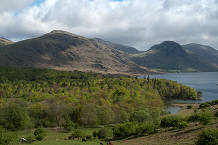
High Birkhow & Low Wood from Wast Water
Lake District Walk
Nat Park - Lake District - Lake District Western Fells
County/Area - Cumbria
Author - Lou Johnson
Length - 4.2 miles / 6.8 km Ascent - 300 feet / 91 metres
Time - 2 hours 20 minutes Grade - easy
Maps 

| Ordnance Survey Explorer OL6 | Sheet Map | 1:25k | BUY |
| Anquet OS Explorer OL6 | Digital Map | 1:25k | BUY |
Walk Route Description
Click image to see photo description.
This low-level Lake District walk starts from the shores of Wast Water and explores the area west towards the village of Nether Wasdale. The route includes a section of open fell, woodland and provides a great view of the Wastwater Screes to Wasdale Head and the high Lakeland fells. The route follows clear paths and tracks.
The start is the small parking area where the lane from Nether Wasdale reached the shores of Wast Water (grid ref. NY148048). After parking walk back up the lane. After 400 metres turn right (grid ref. NY146046) onto a signed track through woodland. Continue to the end of the track and go through the gate onto open fell. The onward grassy track bears left to reach a bridleway and a fingerpost. Turn Left and continue south-west to Ashness How.
Continue ahead passing a path to Woodhow Tarn on the left. At the next junction with a three-way fingerpost (grid ref. NY135044), turn right and continue to another junction after 200 metres. Turn left and cross Scale Bridge. Follow the path south-west passing Mill Place on the right from where you follow a track to reach a road to the east of Nether Wasdale (grid ref. NY129039).
Turn right and almost immediately left to follow a lane through trees. Reaching a road junction continue straight ahead signed to Holmrook. Cross Forest Bridge and turn left onto signed footpath to Wastwater. Follow the track to Easthwaite (grid ref. NY137034). Continue through the farmyard and follow a clear track to reach the River Irt. Turn left and follow the river upstream to Lund Bridge. Cross the bridge and turn right following the path with the river on your right. Stay on this path enjoying the views across Wast Water. Continue past Wasdale Hall Youth Hostel on your left to reach the start of the walk.
Other walks nearby
| Walk 1303 | Buckbarrow, Seatallan & Middle Fell from Loweswater | moderate | 7.0 miles |
| Walk 3489 | Scale Bridge & Low Wood from Greendale | easy | 5.2 miles |
| Walk 1176 | Yewbarrow | moderate | 4.5 miles |
| Walk 2341 | Circuit of Nether Beck and Over Beck from Wasdale | hard | 11.3 miles |
| Walk 1690 | Netherbeck Horseshoe - Middle Fell, Steeple & Red Pike from Wasdale Head | mod/hard | 12.5 miles |
| Walk 2355 | Blea Tarn & Eskdale Green | easy/mod | 6.5 miles |
| Walk 1668 | Silver Knott & Muncaster Fell from Irton Road | easy/mod | 5.0 miles |
| Walk 1126 | Mosedale Horseshoe | hard | 11.5 miles |
| Walk 1246 | Black Sail Pass & Beck Head | moderate | 5.5 miles |
| Walk 2034 | Scafell from Wasdale Head | hard | 6.5 miles |
Recommended Books & eBooks
Walking the Lake District Fells - Wasdale
 Part of the Walking the Lake District Fells series, this guidebook covers a wide range of routes to 25 Lakeland summits that can be climbed from the Wasdale, Eskdale and Ennerdale valleys, with highlights including Scafell Pike, Great Gable and Pillar. Suggestions for longer ridge routes are also included.
More information
Lake District: Low Level and Lake Walks
 This guidebook describes 30 of the best low-level walks in the Lake District. From delightful wooded glades and sparkling tarns, to waterfalls and glacier-carved valleys towered over by craggy mountains. The walks described aim to seek out the best walking that the lower areas of the Lake District have to offer.
More information
Messaging & Social Media
Message Walking Britain and follow the latest news.

Mountain Weather
Stay safe on the mountains with detailed weather forecasts - for iOS devices or for Android devices.