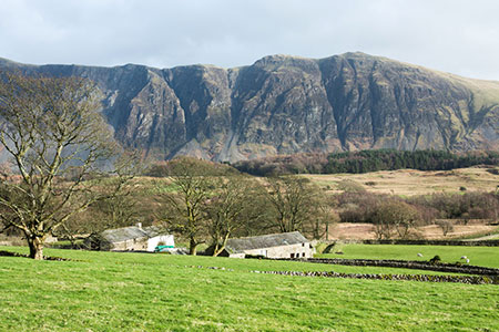
Scale Bridge & Low Wood from Greendale
Lake District Walk
Nat Park - Lake District - Lake District Western Fells
County/Area - Cumbria
Author - Lou Johnson
Length - 5.2 miles / 8.5 km Ascent - 370 feet / 112 metres
Time - 3 hours 0 minutes Grade - easy
Maps 

| Ordnance Survey Explorer OL6 | Sheet Map | 1:25k | BUY |
| Anquet OS Explorer OL6 | Digital Map | 1:25k | BUY |
Walk Route Description
Click image to see photo description.
This Lake District walk explores the area between the southern end of Wast Water and the village of Nether Wasdale. The undulating route offers some wonderful scenery including the high Lakeland Fells above Wasdale Head and the Wastwater Screes. The walk crosses variety of terrain and includes a pleasant woodland walk by the shores of Wast Water.
The start is a small area of grassy verge just east of Greendale on the north side of the road (Grid ref. NY144055) at the foot of the path from Greendale Tarn. After parking, turn right along the road past the cottages on your right. Continue past another solitary cottage and the crags of Buckbarrow, both on your right. Continue along the road for another 700 metres and turn left down a track (grid ref. NY137055) that leads down to Buckbarrow. Pass the house on your left and bear right to join a walled track. The track enters a field. Keep the wall on your left and follow the path around the field edge to the far left-hand-corner.
Turn left here through a gate (grid ref. NY134051) and follow the path with the wall on your right. At the end of this field go through another gate into a smaller field. Again, keep the wall to your right. Reaching the corner of this smaller field, turn left and continue with the wall on you right. Continue following the clear path as it swings to the right. Continue to cross Scale Bridge. Follow the path south-west passing Mill Place on the right from where you follow a clearer track to reach a road to the east of Nether Wasdale (grid ref. NY129039).
Turn right and almost immediately left to follow a lane through trees. Reaching a road junction continue straight ahead signed to Holmrook. Cross Forest Bridge and turn left onto signed footpath to Wastwater. Follow the track to Easthwaite (grid ref. NY137034). Continue through the farmyard and follow a clear track to reach the River Irt. Turn left and follow the river upstream to Lund Bridge. Cross the bridge and turn right following the path with the river on your right. Stay on this path enjoying the views across Wast Water. Continue past Wasdale Hall Youth Hostel on your left to reach a road (grid ref. NY148048). Turn right up the road with Wast Water on your right. Follow the road for 700 metres to a road junction (grid ref. NY151054). Turn left, signed for Gosforth, and continue along the road back to the start.
Other walks nearby
| Walk 3485 | High Birkhow & Low Wood from Wast Water | easy | 4.2 miles |
| Walk 1176 | Yewbarrow | moderate | 4.5 miles |
| Walk 2341 | Circuit of Nether Beck and Over Beck from Wasdale | hard | 11.3 miles |
| Walk 1690 | Netherbeck Horseshoe - Middle Fell, Steeple & Red Pike from Wasdale Head | mod/hard | 12.5 miles |
| Walk 1126 | Mosedale Horseshoe | hard | 11.5 miles |
| Walk 1246 | Black Sail Pass & Beck Head | moderate | 5.5 miles |
| Walk 2034 | Scafell from Wasdale Head | hard | 6.5 miles |
| Walk 2800 | The Scafells via Piers Gill from Wasdale Head | mod/hard | 7.5 miles |
| Walk 2900 | Pillar (by the High Level Path) from Wasdale | mod/hard | 8.0 miles |
| Walk 2718 | The Scafells from Wasdale Head | mod/hard | 9.0 miles |
Recommended Books & eBooks
The Cumbria Way
 A guidebook to the 73 mile Cumbria Way, an easy long-distance walk though the heart of the Lake District National Park, from Ulverston in the south to Carlisle in the north, with good transport links to either end. The route is largely low-level but this guide offers alternative mountain days to climb some of the famous fells en route.
More information
Walking the Lake District Fells - Langdale
 Part of the Walking the Lake District Fells series, this guidebook covers a wide range of routes to 25 Lakeland summits that can be climbed from the Great Langdale valley, Ambleside and Grasmere, with highlights including Scafell Pike, Bowfell, the Langdale Pikes and Helm Crag (the Lion and the Lamb). Includes suggestions for longer ridge routes.
More information
Messaging & Social Media
Message Walking Britain and follow the latest news.

Mountain Weather
Stay safe on the mountains with detailed weather forecasts - for iOS devices or for Android devices.