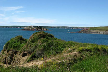
Angle Peninsula from West Angle Bay
Pembrokeshire Coast Walk
Nat Park - Pembrokeshire Coast
County/Area - Pembrokeshire
Author - Lou Johnson
Length - 3.7 miles / 6 km Ascent - 300 feet / 91 metres
Time - 2 hours 10 minutes Grade - easy
Maps 

| Ordnance Survey Explorer OL36 | Sheet Map | 1:25k | BUY |
| Anquet OS Explorer OL36 | Digital Map | 1:25k | BUY |
Walk Route Description
Click image to see photo description.
This easy and rewarding coastal walk explores the Angle Peninsula. The route follows the Pembrokeshire Coast Path which offers some excellent views to Thorn Island, the mouth of Milford Haven and Angle Bay.
The route starts form the car park at West Angle Bay beach (grid ref. SM854032). After parking turn right along the Pembrokeshire Coast Path with the sea on your left. At the far end of the car park to join a track. Continue on the rising track, ignoring a path off to the left by two concrete blocks. At the next fork, bear left to reach a fingerpost. Take the right fork here and continue onto the top of the cliffs. You soon get views across Milford Sound.
As you make progress Thorn Island comes into view. Bear right by the concrete seat and continue along the coast path. Rounding the headland, you can see the oil and gas jetties across Milford Haven. The path follows the boundary of Chapel Bay Fort and Museum to join a tarmac road (grid ref. SM859036). Continue ahead onto a gravel track. Continue past a cottage and shortly after leave the track bearing left onto the signed coast path. Continue through a gate and follow the path between trees to pass through two more gates. The view across Milford Haven opens again on your left.
Continue along the clear path passing through a number of gates to meet a track which leads down to the lifeboat station. Go straight across the track following the fingerpost. After passing through scrub the path emerges into a field. Continue past the Old Point House (refreshments in season) and follow a gravel track at the top od the pebble beach. Passing a large house on the right and continue past some cottages on the right. Reaching a four-way fingerpost continue straight ahead. Follow the track passing the church on your right to reach a road. Turn right and follow this road (B4320) through Angle village. Continue straight ahead to reach the car park used at the start of the walk.
Other walks nearby
| Walk 3498 | Freshwater West & Angle | moderate | 8.7 miles |
| Walk 3496 | St Anne's Head & Dale Peninsula | easy/mod | 7.0 miles |
| Walk 3473 | Marloes Peninsular Circular | easy/mod | 7.0 miles |
| Walk 3362 | Marloes Sands Circular | easy | 4.5 miles |
| Walk 3367 | Nab Head & Musselwick Sands from Marloes | easy/mod | 6.2 miles |
| Walk 2485 | Broad Haven & Druidston Circular | easy/mod | 4.9 miles |
| Walk 3365 | Bosherston Lily Ponds, Broad Haven & St. Govan's Chapel | easy/mod | 5.0 miles |
| Walk 3495 | St. Govan's Chapel, Bosherston & Elegug Stacks | moderate | 9.6 miles |
| Walk 3366 | Bosherston Lily Ponds | easy | 3.4 miles |
| Walk 3364 | The Stackpole Estate from Stackpole Quay | easy | 5.0 miles |
Recommended Books & eBooks
The Wales Coast Path
 A single guidebook to walking the whole Wales Coast Path - 1400km (870 miles) the length of Wales from Chester to Chepstow, including Anglesey, described in 57 stages. The route passes through the Snowdonia and Pembrokeshire National Parks and many AONBs and can be linked with the Offa's Dyke Path for a complete circuit of Wales.
More information
Messaging & Social Media
Message Walking Britain and follow the latest news.

Mountain Weather
Stay safe on the mountains with detailed weather forecasts - for iOS devices or for Android devices.