The Crinkle Crags from Wrynose Pass
Lake District Walk
Nat Park - Lake District - Lake District Southern Fells
Wainwrights - Crinkle Crags
County/Area - Cumbria
Author - Lou Johnson
Length - 5.0 miles / 8.1 km Ascent - 1700 feet / 515 metres
Time - 4 hours 10 minutes Grade - easy/mod
Maps 

| Ordnance Survey Explorer OL6 | Sheet Map | 1:25k | BUY |
| Anquet OS Explorer OL6 | Digital Map | 1:25k | BUY |
| Ordnance Survey Landranger 90 | Sheet Map | 1:50k | BUY |
| Anquet OS Landranger 90 | Digital Map | 1:50k | BUY |
Walk Route Description
Click image to visit gallery of 12 images.
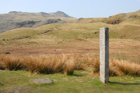
This Lake District walk starts from the Three Shires Stone (grid ref. NY277027) at the top of the Wrynose Pass. The Stone is a replacement for the original, which was damaged when someone reversed their car into it and broke it in two. By using this starting point you are already at 393 metres above sea level and s significant amount of ascent has been avoided. On the negative side the approach is probably less dramatic but it does mean the Crinkle Crags can be completed in a half day walk.
Parking at the Three Shires Stone can be hard to find on busy days so and early or late start is recommended. After parking locate the clear path heading almost due north from the road across undulating fellside. There have been recent improvements to the path and initial progress is relatively fast. Ahead the slopes of Pike of Blisco rise on your right with Cold Pike to your left. The path starts to descend and you arrive at Red Tarn (grid ref. NY266039) with the adjacent junction of paths making it a busy place.
Turn left on the main path. This leads without any navigational difficulties to the Crinkle Crags. As you climb the scenery improves but the initial climb away from red Tarn is rather dull. Once past the subsidiary top of Great Knott on your right, you get a much greater feel for the superb rugged mountain terrain you are crossing.
Reaching the first "crinkle" follow the clear path. All together you have five "crinkles" to conquer of which the second offers the greatest challenge with an awkward scramble or bad step to be overcome. If scrambling skills are insufficient then there is an easy way round the obstacle to the left. Once on the summit of the first crinkle you will realise the amount of ascent involved in covering all five min-summits. Note that the second "crinkle" is the highest.
Once you have had a thorough exploration of all the summits it is time to return to the Three Shires Stone. You can either return the way you came over the tops or alternatively take the avoiding path on the western flank of the summits. If you are feeling energetic then you can include a diversion over Cold Pike by leaving the main path around grid ref. NY256041 and making a beeline for the summit. Descent from Cold Pike to Wrynose needs a little care mainly to avoid the extensive areas of wet ground. If you do intend to visit Cold Pike then it is worth weighing up the potential descent routes as you make your way up to Red Tarn.
Other walks nearby
| Walk 1144 | Lingmoor Fell | moderate | 8.0 miles |
| Walk 1171 | Pike o' Blisco | moderate | 5.0 miles |
| Walk 2582 | Pike o' Stickle, Harrison Stickle & Pavey Ark | moderate | 6.0 miles |
| Walk 2033 | Tilberthwaite & Wetherlam | moderate | 5.0 miles |
| Walk 1132 | Great Langdale & The Crinkle Crags | mod/hard | 7.0 miles |
| Walk 1157 | Bowfell and Esk Pike | hard | 8.8 miles |
| Walk 2037 | Bowfell & Rosset Pike via the Climber's Traverse | hard | 7.5 miles |
| Walk 2818 | Bowfell Circular from Great Langdale | mod/hard | 7.0 miles |
| Walk 1739 | Crinkle Crags and Bowfell (Oxendale Horseshoe) | hard | 7.8 miles |
| Walk 1134 | Wetherlam and The Carrs | mod/hard | 10.8 miles |
Recommended Books & eBooks
Great Mountain Days in the Lake District
 An inspirational guidebook to 50 challenging walks on the high fells of the Lake District. The graded circular routes, between 4 and 14 miles in length, cover classic Lakeland summits like Fairfield, Scafell Pike, Great Gable and Blencathra, to the lesser-known High Spy, King's How and Brund Fell.
More information
Hadrian's Wall Path
 Hadrians Wall Path guidebook to walk the 84 mile National Trail. Described in both directions, the main description is west to east between Bowness-on-Solway and Wallsend, Newcastle, with extensions to Maryport and South Shields. With extensive historical information related to this World Heritage site and separate 1:25,000 OS map booklet included.
More information
Messaging & Social Media
Message Walking Britain and follow the latest news.

Mountain Weather
Stay safe on the mountains with detailed weather forecasts - for iOS devices or for Android devices.