Aldenham to Watling Street Circular
Hertfordshire Walk
County/Area - Hertfordshire
Author - Donald Morton
Length - 5.5 miles / 8.9 km Ascent - 200 feet / 61 metres
Time - 3 hours 0 minutes Grade - easy
Maps 

| Ordnance Survey Landranger 166 | Sheet Map | 1:50k | BUY |
| Anquet OS Landranger 166 | Digital Map | 1:50k | BUY |
Walk Route Description
Click image to visit gallery of 7 images.
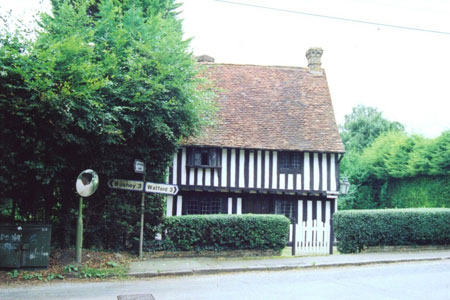
Aldenham is an ancient village that lies on the B462 a couple of miles NE of the centre of Watford. Parking is possible by the church (Grid Ref TQ 140 985). Commence the walk with the church on your left and the village green on your right by walking down the road to the B462. Cross with care and continue straight on down the footpath opposite across the field to the outskirts of Patchetts Green. At the road turn left. First of all you pass between the Three Compasses pub (the present building dating back to the 18th Century) and Patchetts Green "Equestrian Centre". Later you pass between the timbered Patchetts Cottage and the much grander 18th Century Delrow House (now a Camphill Village Trust Community) As you go look out for a well preserved WWII pill box right by the side of the road (Hertfordshire was a hub of anti invasion "stop lines".)
You come to the entrance to Bhaktivendanta Manor, formerly Piggots Manor, donated by Beatle George Harrison to the Hare Krishna movement in 1973. To the right of the drive entrance you will find the start of Public Footpath 22 through the kissing gate. Follow the hedge on the left as it twists round the edge of the field to a second gate. Go through and again follow the field edge, hedge left, to a road by the pond in the village of Letchmore Heath (with The Three Horseshoes beyond the pond). Turn right and follow the road to a footpath to the left precisely where an ETL crosses the road. The footpath follows the ETL to the opposite corner of the field and out onto a dirt track. Turn right to the boundary of Aldenham School (Founded in 1597 by a successful London Brewer - a sort of 16th Century academy school - but effectively dating from the early 19th Century when it was rebuilt and reformed by the Brewers' Company) where a sign shows you the footpath forking left over a field to a hedge gap.
Once through the gap, turn left and follow the edge of the field to the corner and then turn right and continue following the field edge to a hedge gap which this time leads out to the manicured grass of the school grounds. Again turn left and walk along the edge of the grounds. At the corner go over a stile out of the school grounds and continue straight on along field edge, hedge left. After going through a hedge gap again go straight on along the next field edge and straight on through another gap into a third field. Immediately turn right and follow the field edge, hedge right, past one gap leading into a green lane, to a second gap with a stile and white topped waymark post. Here turn left across the field to another waymark post and what appears to be a fence but turns out to be a bridge rail. Cross the bridge and turn left along the field edge. At the field corner go straight on through a wide hedge, over a bridge and into the next field where you turn left to follow the edge round to a road seen ahead.
This is the A5183 (formerly the A5 otherwise known as Watling Street, the Roman Road from Dover via London and St Albans to Wroxeter) where you join the Hertfordshire Way. Turn left and in about 100 yards turn left again over a stile. Follow Public Footpath 31 diagonally right across the pasture to a bridge and then bear left to the field corner at the end of the fence on the right round Little Kendals Farm. Here a stile and gate leads into a newish orchard. The footpath bears slightly left through the trees to another gate and stile. This is clear enough in winter but in summer probably the easiest route is to follow a stone path clockwise round the edge of the orchard, looking out for the gate on the left (NB This is not an official route but I cannot think any one would object to this being used rather than a rather problematical route under the low hanging fruit trees).
The gate and stile lead into a field where you turn left to follow the field edge to a large oak tree where a way mark on its trunk points you along the path over the field; if the path is not clear aim for the pole seen in front of the trees on the other side. When you reach this turn left along a broad grass track. Where this swings right, fork left along a field edge, fence right. Go through a gate and along an enclosed path. At the end dogleg left/right through a kissing gate and along a newly fenced path along the field edge. (At the end, look out for the workshop with the old petrol signs - especially the one for BP.) Cross the tarmac and go straight on through a gate to Common Lane Farm. This is first of all enclosed but where a hedge divides it go to the left of the hedge and follow it to a gate which leads out to a gravel drive. Follow this out to the road where you turn left to the other end of Letchmore Heath.
When you get to a road junction with Common Lane, you can go straight on down Back Lane to reach the The Three Horseshoes where you turn right along The Green to reach the other end of Common Lane, or you can turn right here directly on Common Lane. Either way you get a good impression of what is essentially a Victorian village with a mixture of grand houses of the period and more modest villas: look out particularly for the Great War memorials on individual houses; each house that lost a son in the conflict has its own memorial plaque. If you have gone down Common Lane turn right at the T-junction into Grange Lane. After the last house on the right turn right onto footpath (or bridleway)13. The broad green track between fields comes out at a road junction. Go straight on along The Spinney to the B462 at Roundbush Lane (a short way down is the Roundbush pub). If you do not want refreshment cross the B462 and turn left to follow it to Church Lane. Cross Church Lane and go straight on down an enclosed footpath which leads into the churchyard at Aldenham and the start of the walk. (The church is open to visitors for a couple of hours on Saturday afternoons. In any case look carefully at the tower, built in the 13th and 15th Centuries partly with Hertfordshire Puddingstone. This is a sort of prehistoric concrete - 60 million years old - a conglomerate of pebbles in sand; the unique feature of this stone, found only very locally is that it is bound with silica which makes it extremely hard. It is also very heavy and it must have been very difficult for medieval craftsmen to work with: I certainly found it a challenge when building work dug up an enormous piece in my garden).
Other walks nearby
| Walk 2062 | Cassiobury Park & Grand Union Canal, Watford | easy | 2.0 miles |
| Walk 3122 | Moor Park to Rickmansworth | easy/mod | 7.0 miles |
| Walk 1343 | St Albans & Gorhambury circular | moderate | 9.5 miles |
| Walk 3664 | Northwood Hills to Northolt | moderate | 10.3 miles |
| Walk 1931 | Rickmansworth circular via Croxley Green and Watford | easy/mod | 7.0 miles |
| Walk 3403 | Chipperfield to Kings Langley Circular | easy | 5.0 miles |
| Walk 1507 | Chipperfield Common circular | easy | 2.0 miles |
| Walk 1815 | Hertfordshire Way between Chipperfield and Bovingdon | easy/mod | 7.5 miles |
| Walk 1122 | St Albans & Childwick Green | easy | 4.0 miles |
| Walk 2907 | Hemel Hempstead Circular | easy | 6.5 miles |
Recommended Books & eBooks
No suggestions for this area.Messaging & Social Media
Message Walking Britain and follow the latest news.

Mountain Weather
Stay safe on the mountains with detailed weather forecasts - for iOS devices or for Android devices.