River Dee from Farndon Walk
Walk 3535 - Route Maps
Route Map
Digital Maps - Copyright © 2011-2024. All rights reserved.
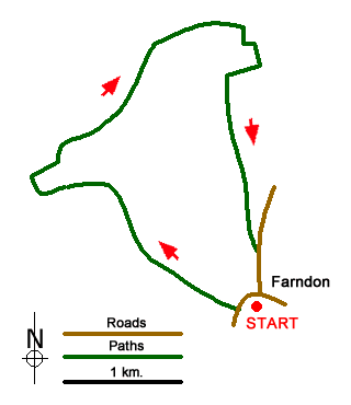
Sketch Map
Suggested Maps 

| Ordnance Survey Explorer 257 | Sheet Map | 1:25k | BUY |
| Anquet OS Explorer 257 | Digital Map | 1:25k | BUY |
| Ordnance Survey Landranger 117 | Sheet Map | 1:50k | BUY |
| Anquet OS Landranger 117 | Digital Map | 1:50k | BUY |
It is recommended you take a map. The preferred scale is 1:25k.
Start Point Details
Ordnance Survey Grid Ref SJ413545
Latitude 53.084476 Longitude -2.877826
Postcode CH3 6QU
what3words start aimed.shirts.valve
Walk description may contain detailed information on the start point for this walk.
Further Information
Cheshire
The County of Cheshire offers a range of walks to suit all abilities. The Sandstone hills between Frodsham and Helsby offer fine walks with some excellent views across the Mersey Estuary. The flat land of the Cheshire Gap is dominated by pleasant rural farmland and easy walking. To the east of the county the land rises to the western moors of the Peak District National Park including the highest point at Shining Tor (559 metres) on the boundary with Derbyshire. It is in this area that most of the more challenging walks can be found with wild country and superb panoramas from the high ground.
Walk grading - Learn how each walk is assessed and select a walk to suit your ability and experience by going to Walk Grading Details.
Messaging & Social Media
Message Walking Britain and follow the latest news.

Mountain Weather
Stay safe on the mountains with detailed weather forecasts - for iOS devices or for Android devices.