High and Over White Horse Walk
Walk 3575 - Route Maps
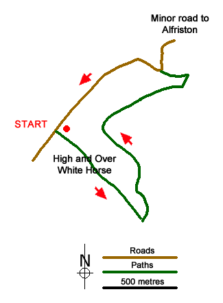
Route Map
Digital Maps - Copyright © 2011-2024. All rights reserved.
Sketch Map
Suggested Maps 

| Ordnance Survey Explorer OL25 | Sheet Map | 1:25k | BUY |
| Anquet OS Explorer OL25 | Digital Map | 1:25k | BUY |
| Ordnance Survey Landranger 199 | Sheet Map | 1:50k | BUY |
| Anquet OS Landranger 199 | Digital Map | 1:50k | BUY |
It is recommended you take a map. The preferred scale is 1:25k.
Start Point Details
Ordnance Survey Grid Ref TQ509011
Latitude 50.789835 Longitude 0.139517
Postcode BN25 3AB
what3words start newlywed.launch.gazette
Walk description may contain detailed information on the start point for this walk.
Further Information
South Downs
The South Downs is Britain's newest National Park and stretches from Winchester to Beachy Head. Steeped in history there are ancient hill-forts, barrows, a Roman road and deserted medieval villages. The area has a rich diversity of natural habitats including flower-studded chalk grassland, ancient woodland, flood meadow, lowland heath and the particularly rare chalk heathland. This varied environment provides an excellent basis for those who enjoy outdoor pursuits, such as walking, cycling and horse riding. South Downs Walking Guide
East Sussex
East Sussex offers some excellent walking with the South Downs offering many excellent routes. The coast also offers some superb walks including Beach Head which rises 162 metres (530 feet) above the Sea. In land the Weald is worth exploring with its attractive villages and historic buildings. The highest point in the County is Ditching Beacon (248 metres, 814 feet). The most important long-distance footpath is the South Downs Way which provides a basis for shorter circular walks.
Walk grading - Learn how each walk is assessed and select a walk to suit your ability and experience by going to Walk Grading Details.
Messaging & Social Media
Message Walking Britain and follow the latest news.

Mountain Weather
Stay safe on the mountains with detailed weather forecasts - for iOS devices or for Android devices.