Wood Walton Circular
Cambridgeshire Walk
County/Area - Cambridgeshire
Author - Lou Johnson
Length - 4.1 miles / 6.7 km Ascent - 100 feet / 30 metres
Time - 2 hours 10 minutes Grade - easy
Maps 

| Ordnance Survey Explorer 225 | Sheet Map | 1:25k | BUY |
| Anquet OS Explorer 225 | Digital Map | 1:25k | BUY |
| Ordnance Survey Landranger 142 | Sheet Map | 1:50k | BUY |
| Anquet OS Landranger 142 | Digital Map | 1:50k | BUY |
Walk Route Description
Click image to see photo description.
This Cambridgeshire walk starts from the village of Wood Walton and explores an area od woodland, crosses some typical countryside of the area, visits a deserted church and enjoys views across extensive farmland.
There is limited on street parking in Wood Walton adjacent to the village green (grid ref. TL215809). From The Green, take Bridge Street and continue under the railway bridge. You can see the railway from near the Elephant and Castle Pub. There is a wide grass verge so you can walk safely along this road. Continue along the road to a T-junction. Go straight across the road onto a track. Pass through a gate and into the wood to reach an information board at Walton Gate (grid ref. TL204805).
Turn right onto Eastedge Ride. Follow this for 600 metres and continue straight ahead to the edge of the wood, another information board and a gate. Go through the gate to a road (B1090). Turn left keeping to the wide grass verge. Where the road bends to the left after 450 metres, take the signed footpath on the right. You are now on Double Back Lane. Pass a solar panel farm on the left and continue ahead. The track then follows the field edge for 800 metres and then heads left and right to continue under a railway bridge to reach a road (grid ref. TL211814).
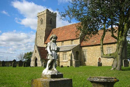
Go straight ahead and take the first footpath on the left. Go straight across the field to a small bridge and through a hedge. The path continues through another field with St Andrew's Church in view ahead. Cross a small plank bridge across a stream to reach the church. Isolated from Wood Walton, the church is in unsafe condition and has been closed to visitors since 2010.
To continue the walk, follow the access track past a house, surrounded by trees, on your left. Go through the gate to reach New Road (grid ref. TL211820). Turn left and take the first footpath on the right. Keep straight ahead and descend towards some trees (Riddy Wood). Enjoy the view to the left across the Fens. Reaching the wood, bear right and follow the edge of the wood (on your left). The path briefly enters the wood to reach a cross track. Walk ahead for 20 metres ignoring the track on the right.
Go right at a fingerpost through some trees to a small bridge. Cross the bridge and head across the field on the path aiming for an electricity pole. The path then continues between small paddocks. Go through a gate, pass an electricity substation on your right. Pass through another gate to reach the road. Bear right to return to The Green and the start of the walk.
Other walks nearby
| Walk 2477 | Alconbury Weston & Buckworth Circular | easy | 6.9 miles |
| Walk 2303 | Holme Fen Circular | easy | 3.1 miles |
| Walk 3741 | St. Ives, Houghton & the Hemingfords | easy | 5.6 miles |
| Walk 3271 | Grafham Water Circular | easy/mod | 8.7 miles |
| Walk 3444 | Fen Drayton Nature Reserve Walk | easy | 4.6 miles |
| Walk 2133 | Graffham Water | easy/mod | 7.8 miles |
| Walk 1798 | Little Paxton & River Ouse Circular | easy/mod | 6.4 miles |
| Walk 1974 | Lyveden New Bield from Wadenhoe | easy/mod | 8.2 miles |
| Walk 1963 | Elsworth & Conington | moderate | 10.1 miles |
| Walk 3605 | Shelton & Yelden from Upper Dean | easy/mod | 7.5 miles |
Recommended Books & eBooks
No suggestions for this area.Messaging & Social Media
Message Walking Britain and follow the latest news.

Mountain Weather
Stay safe on the mountains with detailed weather forecasts - for iOS devices or for Android devices.