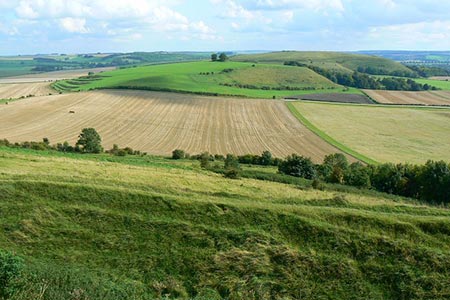
Battlesbury Hill from Norton Bavant
Wiltshire Walk
County/Area - Wiltshire
Author - Lou Johnson
Length - 6.0 miles / 9.8 km Ascent - 800 feet / 242 metres
Time - 3 hours 50 minutes Grade - easy/mod
Maps 

| Ordnance Survey Explorer 143 | Sheet Map | 1:25k | BUY |
| Anquet OS Explorer 143 | Digital Map | 1:25k | BUY |
| Ordnance Survey Landranger 183 | Sheet Map | 1:50k | BUY |
| Anquet OS Landranger 183 | Digital Map | 1:50k | BUY |
Walk Route Description
Click image to see photo description.
This Wiltshire walk from the small village of Norton Bavant explores three hills that lie at the south-eastern corner of Salisbury Plain. Battlesbury, Middle and Scratchbury Hills all have evidence of Iron-Age forts or earthworks. The hills also provide excellent views over the surrounding countryside with a contrast between the chalk uplands of Salisbury Plain and the more pastoral landscape of Wiltshire.
The start is the village of Norton Bavant where limited parking is possible by the telephone box (grid ref. ST908432). With your back to the telephone box, walk left and then right at the road junction. Continue to the next junction with a wooden seat under the tree on your right. Turn left onto the signed footpath along a track. Continue to reach the drive to the Old Vicarage. Continue straight ahead to join a footpath. The path follows the field boundary and soon reaches some cottages which are on your left. The continuing path maintains direction to reach the B3414 (grid ref. ST899439).
Cross the road to the pavement and walk towards Warminster (with the wall on your right). Ignore the first signed bridleway on the right and continue for a further 400 metres passing a hotel on the right to turn right onto the access drive for Home Farm (grid ref. ST894441). Pass the farm on your right, cross the railway to reach the military road. Turn left and continue for 700 metres where you turn right onto a footpath. The path heads towards the left-hand end of a wood, bears left and climbs gently across the western flank of the hill fort.
At a path junction (grid ref. ST896459), turn right and make your way to the trig point on Battlesbury Hill. Maintain direction following the path across the hill to the far side and bear left down a small path to the path at the foot of the earthwork. Continue for a short way to a path junction (grid ref. ST901456) and turn right. The path follows the right-hand edge of a field to reach a cross track. Go straight across the track and continue along the right-hand edge of the next field to a military road (grid ref. ST907452). Turn right and after a short way, turn left onto Middle Hill. Head for the two trees on the summit. From here follow the path down to the left-hand end of a small wood. Bear left and continue to a road (grid ref. ST910446). Stay on the Imber Range Perimeter Path through a kissing gate onto Scratchbury Hill. Leave the main path and head south to the summit from where you can enjoy a wonderful view across Salisbury Plain on your left.
From the summit continue south-east to a gap in the ramparts (grid ref. ST912440). Go through gate and continue along the Imber Range Perimeter Path. Cross the field and bear right with field boundary on your right. At grid ref. ST916435 you reach a fork. The Imber Range Perimeter Path goes left, our route continues ahead on a grassy bridleway which descends over Cotley Hill and down to the B3414 and a roundabout. Cross the road with care and take the minor road signed to Sutton Veny. Cross the railway and take the signed footpath on the right. The path goes half left across the field to enter another field. The path continues with hedge on your left to a stile. Continue ahead up a drive to a lane. Berar right and follow this lane to a T-junction. Turn left and the start of the walk is a short way along this lane on the left.
Other walks nearby
| Walk 2936 | Cold Kitchen Hill from Longbridge Deverill | easy/mod | 8.7 miles |
| Walk 2266 | Westbury White Horse Circular | easy | 3.6 miles |
| Walk 2343 | Higher Pertwood & Wessex Ridgeway from Hindon | easy/mod | 8.1 miles |
| Walk 1748 | East Knoyle & Hindon from West Knoyle | moderate | 9.6 miles |
| Walk 2465 | Steeple Langford Circular | moderate | 9.8 miles |
| Walk 2255 | Urchfont Hill from Market Lavington | easy/mod | 8.6 miles |
| Walk 3679 | Wardour Castle, Ansty Down & Wardour Park | easy/mod | 7.5 miles |
| Walk 2158 | Great Wishford & Grovely Lodge | easy/mod | 6.6 miles |
| Walk 3675 | Bedlam and Great Elm from Mells | easy/mod | 4.7 miles |
| Walk 3626 | The Fovant Badges from Broad Chalke | easy/mod | 9.3 miles |
Recommended Books & eBooks
The Kennet and Avon Canal
 Guidebook to walking along the Kennet & Avon Canal. The 94 mile route from Reading to Bristol is split into 7 stages of fairly easy walking and includes the UNESCO World Heritage Site of Bath and Bristol's Floating Harbour. 20 circular walks are also included, ranging from 4¼ to 9 miles, taking in the best sections of the canal.
More information
Messaging & Social Media
Message Walking Britain and follow the latest news.

Mountain Weather
Stay safe on the mountains with detailed weather forecasts - for iOS devices or for Android devices.