Knathorne & Oldborough from Morchard Richard
Devon Walk
County/Area - Devon
Author - Lou Johnson
Length - 5.2 miles / 8.5 km Ascent - 550 feet / 167 metres
Time - 3 hours 10 minutes Grade - easy/mod
Maps 

| Ordnance Survey Explorer 113 | Sheet Map | 1:25k | BUY |
| Anquet OS Explorer 113 | Digital Map | 1:25k | BUY |
| Ordnance Survey Landranger 191 | Sheet Map | 1:50k | BUY |
| Anquet OS Landranger 191 | Digital Map | 1:50k | BUY |
Walk Route Description
Click image to see photo description.
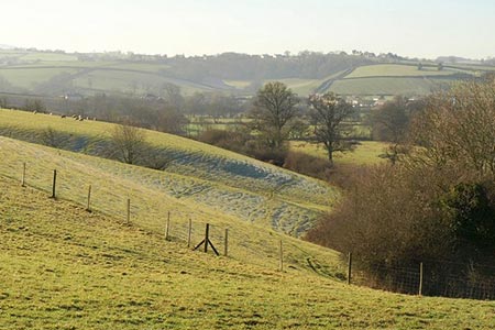
This Devon walk starts from Morchard Bishop with its parish church dominating the hilltop village. The walk uses a section of the Two Moors Way which links Dartmoor and Exmoor and during the walk there are views to both National Parks.
There is a small car park at the east end of the village by the church (grid ref. SS774076). Exit the car park onto Church Street and walk past the church which should be on your left. Continue through the village to a T-junction with the London Inn on your left. Go straight across onto a track following the Two Moors Way. At the end of the gardens, turn left and follow the path half right across a field and then continues in the same direction to cross a track. Go straight over and follow the TMW across a large field (with hedge on your right). At the end of the field turn left down an enclosed track into another field. Go half right across this field aiming for a tree and gate. Go through the gate to join an enclosed track between hedges. This leads to Woodgate (grid ref. SS762065). Continue along a drive to reach a road at Weeke.
Turn right and, after 50 metres, go left on the TMW. Initially the route follows an enclosed path at the end of which the path turns right and follows the right-hand edge of the field. Cross a bridge and walk through a wood to reach Slade Farm. The signed path turns right and then left past a pond to reach a track. Where the track bends right, turn left following the sign. The path follows the left-hand hedge and continues to a wood. The path continues alongside the left-hand side of the wood to reach a path junction at the end of the wood (grid ref. SS759048).
Leave the TMW and turn left (signed to Knathorne). Continue along the left-hand edge of a field. Then turn left continuing towards Knathorne following the left-hand field edge. Turn left through gate and follow waymark and junction of paths (grid ref. SS766048). Go straight ahead passing a barn on your left and join a bridleway. Follow the bridleway passing cottages on your left. Stay on this bridleway for two kilometres to reach a lane at Oldborough (grid ref. SS772063).
Take the road to Morchard Bishop and after 50 metres take the footpath on the right. Cross two fields following signs. Cross a small stream and continue ahead uphill to follow a hedge on your immediate left. Turn left through gate as you approach a farm and then right through a metal gate. Continue with the farm buildings on your right to a path junction by the farmhouse (grid ref. SS780065). Turn left through a small gate following the footpath downhill along the right-hand edge of the field. The path leads onto a track which is followed to a junction of tracks by Lowertown. Bear left at the junction and follow the track to a road. Go straight across through a metal kissing gate to enter the churchyard. Follow the path to the left of the church and bear right to exit the churchyard onto a road. Turn right and the start of the walk is a short distance along the road on your left.
Other walks nearby
| Walk 2901 | Castle Drogo & Sharp Tor from Fingle Bridge | easy | 3.8 miles |
| Walk 2639 | Cosdon Beacon from South Zeal | easy/mod | 6.5 miles |
| Walk 2085 | Cosdon Hill & Oke Tor from Belstone | moderate | 10.7 miles |
| Walk 2154 | West Anstey Common from Molland | easy/mod | 6.4 miles |
| Walk 2636 | North Moor crossing from Okehampton to Bellever | mod/hard | 14.5 miles |
| Walk 3311 | Trenchford & Tottiford Reservoirs (Moretonhampstead) | easy | 3.0 miles |
| Walk 1860 | The River Barle and Withypool from Tarr Steps | easy/mod | 7.5 miles |
| Walk 1669 | Anstey Gate & Hawkridge from Tarr Steps | moderate | 8.2 miles |
| Walk 1075 | High Willhays & Yes Tor | moderate | 6.5 miles |
| Walk 3004 | Yes Tor, Cranmere Pool and Amicombe Hill from Meldon Reservoir | mod/hard | 12.5 miles |
Recommended Books & eBooks
No suggestions for this area.Messaging & Social Media
Message Walking Britain and follow the latest news.

Mountain Weather
Stay safe on the mountains with detailed weather forecasts - for iOS devices or for Android devices.