Walk 3639 - printer friendly version
Rhinefield Walk near Brockenhurst Walk
Author - Dave Ford
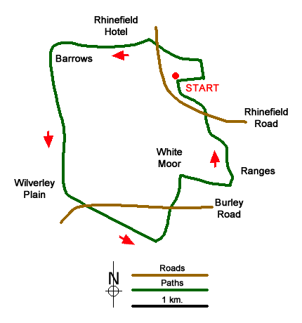
Length - 5.6 miles / 9.1 km
Ascent - 300 feet / 91 metres
Grade - easy
Start - OS grid reference SU271029
Lat 50.8250100 + Long -1.6166170
Postcode SO42 7QD (approx. location only)
This is another video in my series of New Forest Walks with my Whippet, Logan. In this episode, I explore the area around the Rhinefield Walk to the West of Brockenhurst. The 5 mile route takes us through woodland, over open heathland as well as a New Forest Lawn with some fantastic scenery. My ramble takes me through the Alderidgehill, Clumber & Ferny Knapp Inclosures - crossing the Over Water on two occasions. I get to see the historic Rhinefield House (now a Hotel) and finish up exploring the site of a disused Rifle Range.
Messaging & Social Media
Message Walking Britain and follow the latest news.

Mountain Weather
Stay safe on the mountains with detailed weather forecasts - for iOS devices or for Android devices.